MyTopo
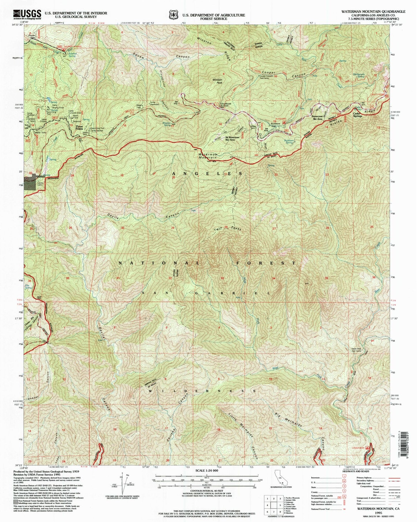
USGS Classic Waterman Mountain California 7.5'x7.5' Topo Map
Couldn't load pickup availability
Historical USGS topographic quad map of Waterman Mountain in the state of California. Scale: 1:24000. Print size: 24" x 27"
This quadrangle is in the following counties: Los Angeles.
The map contains contour lines, roads, rivers, towns, lakes, and grids including latitude / longitude and UTM / MGRS. Printed on high-quality waterproof paper with UV fade-resistant inks.
Contains the following named places: Buckhorn Flat, Buckhorn Guard Station, Buckhorn Spring, Camp Christian, Camp Cumorah Crest, Camp Glenwood, Camp Pajarito, Camp Singing Pines, Camp Valcrest, Cloudburst Canyon, Cloudburst Summit, Conservation Camp Thirtyseven, Cooper Canyon, Kratka Ridge, Louies Cabin, Pasadena Camp, Rattlesnake Spring, Rattlesnake Trail, Ridge Crest Picnic Ground, Sulphur Spring, Vista Picnic Ground, West Fork Bear Creek, Winston Peak, Winston Spring, Twin Peaks, Three Points, Waterman Mountain, Winston Ridge, Cooper Canyon Trail Camp, Upper Bear Trail Camp, Lower Bear Campground, Mount Waterman Ski Area, Kratka Ridge Ski Area, Eagles Roost Picnic Ground, Sulpher Springs Campground, Cedar Springs, Cedar Spring, San Gabriel Wilderness, San Gabriel Mountains National Monument