MyTopo
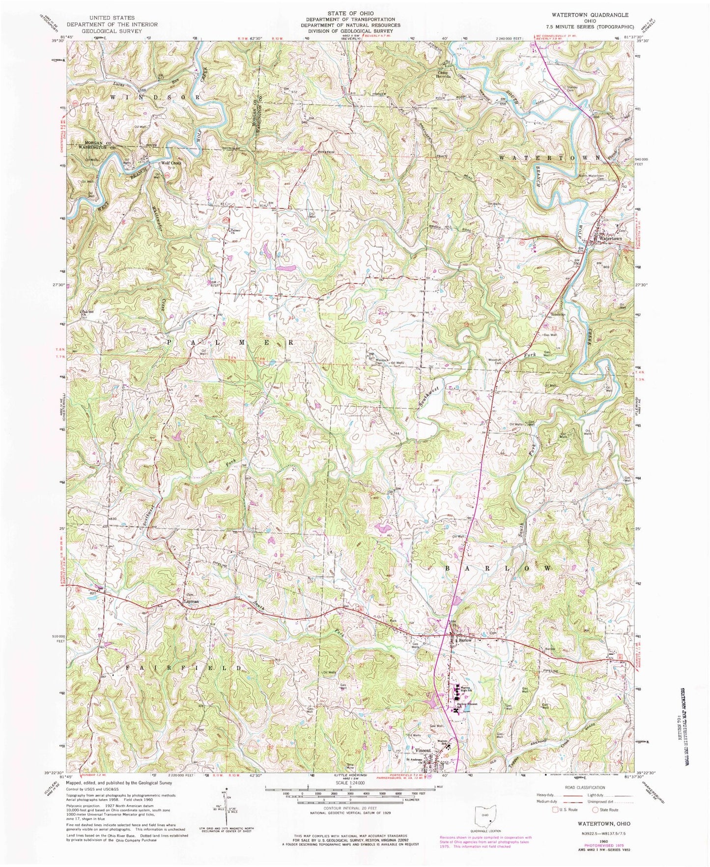
Classic USGS Watertown Ohio 7.5'x7.5' Topo Map
Couldn't load pickup availability
Historical USGS topographic quad map of Watertown in the state of Ohio. Map scale may vary for some years, but is generally around 1:24,000. Print size is approximately 24" x 27"
This quadrangle is in the following counties: Morgan, Washington.
The map contains contour lines, roads, rivers, towns, and lakes. Printed on high-quality waterproof paper with UV fade-resistant inks, and shipped rolled.
Contains the following named places: Barlow, Barlow Central Cemetery, Barlow Methodist Church, Barlow Volunteer Fire Department, Barlow-Vincent Elementary School, Bell Bridge, Browns Mill, Camp Hervida, Harra Bridge, Layman, Layman Cemetery, Lucas Run, Murdock Cemetery, North Watertown Cemetery, Painter Run, Palmer United Methodist Church, Plumb Run, Rod's Sod Airport, Saint Ambrose Church, South Fork South Branch Wolf Creek, Southwest Fork South Branch Wolf Creek, Stanley Cemetery, Sterling Acres, Township of Barlow, Township of Fairfield, Township of Palmer, Vincent, Vincent Post Office, Vincent United Methodist Church, Wagner Pond, Wagner Pond Dam, Warren Elementary School, Warren High School, Watertown, Watertown Elementary School, Watertown Historic District, Watertown Volunteer Fire Department, Whitewater Creek, Wolf Creek, Woodruff Cemetery, ZIP Codes: 45784, 45787