MyTopo
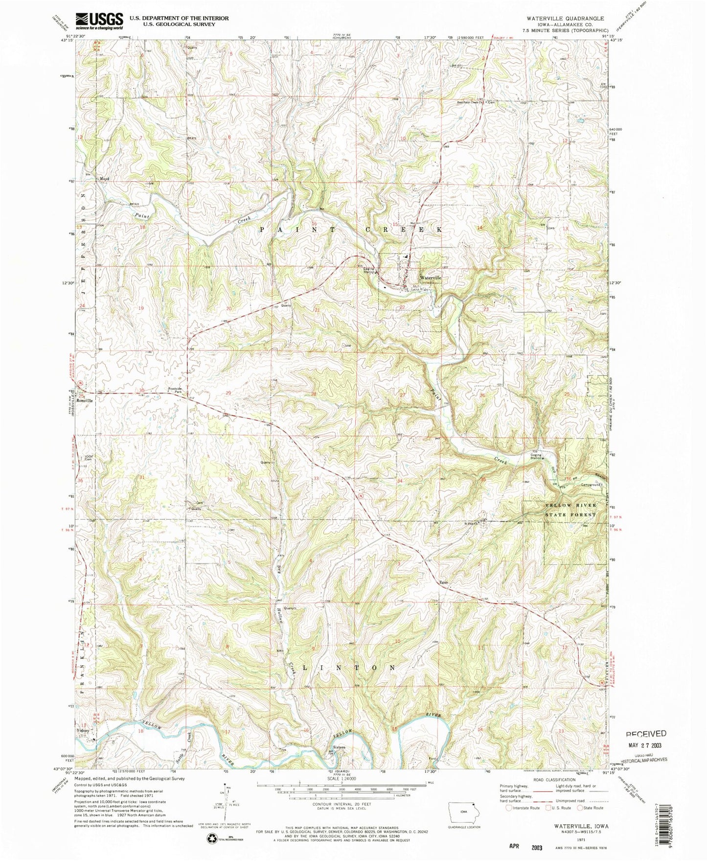
Classic USGS Waterville Iowa 7.5'x7.5' Topo Map
Couldn't load pickup availability
Historical USGS topographic quad map of Waterville in the state of Iowa. Map scale may vary for some years, but is generally around 1:24,000. Print size is approximately 24" x 27"
This quadrangle is in the following counties: Allamakee.
The map contains contour lines, roads, rivers, towns, and lakes. Printed on high-quality waterproof paper with UV fade-resistant inks, and shipped rolled.
Contains the following named places: Bridge Sixteen Canoe Access, Buckland Post Office, Cherry Mound Cemetery, City of Waterville, Dry Hollow Creek, East Paint Creek Church, East Paint Creek Synod Cemetery, Egan, Egan Post Office, Independent Order of Odd Fellows Cemetery, Maple Hill Cemetery, Maud, Maud Post Office, Monsrud Bridge, Paintville Post Office, Rossville Park, Saint Pius Church, Sixteen, Sixteen Cemetery, Suttle Creek, Township of Linton, Township of Paint Creek, Volney, Volney Post Office, Waterville, Waterville Ambulance Service, Waterville Elementary School, Waterville Farm, Waterville Lutheran Cemetery, Waterville Lutheran Church, Waterville Pines Park, Waterville Post Office, Waterville Public Library, Waterville Rural Fire Department, Waterville Town Hall, ZIP Code: 52170