MyTopo
Classic USGS Wathena Kansas 7.5'x7.5' Topo Map
Couldn't load pickup availability
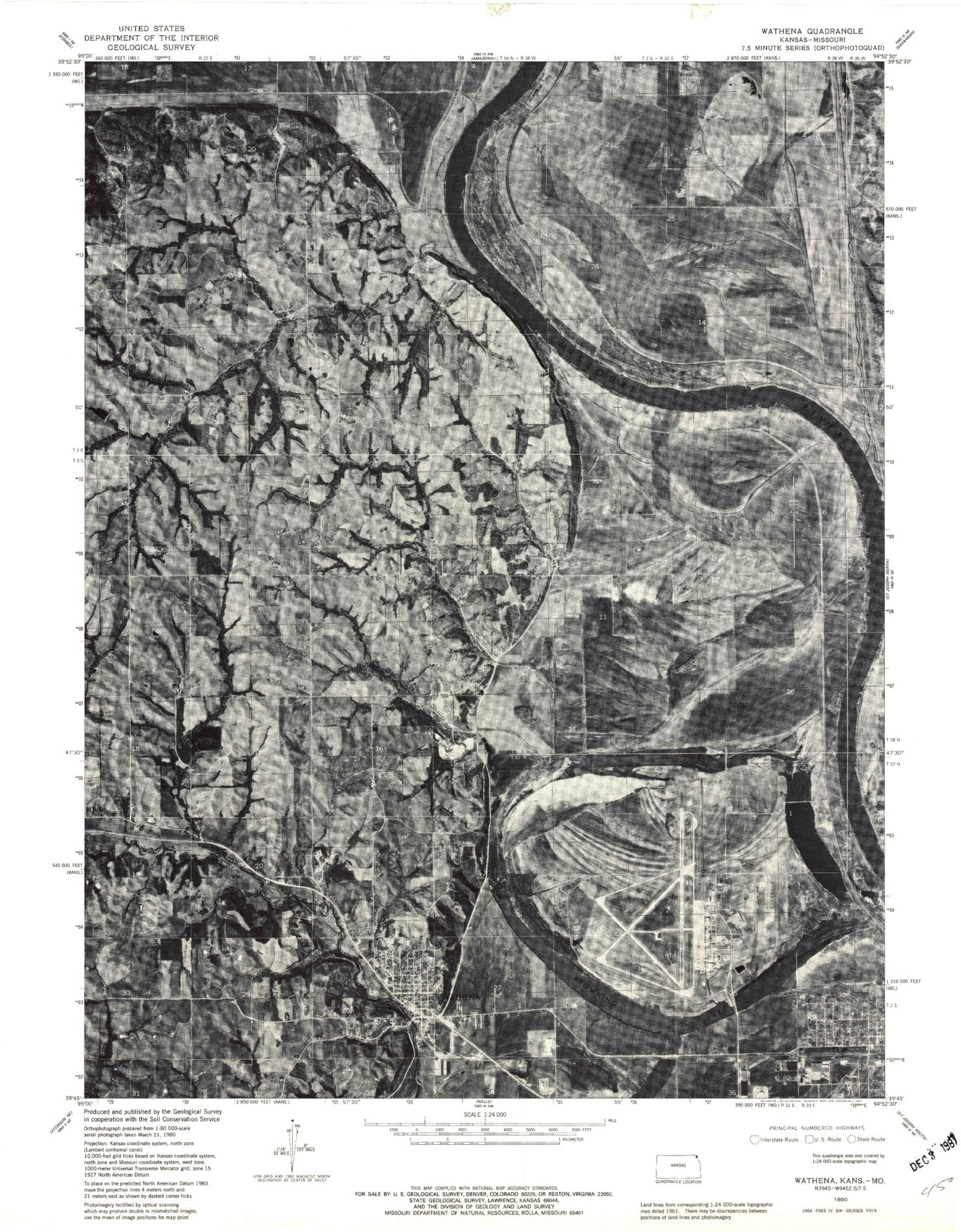
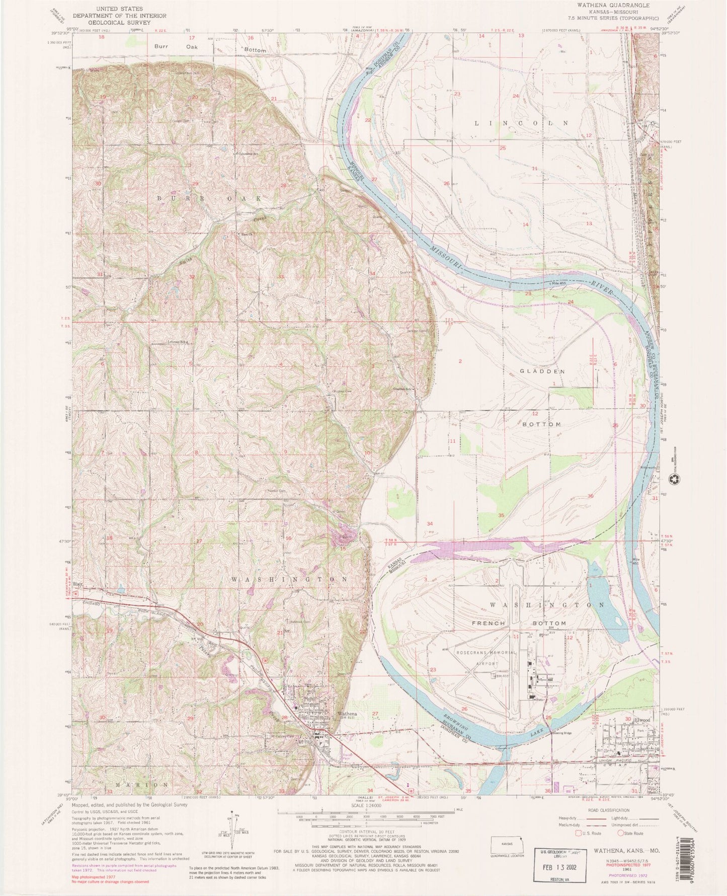
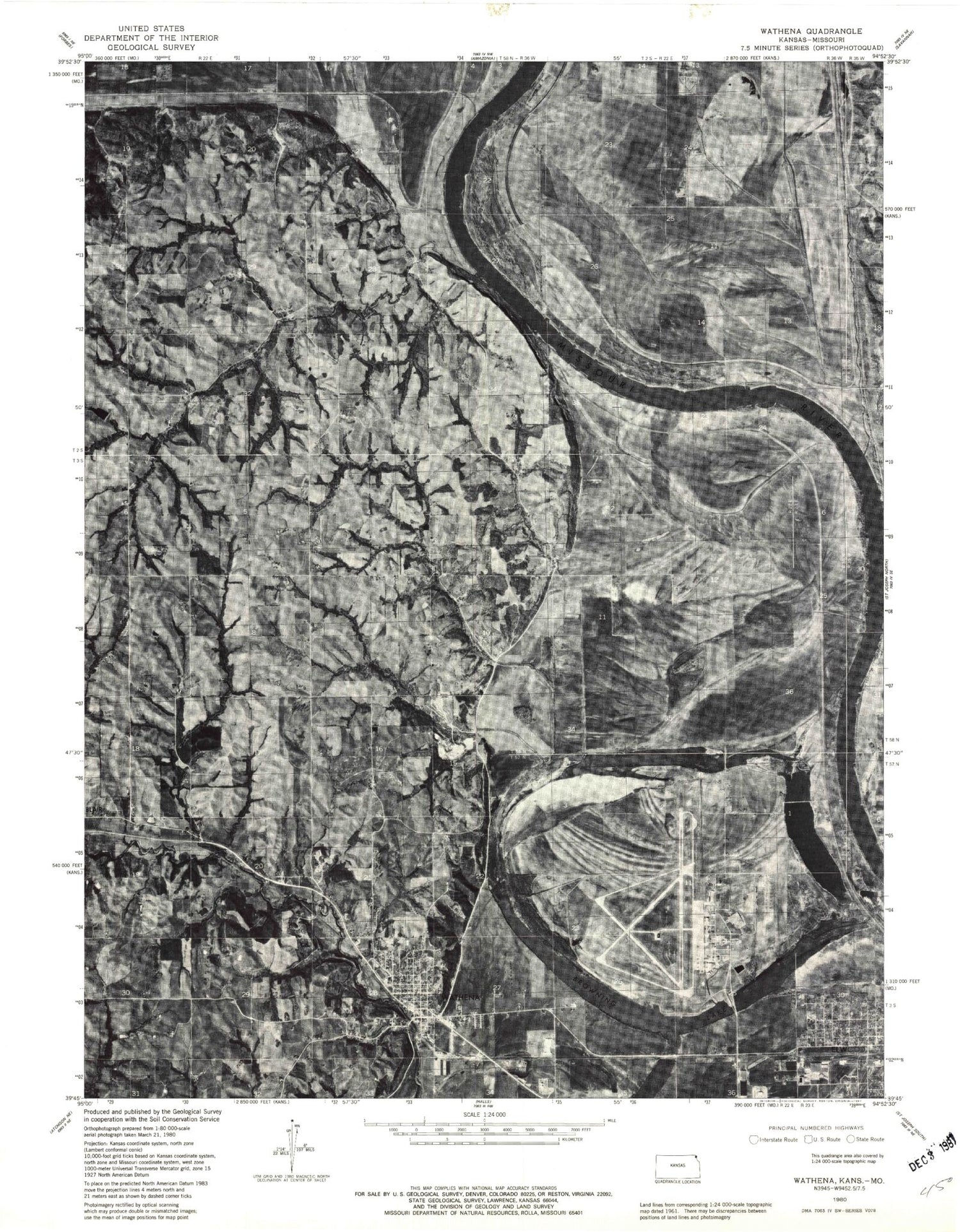
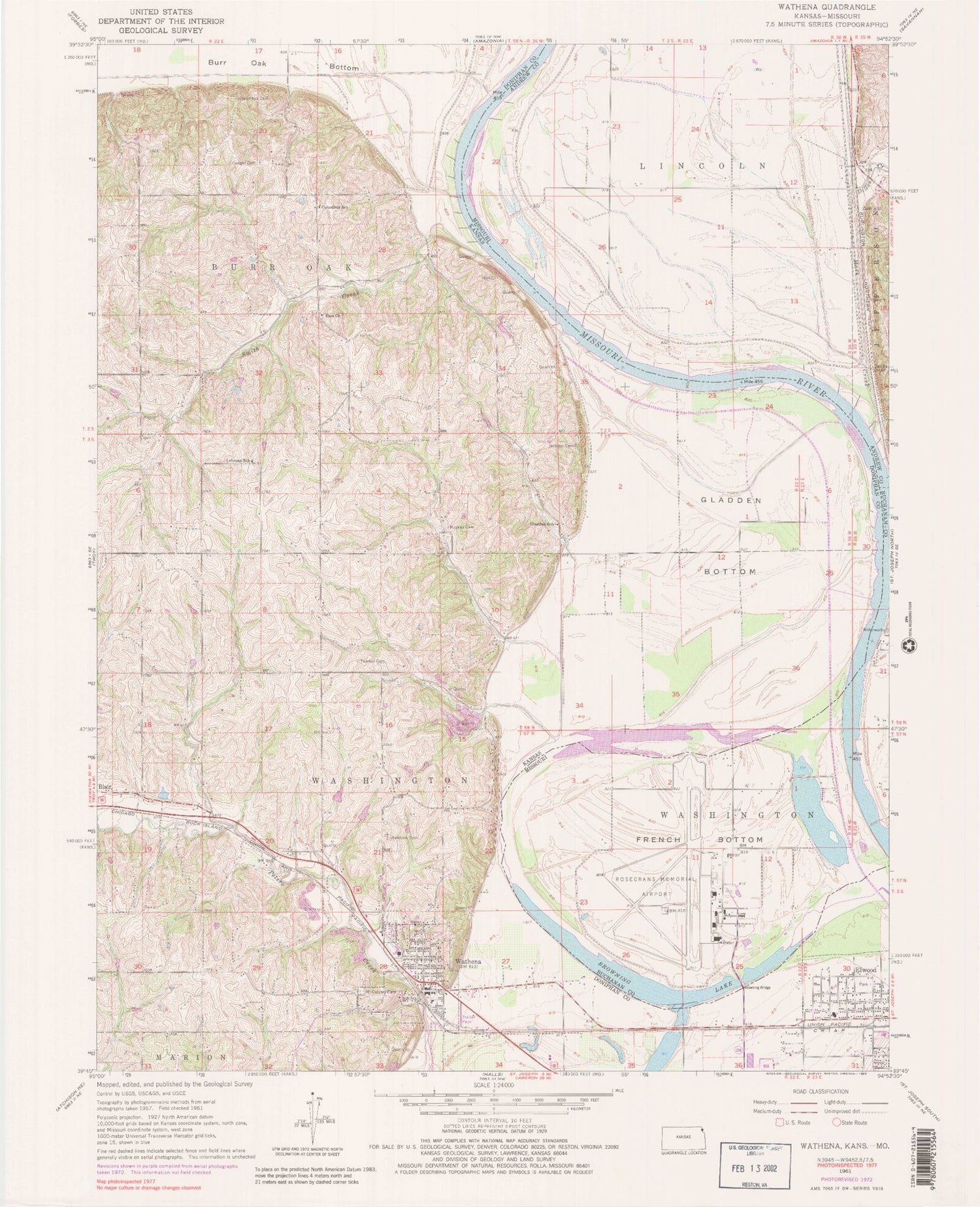
Historical USGS topographic quad map of Wathena in the states of Kansas, Missouri. Map scale may vary for some years, but is generally around 1:24,000. Print size is approximately 24" x 27"
This quadrangle is in the following counties: Andrew, Buchanan, Doniphan.
The map contains contour lines, roads, rivers, towns, and lakes. Printed on high-quality waterproof paper with UV fade-resistant inks, and shipped rolled.
Contains the following named places: Bellemont Cemetery, Bellemont School, Browning Bridge, Browning Lake, Christ Lutheran Church, City of Elwood, City of Wathena, Columbus Cemetery, Columbus School, Dillon Creek, Doniphan Company Rural Fire District 4, Doniphan County Elwood Branch Library, Doniphan County Rural Fire District 1, Doniphan County Wathena Branch Library, Elwood City Hall, Elwood Community Center, Elwood Police Department, Elwood Post Office, Elwood Senior Center, First Baptist Church, French Bottom, Gaslight Mobile Home Park, Gladden Bottom, Gladden School, Hunt, Jackson Cemetery, Lehman School, Mace Creek, Missouri Air National Guard Department of Defense Rosecrans Fire Department, Moskau Cemetery, Mount Calvary Cemetery, Riverside High School, Riverside Intermediate School, Riverside Middle School, Riverside School, Rosecrans Memorial Airport, Saint Joseph Army Air Field, Saint Joseph's Catholic Church, Smith Creek, Smithton, Tambor Cemetery, Township of Burr Oak, Township of Washington, Wathena, Wathena City Hall, Wathena Elementary School, Wathena Police Department, Wathena Post Office, Wathena United Methodist Church, Zion United Evangelical Church, ZIP Code: 66090