MyTopo
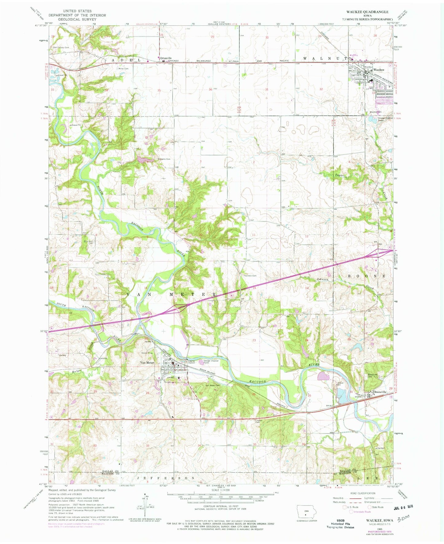
Classic USGS Waukee Iowa 7.5'x7.5' Topo Map
Couldn't load pickup availability
Historical USGS topographic quad map of Waukee in the state of Iowa. Map scale may vary for some years, but is generally around 1:24,000. Print size is approximately 24" x 27"
This quadrangle is in the following counties: Dallas, Madison.
The map contains contour lines, roads, rivers, towns, and lakes. Printed on high-quality waterproof paper with UV fade-resistant inks, and shipped rolled.
Contains the following named places: Bob Feller Hometown Exhibit, Booneville, Booneville Access, Booneville Cemetery, Booneville Post Office, Bulger Creek, City of Van Meter, Clayton Cemetery, Heartland Co-op Elevator, Iowa Veterans Cemetery, Miller Cemetery, North Raccoon River, Odd Fellows Cemetery, Ortonville, Ortonville Post Office, Otterman Cemetery, Prairie Village Mobile Home Park, Puckerbrush Access, South Raccoon River, Speak the Word Church, Thornton Cemetery, Township of Van Meter, Trindle Park, Trinity Lutheran Church, Two Rivers Area, Van Meter, Van Meter Baptist Church, Van Meter Cemetery, Van Meter City Hall, Van Meter Elementary School, Van Meter Junior - Senior High School, Van Meter Post Office, Van Meter Public Library, Van Meter United Methodist Church, Van Meter Volunteer Fire Rescue Department, Waukee, Waukee Baptist Church, Waukee Cemetery, Waukee Christian Church, Waukee City Hall, Waukee Elementary School, Waukee Post Office, Waukee Public Library, Waukee United Methodist Church, Williams Cemetery, ZIP Code: 50038