MyTopo
Classic USGS Waukon Iowa 7.5'x7.5' Topo Map
Couldn't load pickup availability
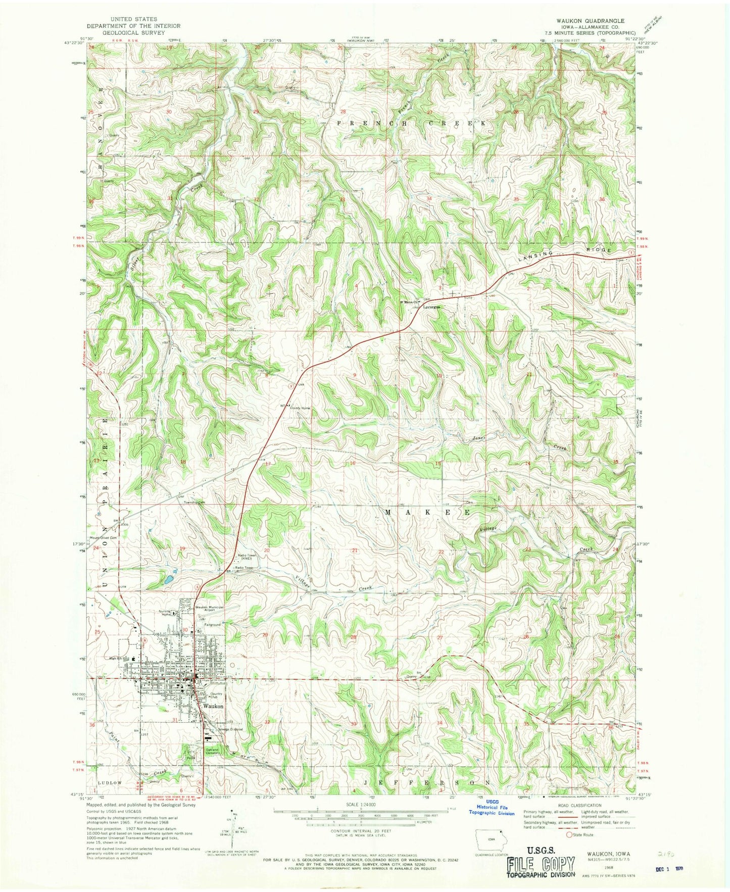
Historical USGS topographic quad map of Waukon in the state of Iowa. Map scale may vary for some years, but is generally around 1:24,000. Print size is approximately 24" x 27"
This quadrangle is in the following counties: Allamakee.
The map contains contour lines, roads, rivers, towns, and lakes. Printed on high-quality waterproof paper with UV fade-resistant inks, and shipped rolled.
Contains the following named places: Allamakee County, Allamakee County Courthouse, Allamakee County Fairgrounds, Allamakee County Historical Museum, Allamakee County Home, Allamakee County Home Park, Allamakee County Sheriff's Office, Allamakee Learning Center, Calvary Baptist Church, City of Waukon, County Care Facility Cemetery, East Elementary School, First Baptist Church, First Presbyterian Church, Good Samaritan Center, Gundersen Vision Center, Howard District School, KNEI-AM (Waukon), KNEI-FM (Waukon), Little Red Schoolhouse Museum, Lycurgus, Lycurgus Cemetery, Lycurgus Post Office, Makee Post Office, Makee Township Cemetery, Northgate Care Center, Oakland Cemetery, Robey Memorial Library, Round Prairie Cemetery, Saint Johns Lutheran Church, Saint Marys Church, Saint Patrick Catholic Church, Saint Patrick School, Saint Patrick Upper Grade School, Saint Pauls Methodist Church, Seventh Day Adventist Church, Township of Makee, Veterans Memorial Hospital, Waukon, Waukon Ambulance, Waukon Chiropractic Center, Waukon City Hall, Waukon City Park, Waukon Dental Clinic, Waukon Fire Department, Waukon Golf and Country Club, Waukon High School, Waukon Middle School, Waukon Municipal Airport, Waukon Police Department, Waukon Post Office, West Elementary School, Zion United Church of Christ, ZIP Code: 52172