MyTopo
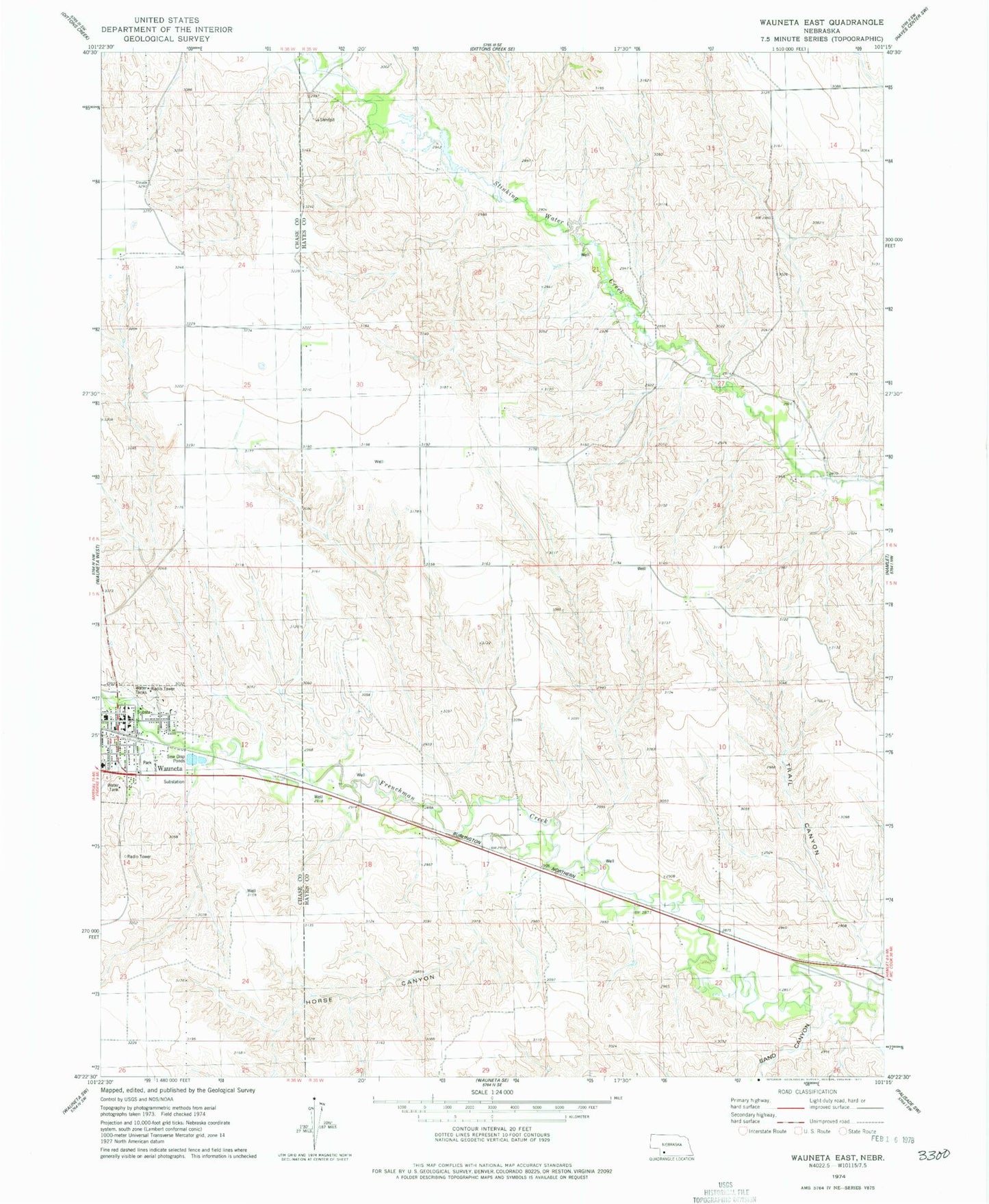
Classic USGS Wauneta East Nebraska 7.5'x7.5' Topo Map
Couldn't load pickup availability
Historical USGS topographic quad map of Wauneta East in the state of Nebraska. Map scale may vary for some years, but is generally around 1:24,000. Print size is approximately 24" x 27"
This quadrangle is in the following counties: Chase, Hayes.
The map contains contour lines, roads, rivers, towns, and lakes. Printed on high-quality waterproof paper with UV fade-resistant inks, and shipped rolled.
Contains the following named places: Church of Christ, Church of the Nazarene, Eden Missionary Church, Frenchman Valley Baptist Fellowship, Frenchman Valley Co-op Elevator, Heritage of Wauneta Incorporated, Horse Canyon, Immanuel Missionary Church, Immanuel Missionary School, Methodist Church, Moody Dam, Moody Reservoir, Redeemer Lutheran Church, Saint Johns Catholic Church, Saint Pauls Lutheran Church, Sand Canyon, Stinking Creek, Trail Canyon, Wauneta, Wauneta Emergency Medical Services, Wauneta Family Practice Association, Wauneta Police Department, Wauneta Post Office, Wauneta Public Library, Wauneta Volunteer Fire Department, Wauneta-Palisade High School, ZIP Code: 69045