
MyTopo
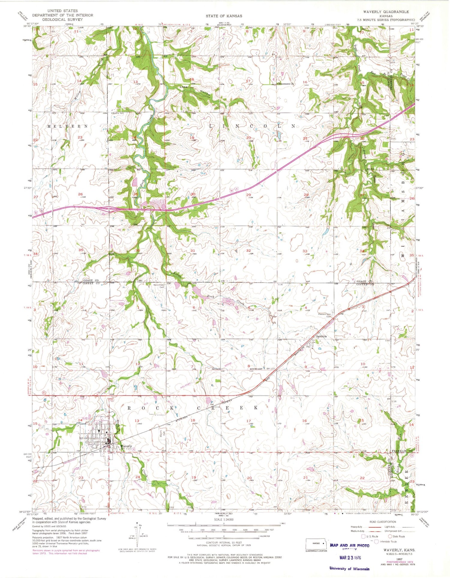
Classic USGS Waverly Kansas 7.5'x7.5' Topo Map
Couldn't load pickup availability
Historical USGS topographic quad map of Waverly in the state of Kansas. Map scale may vary for some years, but is generally around 1:24,000. Print size is approximately 24" x 27"
This quadrangle is in the following counties: Anderson, Coffey, Franklin, Osage.
The map contains contour lines, roads, rivers, towns, and lakes. Printed on high-quality waterproof paper with UV fade-resistant inks, and shipped rolled.
Contains the following named places: Agricola, Bethany Church of Christ, Boothe Hall, City of Waverly, Coffey County Fire District 1 Station 7, Coffey County Library Waverly Branch, East Branch Tequa Creek, First Baptist Church, Lane Hollow, Little Rock Creek, Pleasant View Cemetery, Rock Creek Cemetery, Rosemont, Rosemont Church, Saint Joseph Catholic Church, Schoolcraft Airport, South Branch Tequa Creek, Township of Lincoln, Township of Rock Creek, Waverly, Waverly Cemetery, Waverly City Hall, Waverly Community Building, Waverly Elementary School, Waverly Junior / Senior High School, Waverly Police Department, Waverly Post Office, Waverly Sewer Treatment Plant, Waverly United Methodist Church, Weaver, ZIP Code: 66510


