MyTopo
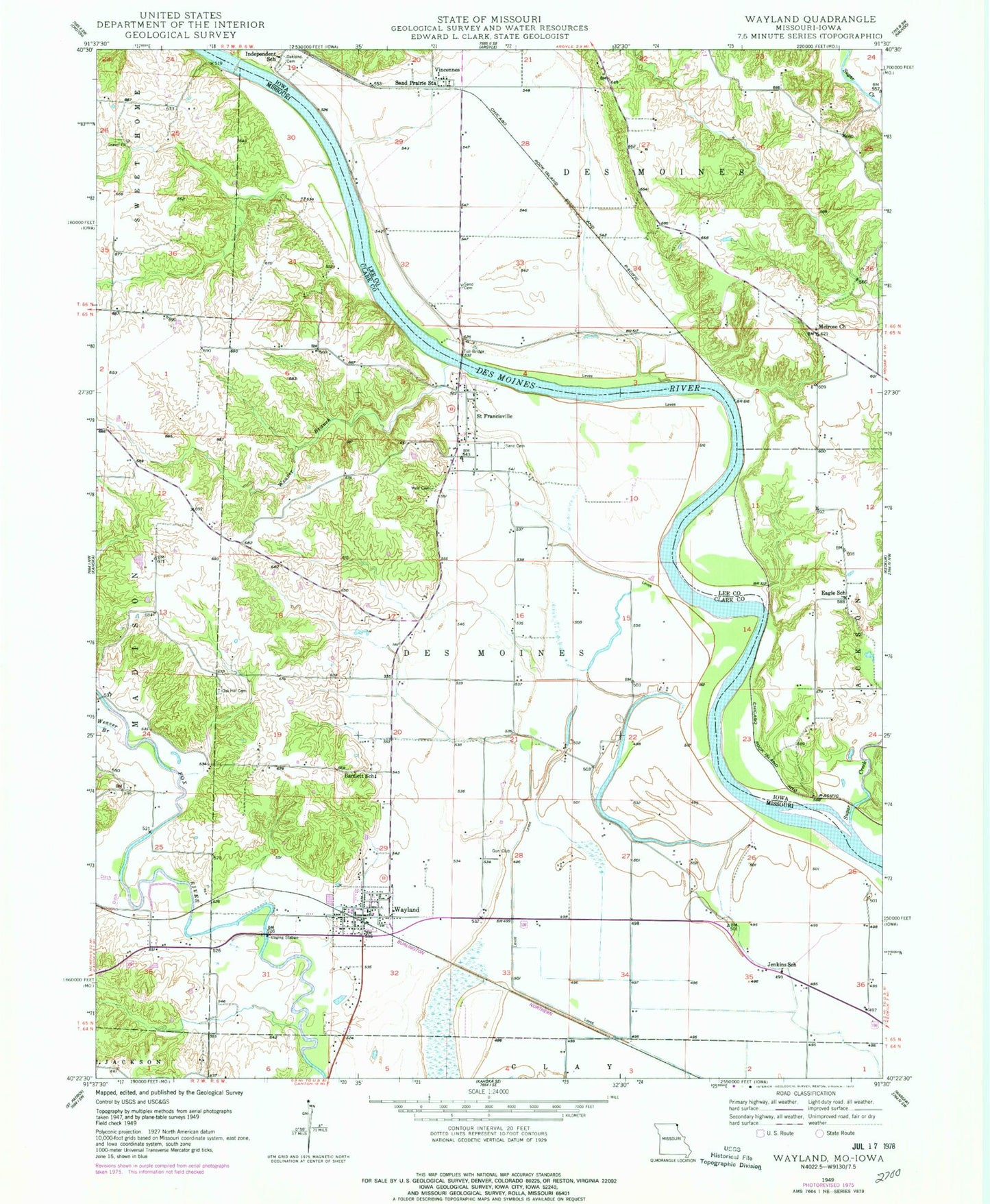
Classic USGS Wayland Missouri 7.5'x7.5' Topo Map
Couldn't load pickup availability
Historical USGS topographic quad map of Wayland in the states of Missouri, Iowa. Map scale may vary for some years, but is generally around 1:24,000. Print size is approximately 24" x 27"
This quadrangle is in the following counties: Clark, Lee.
The map contains contour lines, roads, rivers, towns, and lakes. Printed on high-quality waterproof paper with UV fade-resistant inks, and shipped rolled.
Contains the following named places: Amborn-Pagin Wildlife Area, Bartlett School, City of Wayland, Dinsmore School, Eagle School, Glades Lake Dam, Independent School, Jenkins School, Lawrence School, Melrose Church, Moores Mill, Oak Hill Cemetery, Oakland Cemetery, Saint Francisville, Saint Francisville Bridge, Saint Francisville Census Designated Place, Sand Cemetery, Sand Prairie Station, Sugar Creek, Township of Des Moines, Vincennes, Vincennes Post Office, Wayland, Wayland Bridge, Wayland Post Office, Wayland Volunteer Fire Protection Association, Weaver Branch, Winter-Wood Lake, Winter-Wood Lake Dam, Wolf Cemetery, ZIP Codes: 63430, 63472