
MyTopo
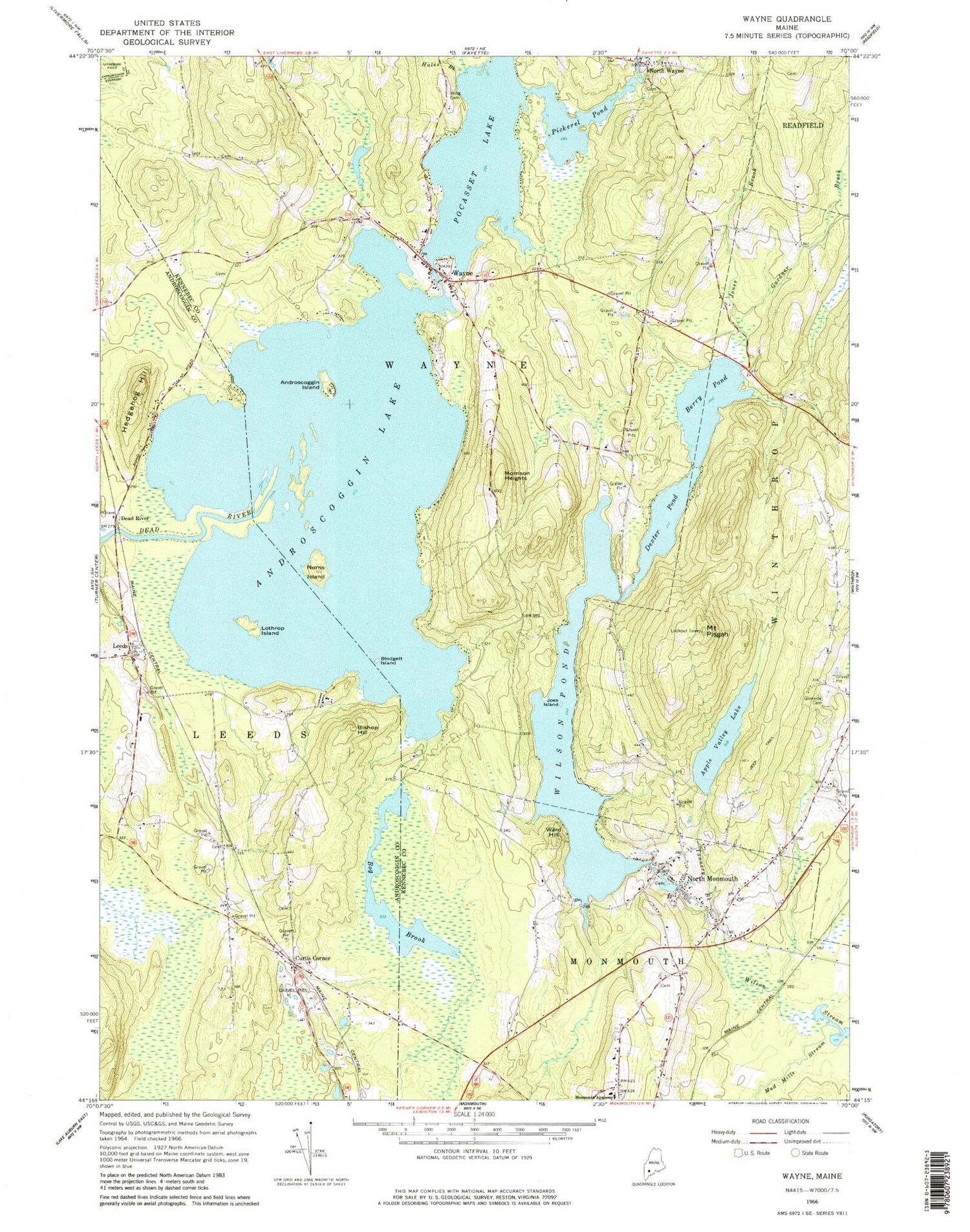
Classic USGS Wayne Maine 7.5'x7.5' Topo Map
Couldn't load pickup availability
Historical USGS topographic quad map of Wayne in the state of Maine. Typical map scale is 1:24,000, but may vary for certain years, if available. Print size: 24" x 27"
This quadrangle is in the following counties: Androscoggin, Kennebec.
The map contains contour lines, roads, rivers, towns, and lakes. Printed on high-quality waterproof paper with UV fade-resistant inks, and shipped rolled.
Contains the following named places: Androscoggin Island, Androscoggin Lake, Apple Valley Lake, Berry Pond, Bishop Hill, Blodgett Island, Bog Brook, Dead River, Dexter Pond, Gardner Brook, Glenside Cemetery, Hales Brook, Hedgehog Hill, Joes Island, Jones Brook, Lothrop Island, Monmouth Academy, Morrison Heights, Mud Mills Stream, Norris Island, North Monmouth, North Wayne, Pickerel Pond, Mount Pisgah, Tannery Brook, Ward Hill, Wayne, Wilson Pond, Wing Cemetery, Curtis Corner, Leeds, Pocasset Lake, Town of Wayne, Lovejoy Pond Dam, Lower Wilson Stream Dam, Wilson Stream Reservoir, Wilson Pond Dam, Wayne Village Dam, Apple Valley Lake Dam, Leeds Center Cemetery, Leeds Central School, Riverbend Campground, Leeds Fire Department, Monmouth Volunteer Fire Department North Station, Wayne Volunteer Fire Department Village Station, Wayne Volunteer Fire Department North Wayne Station, Old Indian Cemetery, Union Cemetery, Bishop Hill Cemetery, Fish Cemetery, Beech Hill Cemetery, Evergreen Cemetery, Gove Grove Cemetery, Huntoon Cemetery, Lakeshore Cemetery, North Wayne Cemetery, Wayne Village Cemetery, Wayne Elementary School, Monmouth Middle School, Henry L Cottrell School, Cary Memorial Library, Leeds Post Office, North Monmouth Post Office, Wayne Post Office


