MyTopo
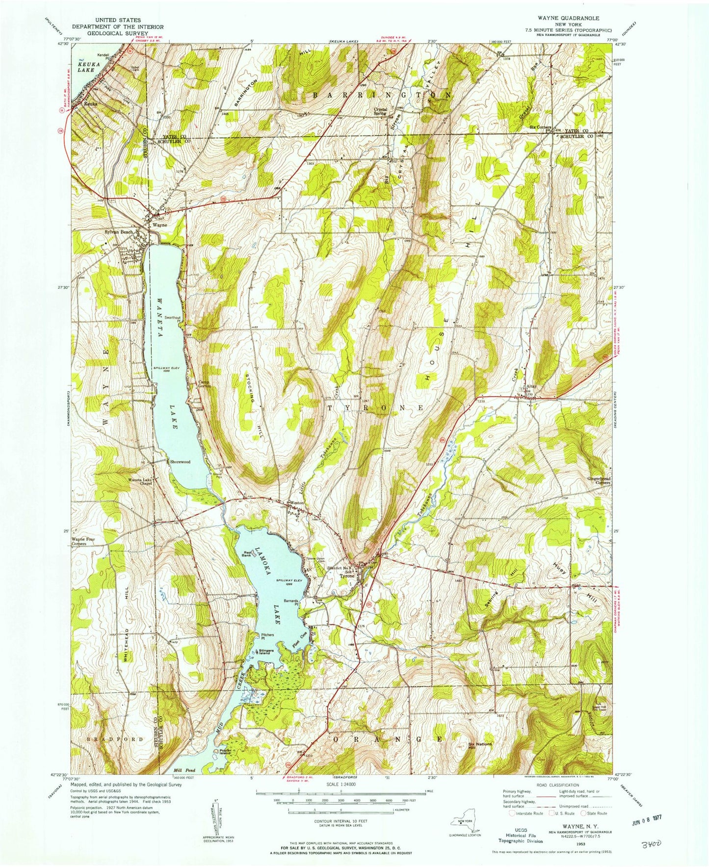
Classic USGS Wayne New York 7.5'x7.5' Topo Map
Couldn't load pickup availability
Historical USGS topographic quad map of Wayne in the state of New York. Typical map scale is 1:24,000, but may vary for certain years, if available. Print size: 24" x 27"
This quadrangle is in the following counties: Schuyler, Steuben, Yates.
The map contains contour lines, roads, rivers, towns, and lakes. Printed on high-quality waterproof paper with UV fade-resistant inks, and shipped rolled.
Contains the following named places: Altay, Barnards Point, Barrington Hill, Camp Gorton, District Number 3 School (historical), Fleet Cove, Gobel Cemetery, House Hill, Huey Hill, Kendell Point, Keuka, Lamoka Lake, Little Tobehanna Creek, Mill Pond, Pitchers Point, Poplar Island, Red Bank, Sebring Hill, Six Corners, Six Nations Hill, Stingers Island, Stocking Hill, Swarthout Point, Sylvan Beach, Tobehanna Creek, Tyrone, Tyrone Union Cemetery, Waneta Lake, Waneta Lake Chapel, Wayne, Wayne Four Corners, Weston, Whitehead Hill, Crystal Spring, Shorewood, Sugar Hill Fire Tower, Town of Tyrone, Altay Baptist Church, Altay Baptist Church Cemetery, Wayne Baptist Church, Wayne Baptist Church Cemetery, Beach Cemetery, Crystal Valley Mennonite Church, Weston Presbyterian Church, Keuka Overlook Cellars, McGregor Vineyard Winery, Our Shepherds Farm, McDowell Cemetery, Waneta Lake Baptist Chapel, Tyrone United Methodist Church, Tyrone Post Office, Crystal Valley Christian School, Hickory Knoll School, Wayne Volunteer Fire Department, Tyrone Volunteer Fire Department Company, Allen Farms, Wayne Post Office