MyTopo
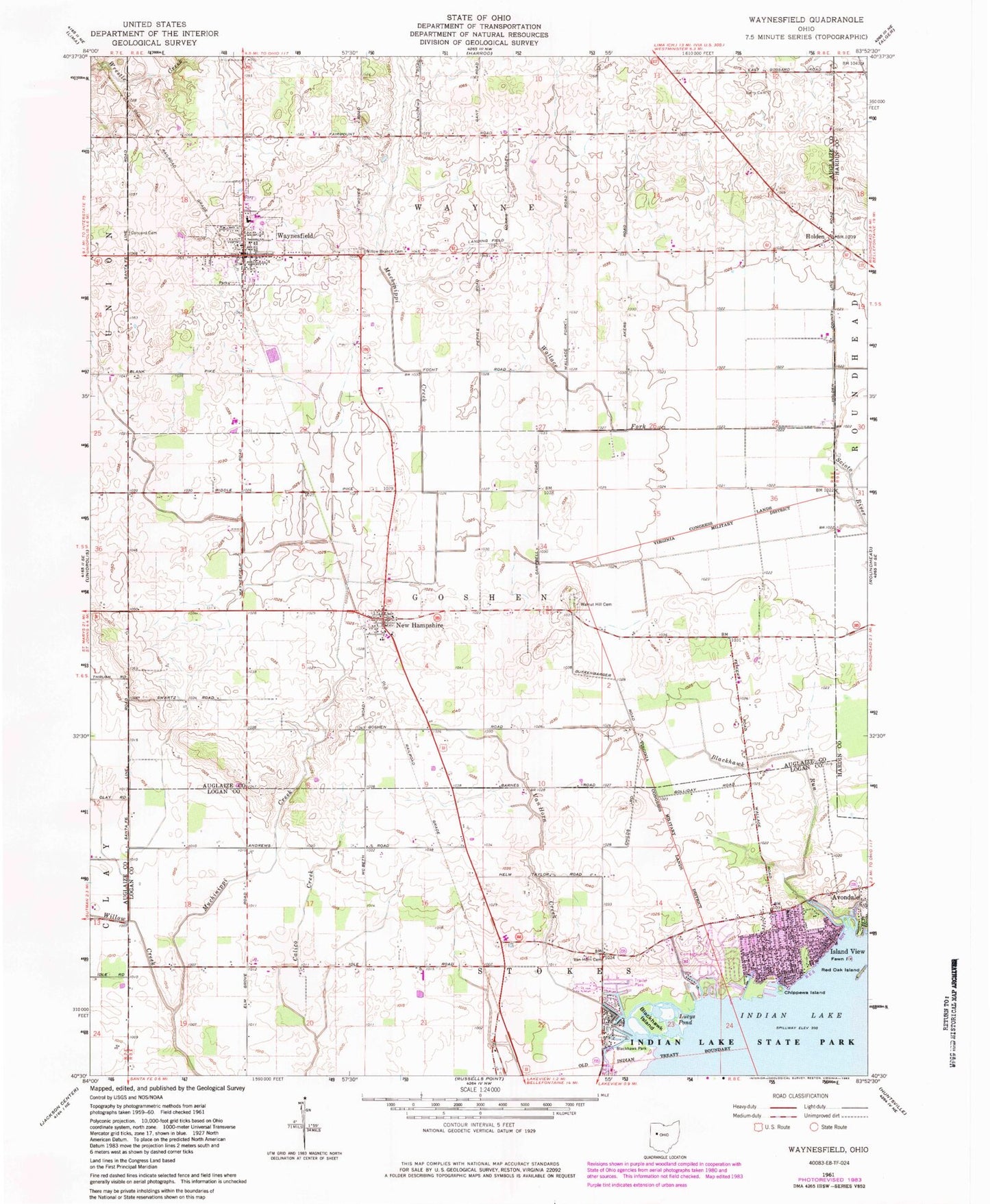
Classic USGS Waynesfield Ohio 7.5'x7.5' Topo Map
Couldn't load pickup availability
Historical USGS topographic quad map of Waynesfield in the state of Ohio. Map scale may vary for some years, but is generally around 1:24,000. Print size is approximately 24" x 27"
This quadrangle is in the following counties: Auglaize, Hardin, Logan.
The map contains contour lines, roads, rivers, towns, and lakes. Printed on high-quality waterproof paper with UV fade-resistant inks, and shipped rolled.
Contains the following named places: Beehive School, Berry Cemetery, Blackhawk Island, Blackhawk Mobile Home Park, Blackhawk Park, Blackhawk Run, Chippewa Island, Chippewa Park, Chippewa Park Census Designated Place, Concord Cemetery, East Lynn School, Elm Grove School, Fawn Island, Goshen School, Holden, Holiday Shores Mobile Home Park, Houchin School, Island View, Island View Post Office, Lone Oak School, Lucys Pond, Manchester School, New Hampshire, New Hampshire Census Designated Place, New Hampshire Church of the Nazarene, New Hampshire Methodist Church, New Hampshire Post Office, Prairie Fork School, Red Oak Island, Sandee Farms, School Number 1, Scioto River Ditch, Township of Goshen, Township of Wayne, Van Horn Cemetery, Van Horn Creek, Van Horn School, Village of Waynesfield, Wallace Fork, Wallace Fork School, Walnut Hill Cemetery, Wayne Township Fire and Rescue Services, Waynesfield, Waynesfield Baptist Church, Waynesfield High School, Waynesfield Post Office, Waynesfield United Methodist Church, Waynesfield-Goshen Elementary School, Willow Branch Cemetery, Willow Branch School, Willow Creek, ZIP Codes: 43331, 45870, 45896