MyTopo
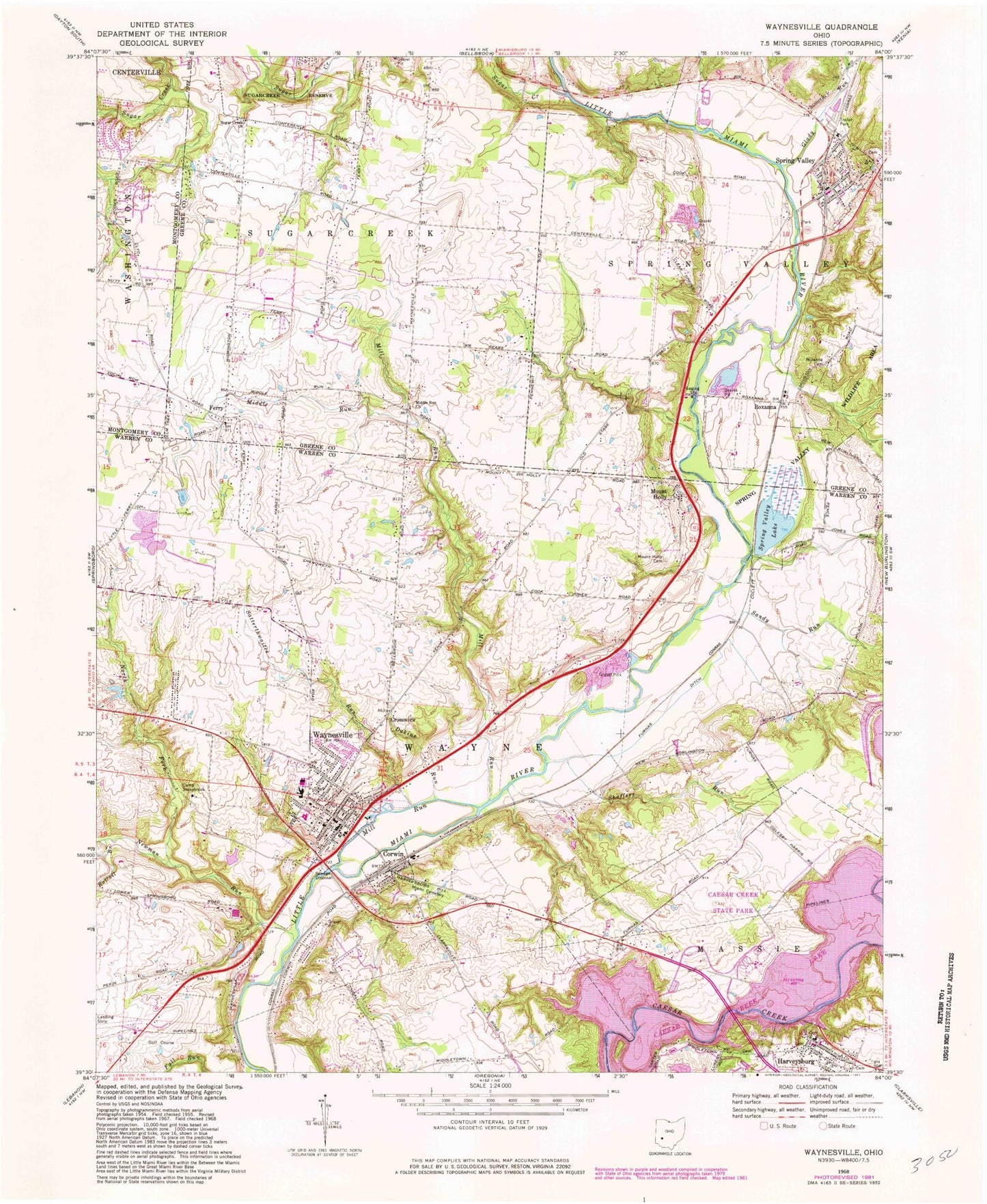
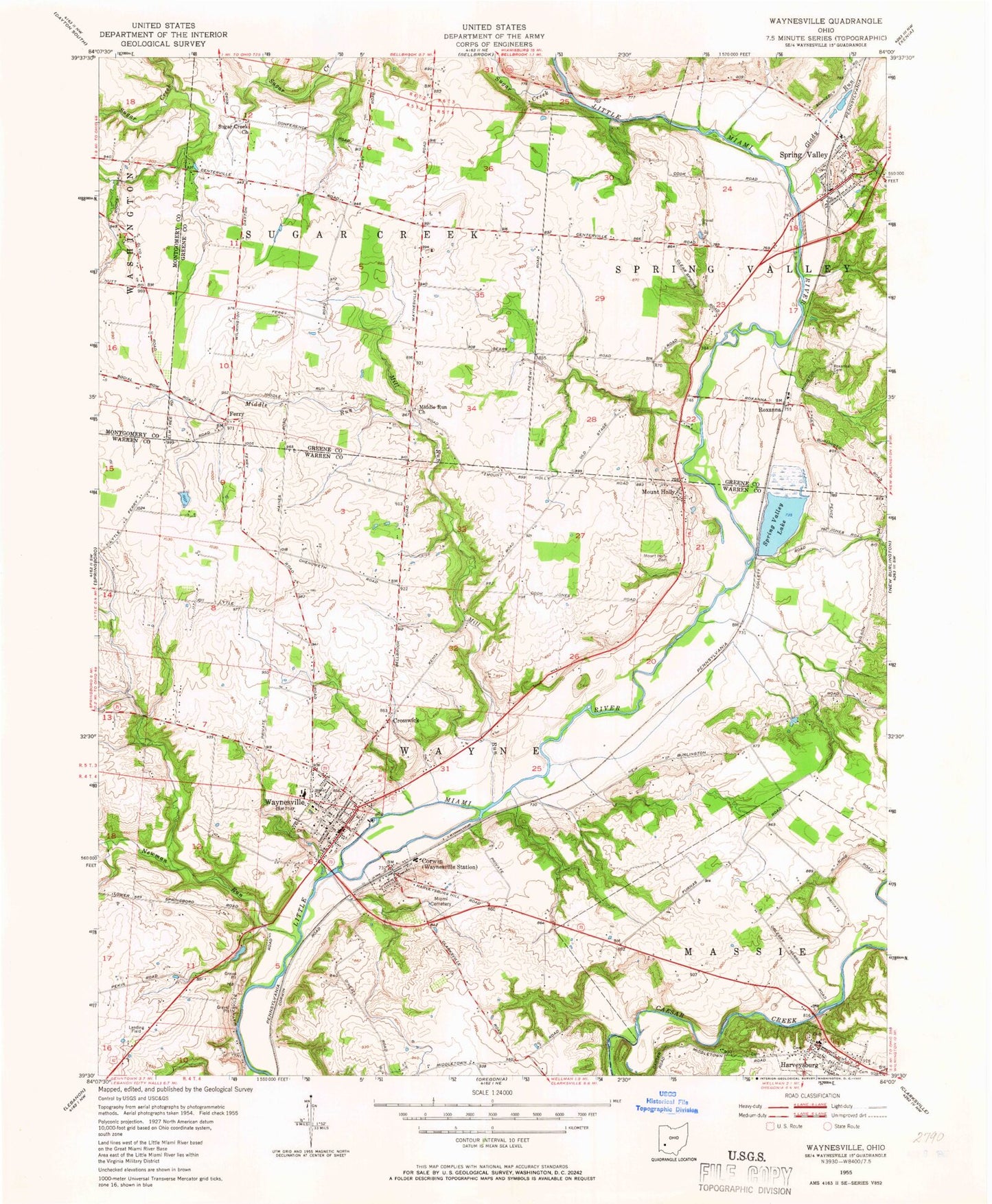
Classic USGS Waynesville Ohio 7.5'x7.5' Topo Map
Couldn't load pickup availability
Historical USGS topographic quad map of Waynesville in the state of Ohio. Typical map scale is 1:24,000, but may vary for certain years, if available. Print size: 24" x 27"
This quadrangle is in the following counties: Greene, Montgomery, Warren.
The map contains contour lines, roads, rivers, towns, and lakes. Printed on high-quality waterproof paper with UV fade-resistant inks, and shipped rolled.
Contains the following named places: Camp Stonybrook, Dakins Run, Furnas Ditch, Glady Run, Miami Cemetery, Middle Run, Middle Run Church, Mill Run, Mill Run, Mount Holly Cemetery, Newman Run, Rattail Branch, Roxanna Cemetery, Sandy Run, Satterthwaites Run, Shaffers Run, Spring Valley Wildlife Area, Sugar Creek, Sugar Creek Church, Waynesville, Ferry, Clear Springs School (historical), Sugar Grove School (historical), School Number 5 (historical), College Hill School (historical), Harmony Grove School (historical), School Number 10 (historical), Sugar Grove School (historical), Waynesville Elementary School, Waynesville High School, Treeline Park, Rooks Ravine Park, Corwin, Spring Valley, Crosswick, Harveysburg, Mount Holly, Roxanna, Bear Branch, Main Street Historic District, Spring Valley Lake Dam, Spring Valley Lake, Glass Pond Dam, Glass Pond, Poore Pond Dam, Poore Pond, Stoneybrook Farm Lake Dam, Stoneybrook Farm Lake, Caesar Creek Dike B Dam, Caesar Creek Dike F Dam, Fry Field Airport, Red Stewart Airfield, Township of Sugarcreek, Township of Wayne, Corwin Pentecostal Church, Saint Marys Episcopal Church, Waynesville Methodist Church, Middle Run Primitive Baptist Church Cemetery, Spring Valley Baptist Church, Spring Valley Cemetery, Spring Valley United Methodist Church, Spring Valley Post Office, Ferry Post Office (historical), Roxanna Post Office (historical), Spring Valley Post Office, Village of Corwin, Village of Spring Valley, Village of Waynesville, Air Jordan Airport, Anderson Airfield, Spring Valley Estates, Wayne Township Fire and Emergency Medical Services Station 91, Spring Valley Aggregates Pit, Waynesville Police Department, Harveysburg Police Department, Harveysburg Post Office, Waynesville Post Office, Waynesville Friends Cemetery