MyTopo
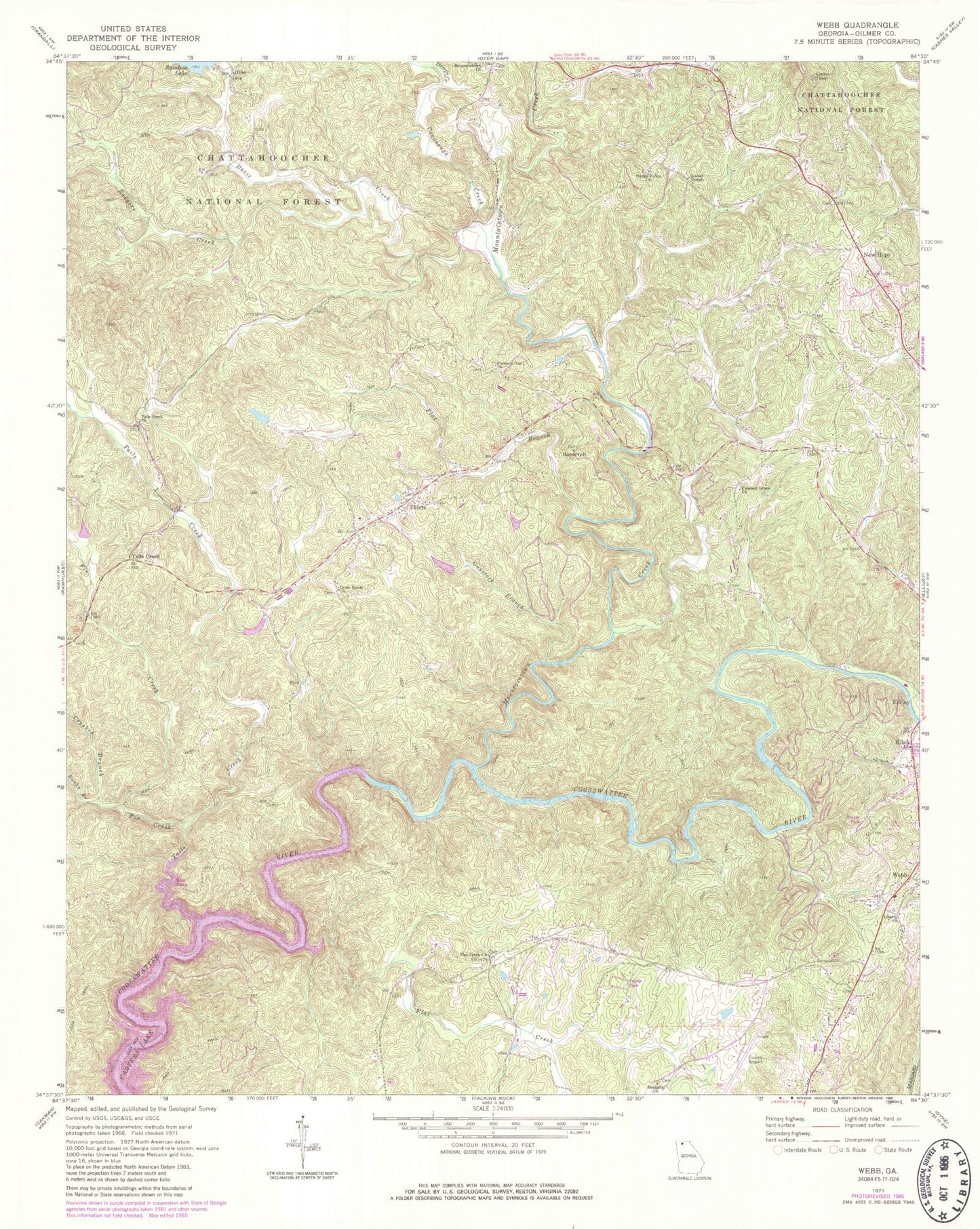
Classic USGS Webb Georgia 7.5'x7.5' Topo Map
Couldn't load pickup availability
Historical USGS topographic quad map of Webb in the state of Georgia. Typical map scale is 1:24,000, but may vary for certain years, if available. Print size: 24" x 27"
This quadrangle is in the following counties: Gilmer.
The map contains contour lines, roads, rivers, towns, and lakes. Printed on high-quality waterproof paper with UV fade-resistant inks, and shipped rolled.
Contains the following named places: Banks Branch, Conasauga Creek, Crooked Branch, Davis Creek, Demps Creek, Fir Creek, Flat Branch, Flat Creek, Flat Creek Baptist Church, Gospel Temple, Gunstock Branch, Happy Valley Church, Kiker, Mountaintown Creek, Ollie, Pleasant Gap Church, Pleasant Grove Church, Rodgers Creek, Sunlight Church, Tails Creek, Tails Creek Church, Webb, Liberty Church, Gilmer County Airport, Elders, New Hope, Roosevelt, Chitwood Lake Dam, Chitwood Lake, WLJA-FM (Ellijay), Mountaintown Baptist Church Cemetery, Mountaintown School (historical), New Hope Baptist Church, New Hope Baptist Church Cemetery, Pleasant Gap School (historical), Pleasant Grove School (historical), Ridgeway Recreation Area, Seventh Day Adventist Church, Seventh Day Adventist School, Tails Creek Baptist Church Cemetery, Cross Roads Church, Gilmer High School, Tails Creek, Ratcliff (historical), Flat Creek Baptist Church Cemetery, North Georgia Christian Academy, Grace Christian School, Mountain View Elementary School, Gilmer County Fire Department Station 6, Calvary Way Baptist Church Cemetery, Crossroads Baptist Church Cemetery, Dover Chapel Cemetery, Goble Family Cemetery, Liberty Baptist Church Cemetery, Pleasant Gap Baptist Church Cemetery, Pleasant Grove Baptist Church Cemetery, Seventh - Day Adventist Church Cemetery, Sunlight Baptist Church Cemetery