
MyTopo
Classic USGS Webster Flat Utah 7.5'x7.5' Topo Map
Couldn't load pickup availability
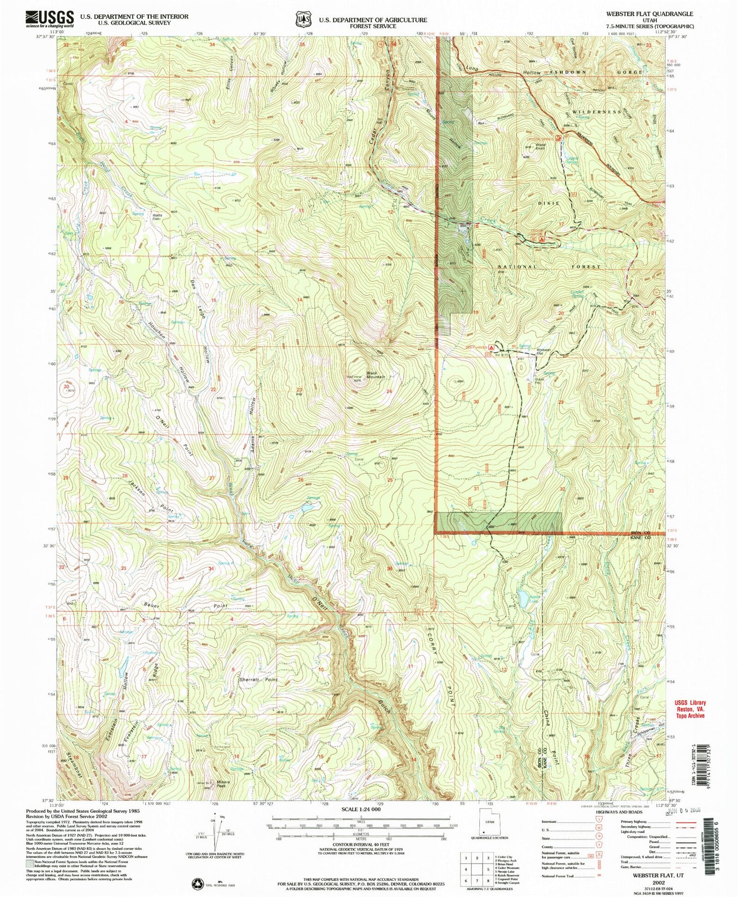
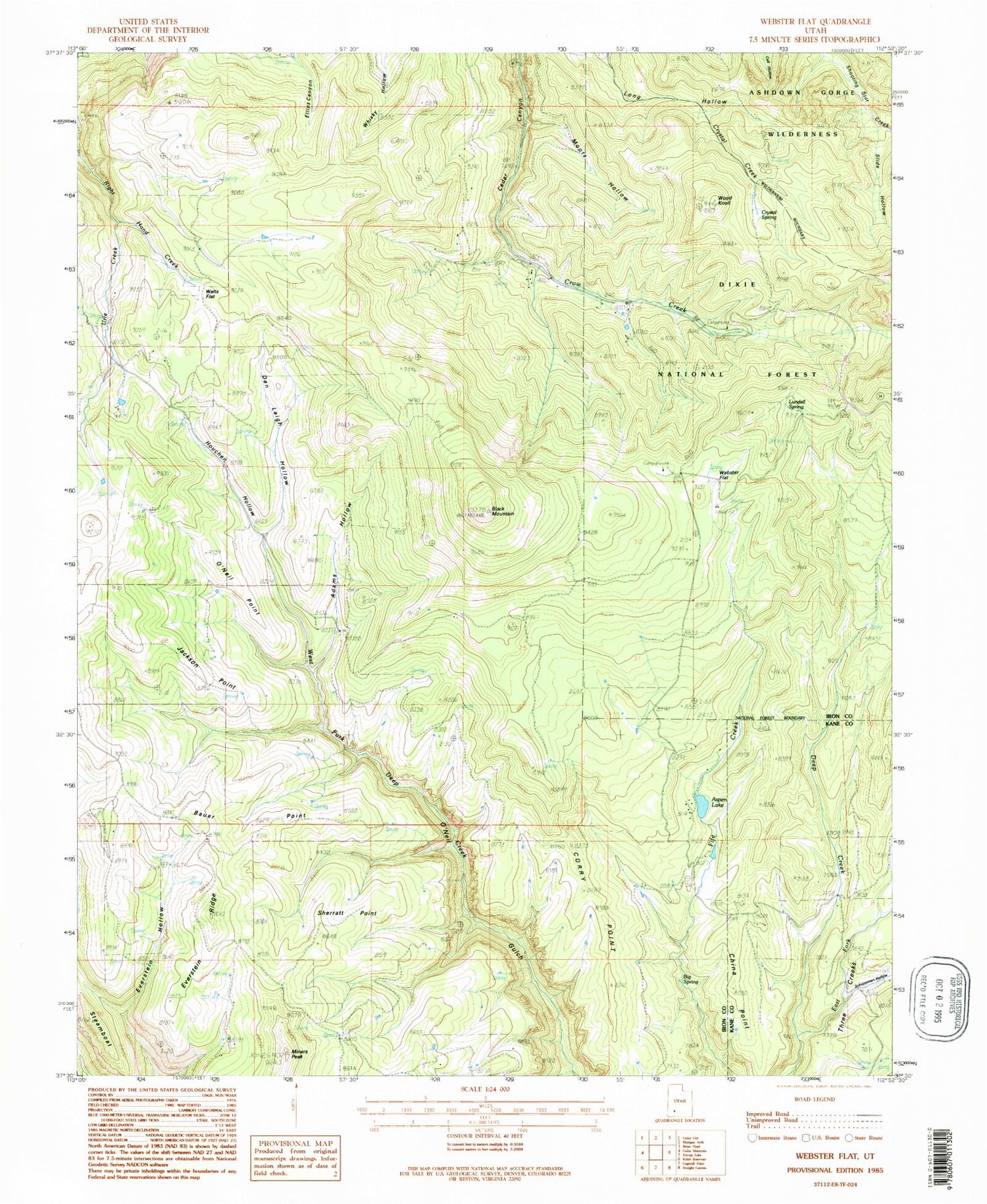
Historical USGS topographic quad map of Webster Flat in the state of Utah. Typical map scale is 1:24,000, but may vary for certain years, if available. Print size: 24" x 27"
This quadrangle is in the following counties: Iron, Kane.
The map contains contour lines, roads, rivers, towns, and lakes. Printed on high-quality waterproof paper with UV fade-resistant inks, and shipped rolled.
Contains the following named places: Adams Hollow, Bauer Point, Big Spring, Black Mountain, China Point, Corry Point, Crystal Creek, Crystal Spring, Dan Leigh Hollow, East Fork Deep Creek, Everstein Hollow, Everstein Ridge, Houchen Hollow, Jackson Point, Kolob Terrace, Lundell Spring, Miners Peak, Moots Hollow, O'Neil Point, Schoppmann Hollow, Sherratt Point, Slide Hollow, Urie Creek, Walts Flat, Webster Flat, Wood Knoll, Wood Ranch, Aspen Lake, Cedar Canyon Ski Area, Steamboat, Three Creeks Flat, Cedar Canyon Campground, Deer Haven Campground, Zion Overlook


