MyTopo
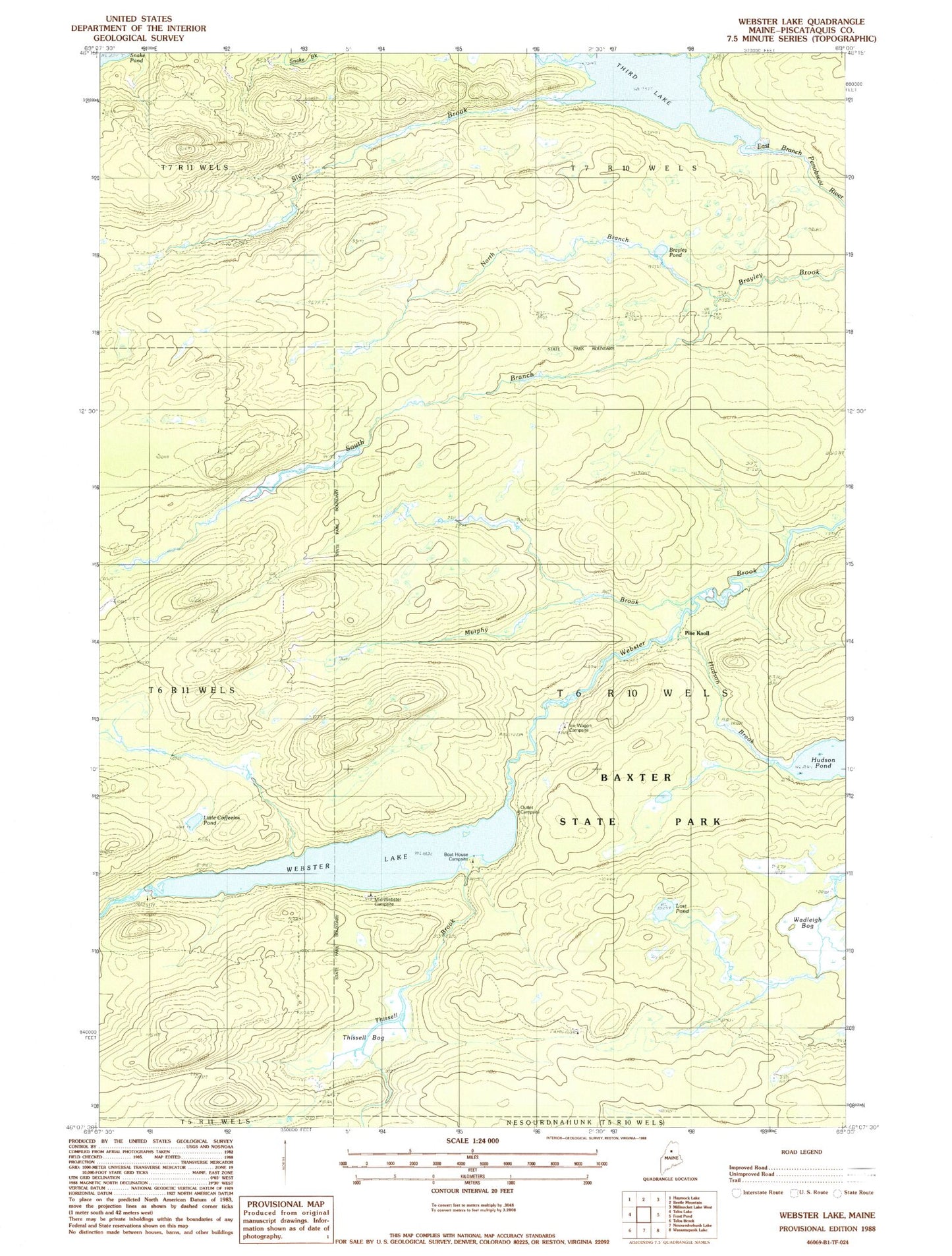
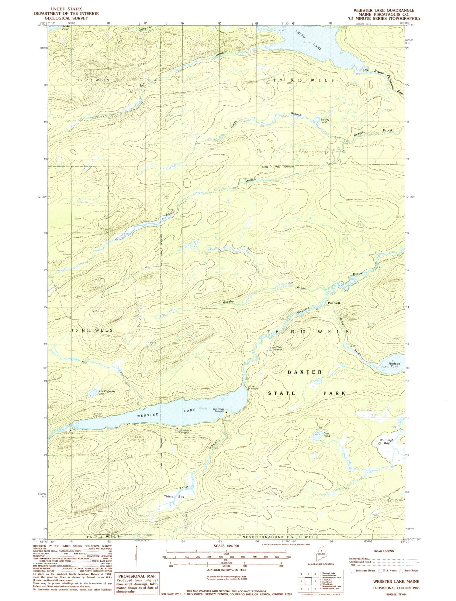
Classic USGS Webster Lake Maine 7.5'x7.5' Topo Map
Couldn't load pickup availability
Historical USGS topographic quad map of Webster Lake in the state of Maine. Typical map scale is 1:24,000, but may vary for certain years, if available. Print size: 24" x 27"
This quadrangle is in the following counties: Piscataquis.
The map contains contour lines, roads, rivers, towns, and lakes. Printed on high-quality waterproof paper with UV fade-resistant inks, and shipped rolled.
Contains the following named places: Brayley Pond, Hudson Brook, Hudson Pond, Little Coffeelos Pond, Lost Pond, Murphy Brook, North Branch Brayley Brook, Sly Brook, South Branch Brayley Brook, Third Lake, Thissell Bog, Thissell Brook, Wadleigh Bog, Webster Lake, Mid-Webster Campsite, Boathouse Campsite, Outlet Campsite, Ice Wagon Campsite, Telos Landing Campsite, Fields Campsite, Pine Knoll, T6 R10 WELS