
MyTopo
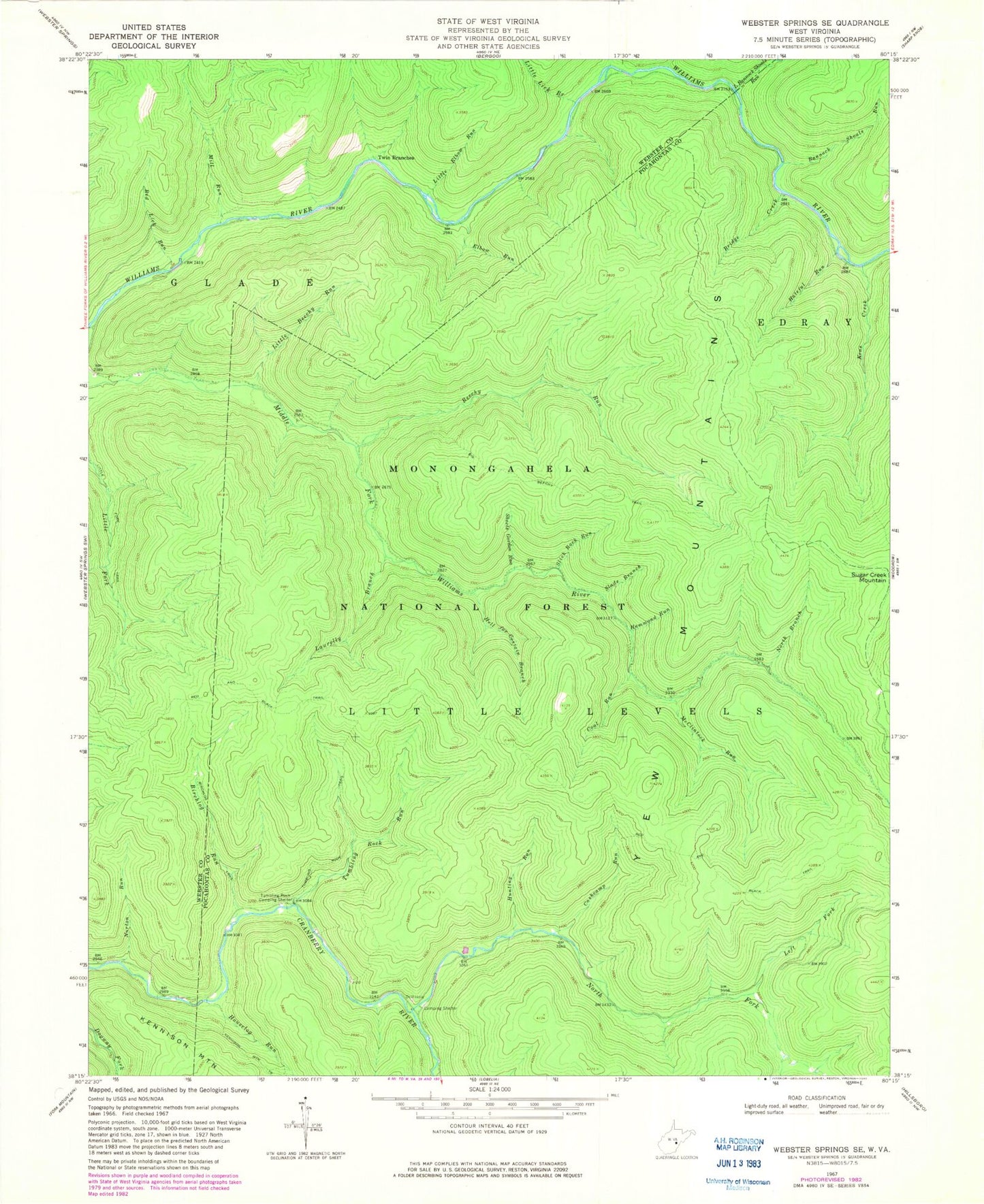
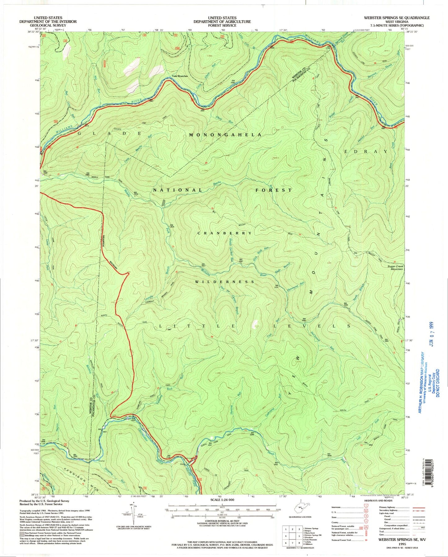
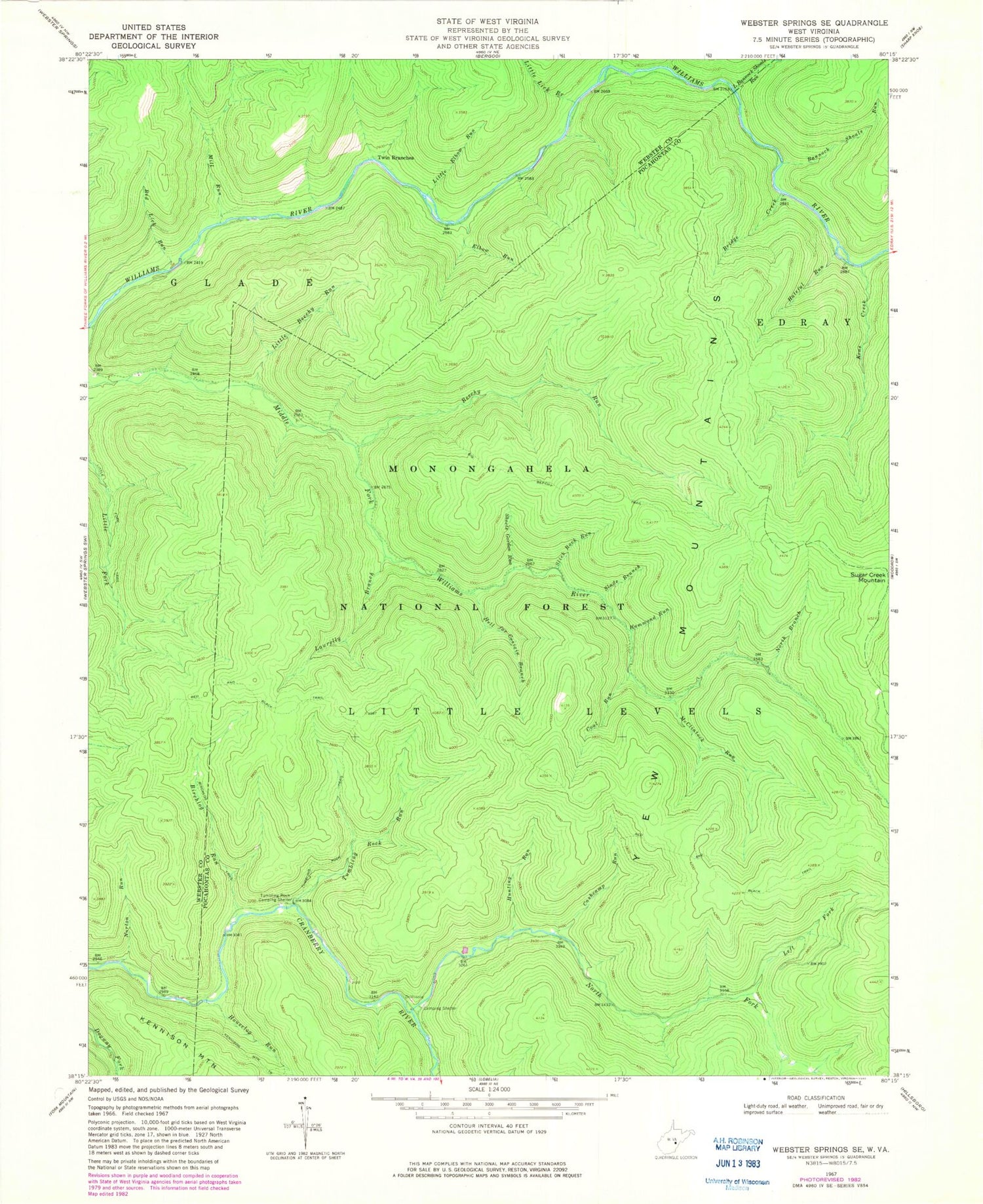
USGS Classic Webster Springs SE West Virginia 7.5'x7.5' Topo Map
Couldn't load pickup availability
Historical USGS topographic quad map of Webster Springs SE in the state of West Virginia. Scale: 1:24000. Print size: 24" x 27"
This quadrangle is in the following counties: Pocahontas, Webster.
The map contains contour lines, roads, rivers, towns, lakes, and grids including latitude / longitude and UTM / MGRS. Printed on high-quality waterproof paper with UV fade-resistant inks.
Contains the following named places: Bannock Shoals Run, Beechy Run, Big Beechy Trail, Birchlog Run, Birchlog Trail, Bridge Creek, Cashcamp Run, Coal Run, Elbow Run, Hammond Run, Hateful Run, Hell for Certain Branch, Houselog Run, Hunting Run, Kens Creek, Laurelly Branch, Left Fork North Fork Cranberry River, Little Bannock Shoals Run, Little Beechy Run, Little Elbow Run, Little Fork Trail, Little Lick Branch, McClintock Run, Mill Run, North Branch Middle Fork Williams River, North Fork Cranberry River, Norton Run, North South Trail, Red Lick Run, Rocklick Run, Sheets Gordon Run, Slabcamp Branch, Slade Branch, Slick Rock Run, Sugar Creek Mountain, Tumbling Rock Camping Shelter, Tumbling Rock Run, Tumbling Rock Trail, Twin Branches, Yew Mountains, South Fork Cranberry River, Laurelly Branch Trail, Cranberry Wilderness, North Fork Trail, Middle Fork Trail, County Line Trail, District Line Trail, Kennison Mountain