MyTopo
Classic USGS Webster Nebraska 7.5'x7.5' Topo Map
Regular price
$16.95
Regular price
Sale price
$16.95
Unit price
per
Couldn't load pickup availability
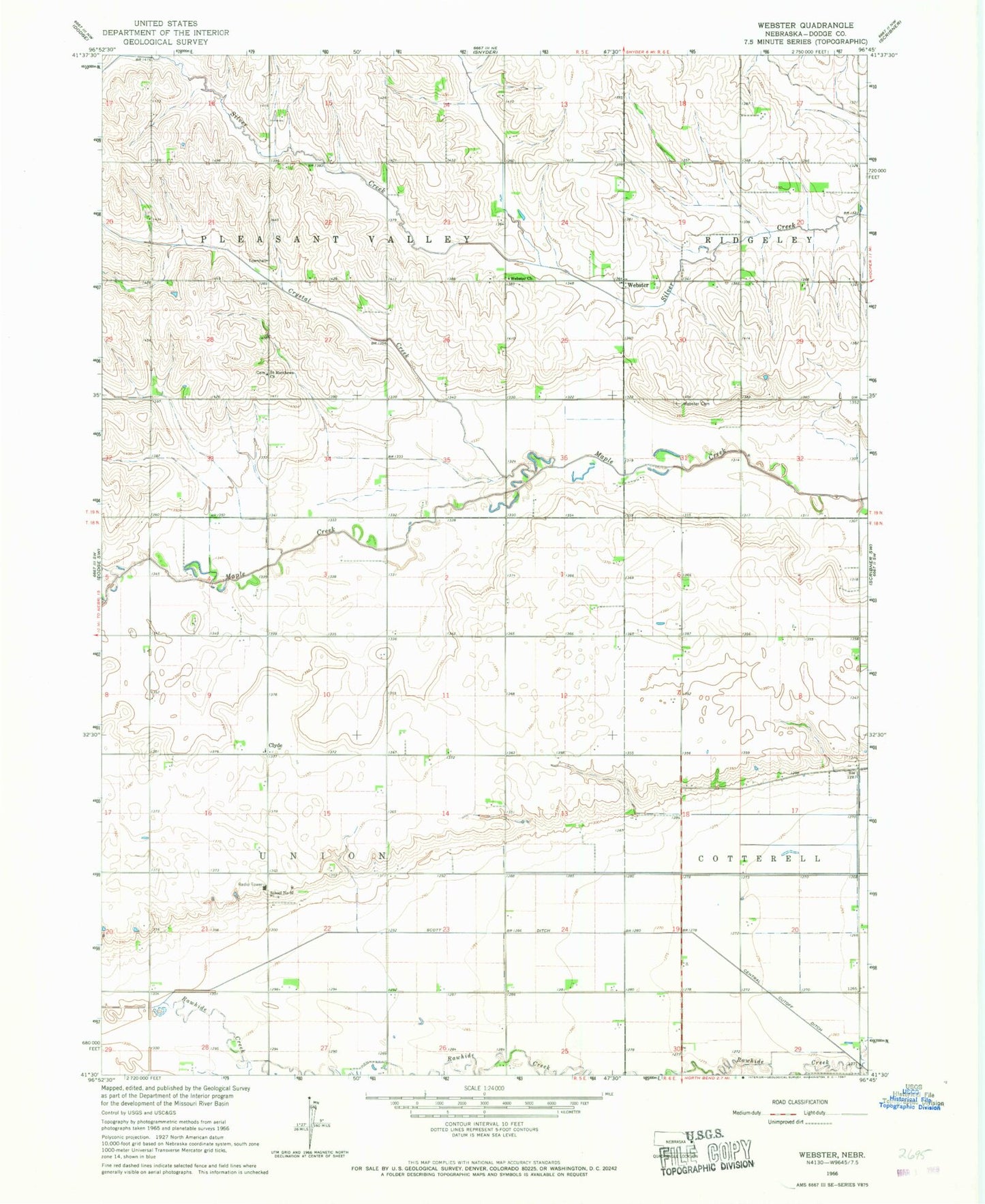
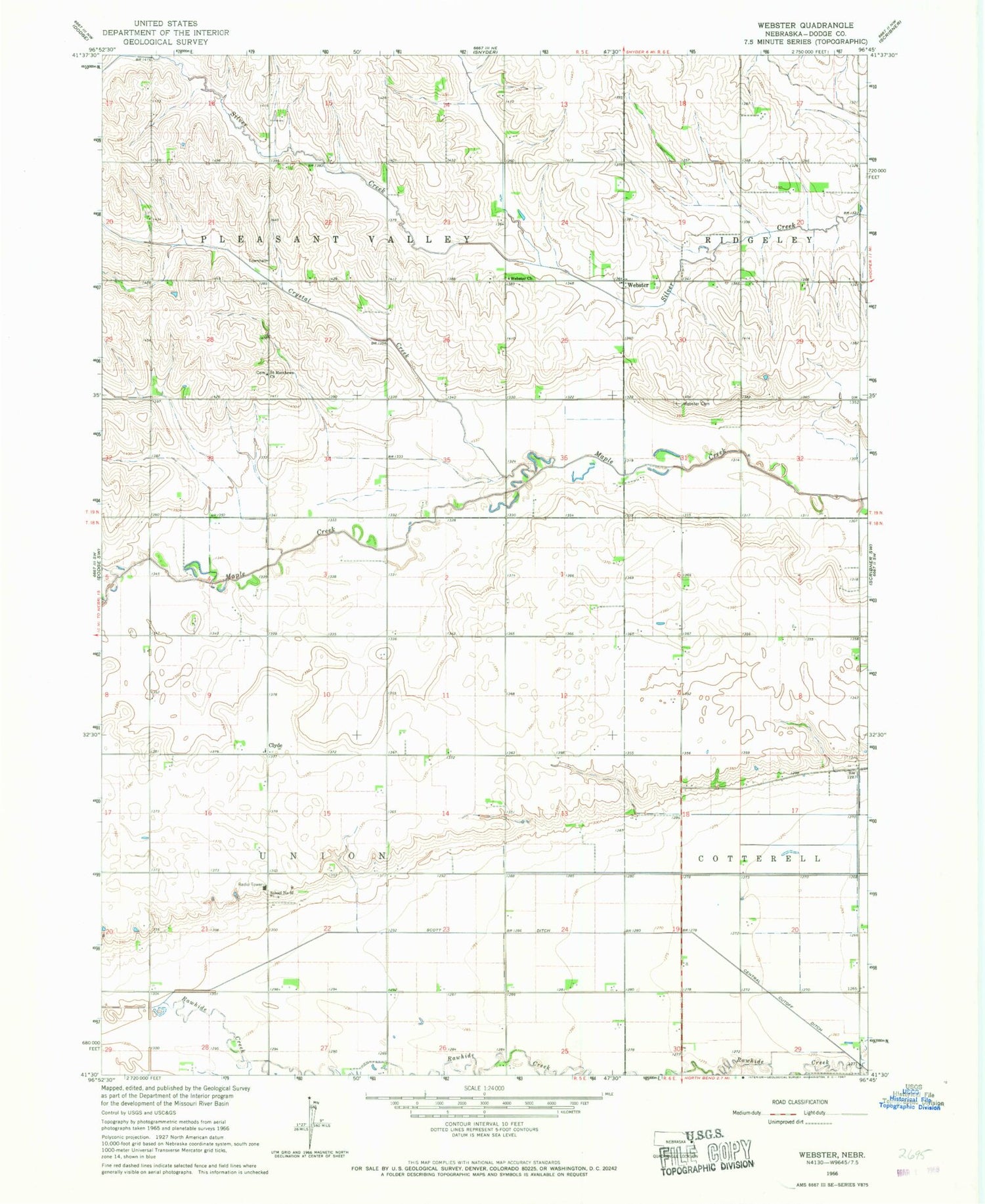
Historical USGS topographic quad map of Webster in the state of Nebraska. Map scale may vary for some years, but is generally around 1:24,000. Print size is approximately 24" x 27"
This quadrangle is in the following counties: Dodge.
The map contains contour lines, roads, rivers, towns, and lakes. Printed on high-quality waterproof paper with UV fade-resistant inks, and shipped rolled.
Contains the following named places: Clyde, Clyde Post Office, Crystal Creek, Saint Matthews Church, School Number 92, Scott Ditch, Township of Pleasant Valley, Township of Union, Webster, Webster Cemetery, Webster Church, Webster Post Office, Webster Public School, ZIP Code: 68649