MyTopo
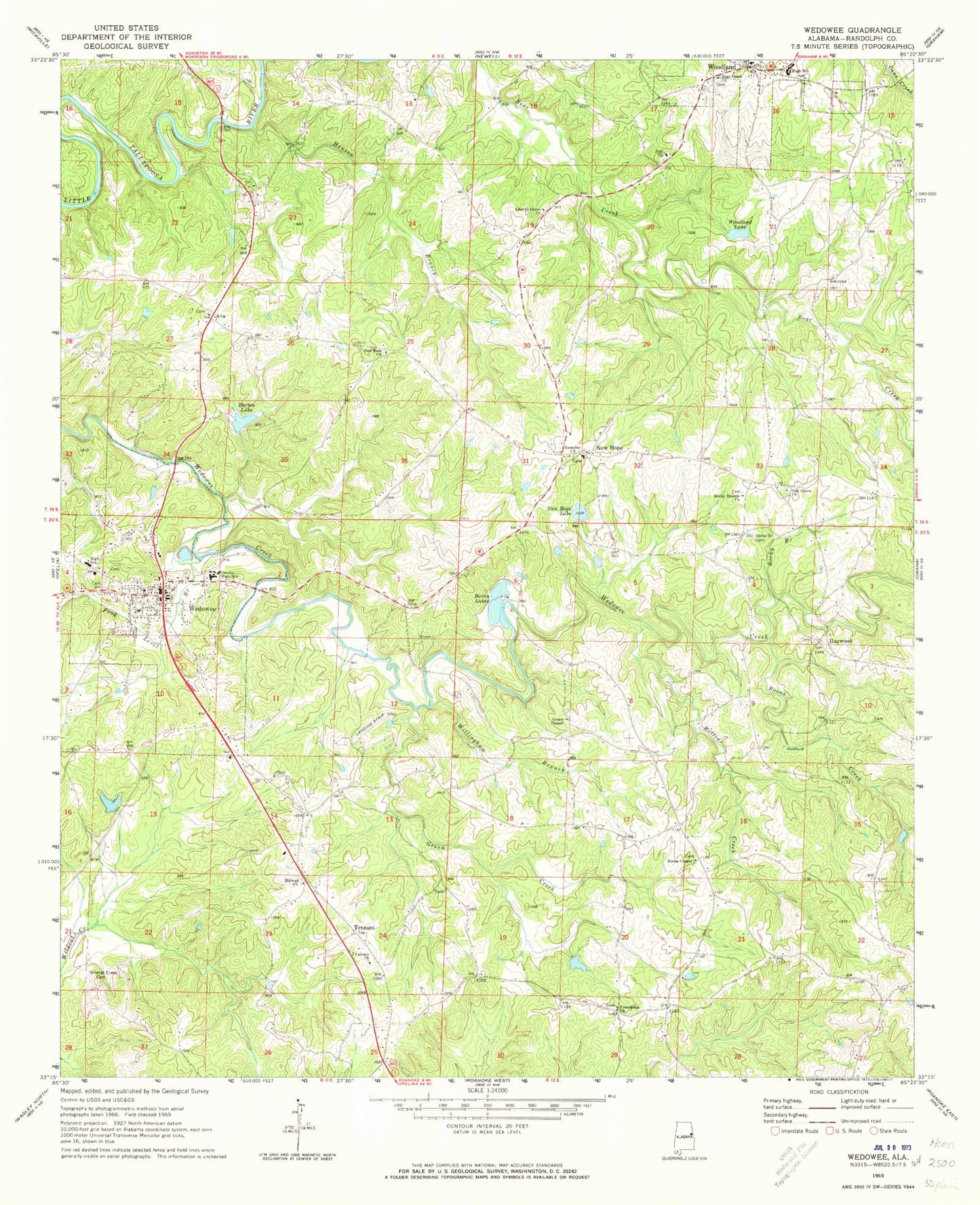
Classic USGS Wedowee Alabama 7.5'x7.5' Topo Map
Couldn't load pickup availability
Historical USGS topographic quad map of Wedowee in the state of Alabama. Map scale may vary for some years, but is generally around 1:24,000. Print size is approximately 24" x 27"
This quadrangle is in the following counties: Randolph.
The map contains contour lines, roads, rivers, towns, and lakes. Printed on high-quality waterproof paper with UV fade-resistant inks, and shipped rolled.
Contains the following named places: A and M Volunteer Fire Department, Ava, Ava Church, Barton Lake, Bear Creek Methodist Church Cemetery, Bear Creek United Methodist Church, Boone Creek, Burke Chapel, Burns Lake Number 2, Burns Lakes, Burns Number 2 Dam, Calvary Church, Carpenter Dam, Carpenter Lake, Corbin, Curt, Friendship Church, Frog Level Branch, Green Chapel, Green Creek, Haywood, Henson Branch, Hobson, Liberty Grove, Liberty Grove Church Cemetery, Liberty Grove Congregational Methodist Church, McBurnett Ford, McCain Dam, McManus Dam, McManus Pond, Midway, Midway United Methodist Church, Midway United Methodist Church Cemetery, Mount Pisgah Methodist Church Cemetery, Mount Pleasant, Mud Creek, New Hope, New Hope Dam, New Hope Lake, New Hope Volunteer Fire Department, New Life Church, Noonday Church, Oak Grove Church of Christ, Old Rocky Branch Baptist Church Cemetery, Peace, Randolph County, Randolph County High School, Randolph County Sheriff's Office, Rocky Branch, Rocky Branch Baptist Church, Rollins Creek, Strain Dam, Tennant, Town of Wedowee, Traylor Family Cemetery, Victory Church, Wedowee, Wedowee Club Lake, Wedowee Club Lake Dam, Wedowee High School, Wedowee Hospital and Clinic, Wedowee Police Department, Wedowee Post Office, Wedowee Volunteer Fire Department, West, Willingham Branch, Woodland, Woodland High School, Woodland Lake, Woodland Post Office, Woodland Volunteer Fire Department, Zion Church, Zion Rest Church


