MyTopo
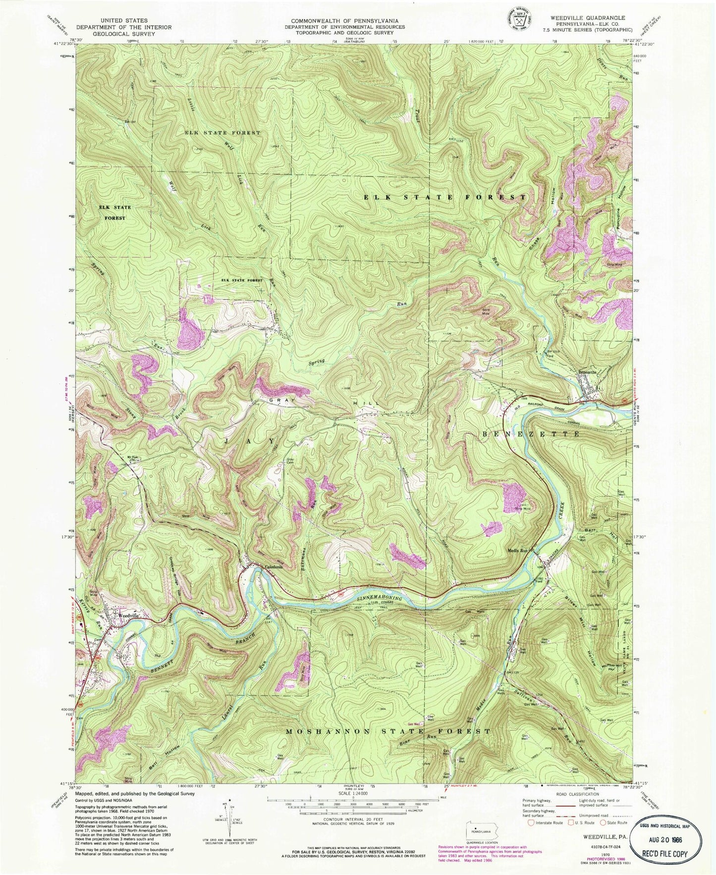
Classic USGS Weedville Pennsylvania 7.5'x7.5' Topo Map
Couldn't load pickup availability
Historical USGS topographic quad map of Weedville in the state of Pennsylvania. Typical map scale is 1:24,000, but may vary for certain years, if available. Print size: 24" x 27"
This quadrangle is in the following counties: Elk.
The map contains contour lines, roads, rivers, towns, and lakes. Printed on high-quality waterproof paper with UV fade-resistant inks, and shipped rolled.
Contains the following named places: Bakemans Run, Barr Hollow, Bear Run, Bell Hollow, Benezette, Browns Run, Caledonia, Chase Hollow, Crooked Bridge Hollow, Gray Cemetery, Gray Hill, Little Wolf Lick Run, McPherson Hollow, Medix Run, Medix Run, Mount Zion Church, Silver Mill Hollow, Spring Run, Stony Brook, Sullivan Run, Trout Run, Weedville, Wolf Lick Run, Kersey Run, Laurel Run, Little Dents Run, Stoney Brook, Caledonia Run, McPherson Run, Silvermill Hollow Run, Township of Jay, Weedville Census Designated Place, Weedville Post Office, Benezett Post Office, Benezette Cemetery, Weedville United Methodist Cemetery, Mount Zion Cemetery