MyTopo
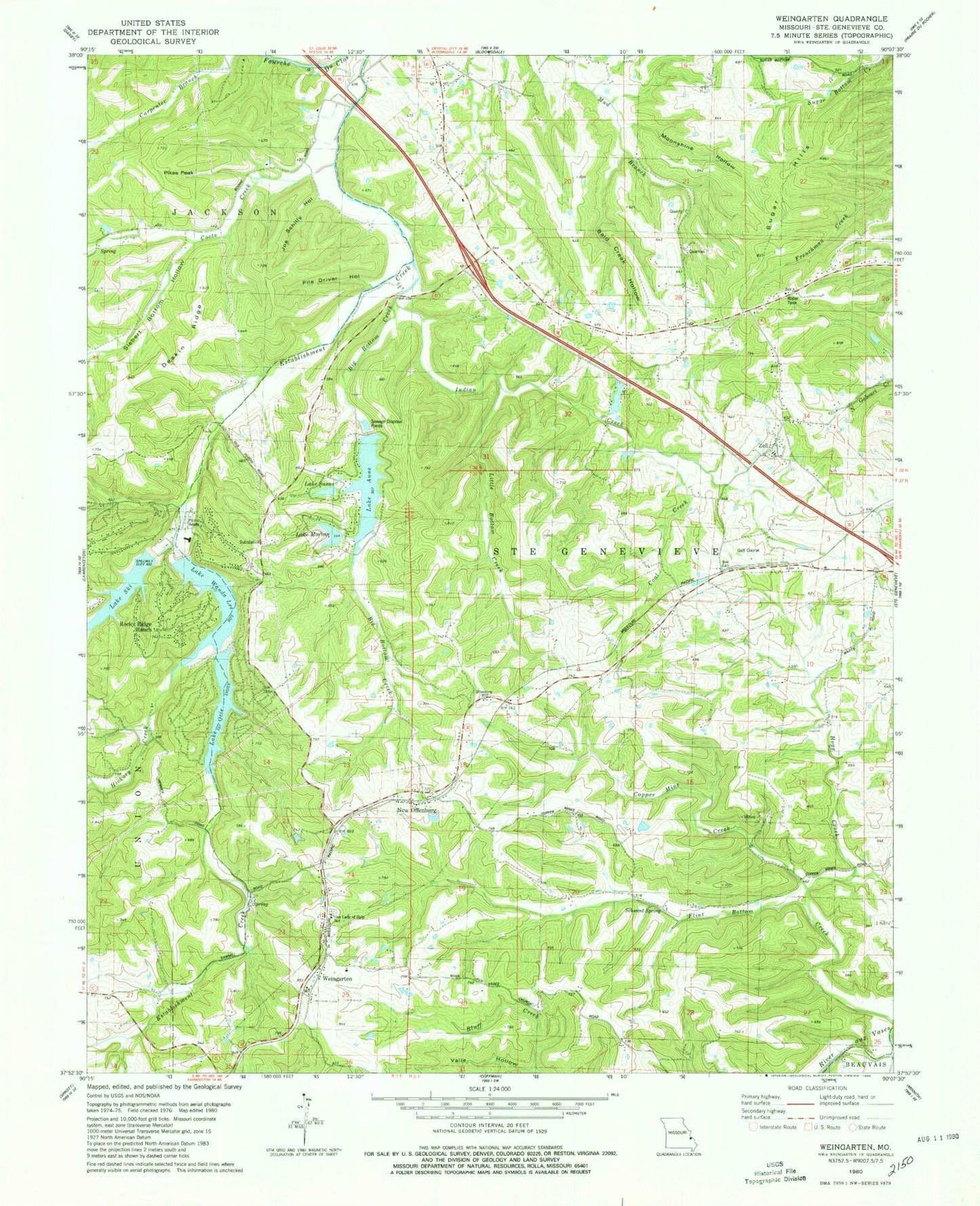
Classic USGS Weingarten Missouri 7.5'x7.5' Topo Map
Couldn't load pickup availability
Historical USGS topographic quad map of Weingarten in the state of Missouri. Map scale may vary for some years, but is generally around 1:24,000. Print size is approximately 24" x 27"
This quadrangle is in the following counties: Ste. Genevieve.
The map contains contour lines, roads, rivers, towns, and lakes. Printed on high-quality waterproof paper with UV fade-resistant inks, and shipped rolled.
Contains the following named places: Bald Creek Hollow, Big Bottom Creek, Coal Creek, Coots Creek, Copper Mine, Copper Mine Creek, Cornwall Copper Mine, Deakin Ridge, Flint Bottom Creek, Grayhawk Census Designated Place, Hickory Creek, Hogg Creek, Indian Creek, Joe Schilly Hollow, Lake Anne, Lake Forest Dam, Lake Forest Estates, Lake Forest Volunteer Fire Department, Lake Marian, Lake Marian Dam, Lake Ocie, Lake Ocie Dam, Lake Ski, Lake Ski Dam, Lake Susan, Lake Susan Dam, Lake Wanda Lee, Lake Wanda Lee Dam, Lick Hollow, Little Bottom Creek, Moonshine Hollow, New Offenburg, New Offenburg Census Designated Place, Our Lady Help of Christians Catholic Church, Our Lady of Help School, Pikes Peak, Pile Driver Hollow, Pine Valley School, Red Hill School, Rocky Ridge Ranch, Saint Josephs Catholic Church, Sainte Genevieve County, Schwent Spring, Siebert Bottom Hollow, Sugar Hills, Valle Hollow, Weingarten, Weingarten Census Designated Place, Weingarten Volunteer Fire Department, Zell, Zell Station, Zell Volunteer Fire Department, ZIP Code: 63670