MyTopo
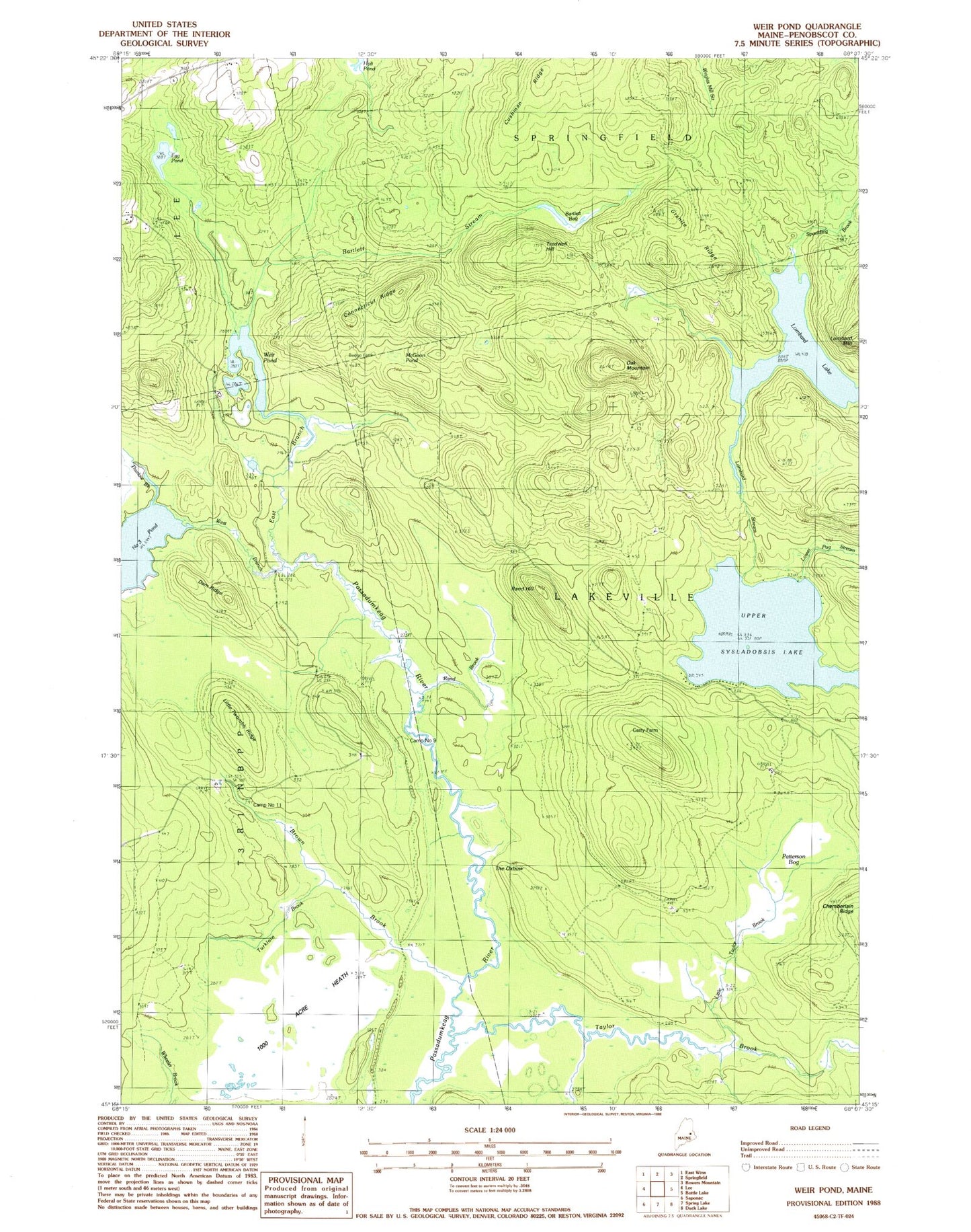
Classic USGS Weir Pond Maine 7.5'x7.5' Topo Map
Couldn't load pickup availability
Historical USGS topographic quad map of Weir Pond in the state of Maine. Typical map scale is 1:24,000, but may vary for certain years, if available. Print size: 24" x 27"
This quadrangle is in the following counties: Penobscot.
The map contains contour lines, roads, rivers, towns, and lakes. Printed on high-quality waterproof paper with UV fade-resistant inks, and shipped rolled.
Contains the following named places: Bartlett Bog, Bartlett Stream, Brown Brook, Budge Farm, Camp Number Eleven, Camp Number Nine, Carry Farm, Connecticut Ridge, Cushman Ridge, Dam Ridge, East Branch Passadumkeag River, Egg Pond, Granite Ridge, Little Taylor Brook, Little Twombly Ridge, Lombard Lake, Lombard Stream, Lower Pug Stream, McGoon Pond, Oak Mountain, One Thousand Acre Heath, Patterson Bog, Rand Brook, Rand Hill, Spaulding Brook, Taylor Brook, The Oxbow, Thurlow Brook, Tredwell Hill, Turkloin Brook, Upper Sysladobsis Lake, Weir Pond, West Branch Passadumkeag River, Drake Place (historical)