
MyTopo
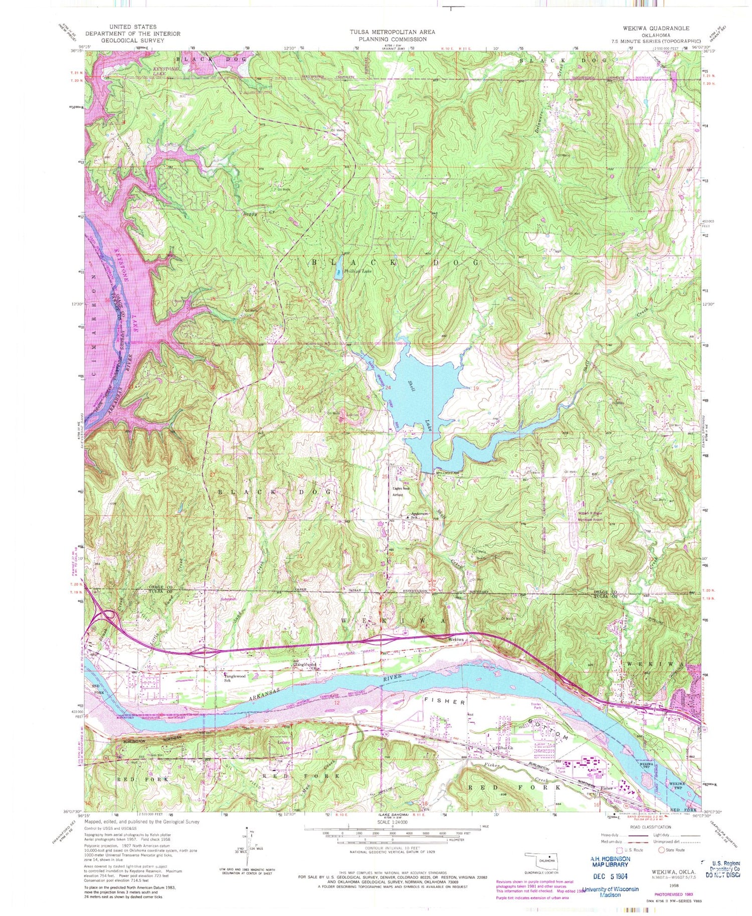
Classic USGS Wekiwa Oklahoma 7.5'x7.5' Topo Map
Couldn't load pickup availability
Historical USGS topographic quad map of Wekiwa in the state of Oklahoma. Map scale may vary for some years, but is generally around 1:24,000. Print size is approximately 24" x 27"
This quadrangle is in the following counties: Osage, Pawnee, Tulsa.
The map contains contour lines, roads, rivers, towns, and lakes. Printed on high-quality waterproof paper with UV fade-resistant inks, and shipped rolled.
Contains the following named places: Anderson Elementary School, Boggy Creek, Brush Creek, City of Sand Springs, Double W Airport, Euchee Creek, First Pentecostal Holiness Church, Fisher, Fisher Bottom, Fisher Church, Green Country Fire and Rescue, Gull Bay Landing, Hissom Memorial Center Heliport, L E Rader Center, Little Sand Creek, Lotsee, Mud Creek, Phillips Lake, Sand Creek, Shell Creek, Shell Dam, Shell Lake, Tanglewood Church, Tanglewood School, Town of Lotsee, Township of Wekiwa, Wekiwa, William R Pogue Municipal Airport, ZIP Code: 74063


