MyTopo
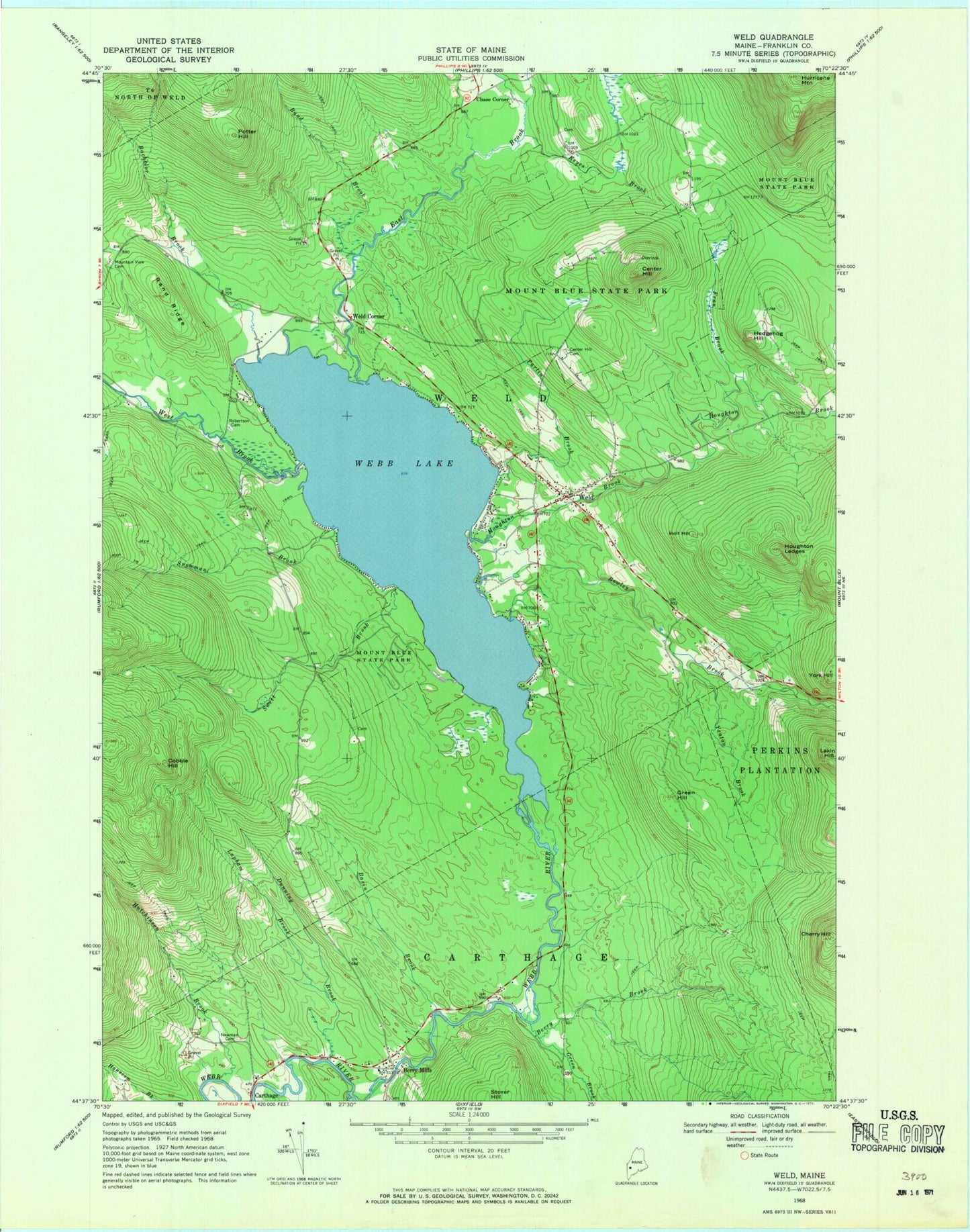
Classic USGS Weld Maine 7.5'x7.5' Topo Map
Couldn't load pickup availability
Historical USGS topographic quad map of Weld in the state of Maine. Typical map scale is 1:24,000, but may vary for certain years, if available. Print size: 24" x 27"
This quadrangle is in the following counties: Franklin.
The map contains contour lines, roads, rivers, towns, and lakes. Printed on high-quality waterproof paper with UV fade-resistant inks, and shipped rolled.
Contains the following named places: Bachelor Brook, Basin Brook, Berry Brook, Berry Mills, Bowley Brook, Center Hill, Center Hill Cemetery, Cherry Hill, Cobble Hill, Dunning Brook, East Brook, Fran Brook, Green Brook, Green Hill, Hedgehog Hill, Holt Hill, Houghton Brook, Houghton Ledges, Hurricane Mountain, Hutchinson Brook, Keyes Brook, Lakin Hill, Lapham Brook, Mount Blue State Park, Mountain View Cemetery, Newman Cemetery, Parlin Brook, Potter Hill, Rand Brook, Rand Ridge, Robertson Cemetery, Snowman Brook, Swett Brook, Webb Lake, Weld, West Brook, Yeaton Brook, York Hill, Chase Corner, Weld Corner, Town of Weld, Berry Mills Cemetery, Weld Elementary school, Weld Post Office, Weld Volunteer Fire Station, Carthage Volunteer Fire Department, Old Tainter Burial Ground, Weld Elementary School, Weld Public Library