
MyTopo
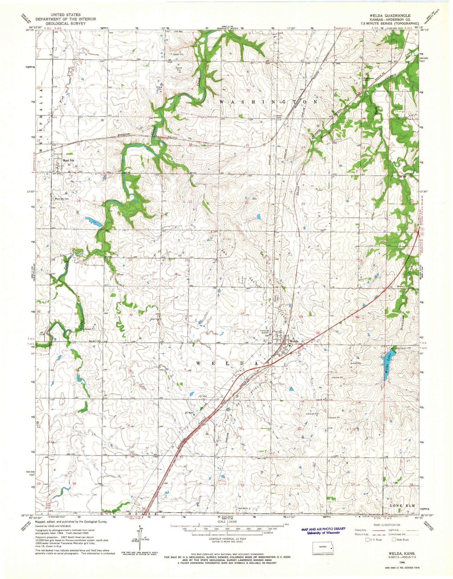
Classic USGS Welda Kansas 7.5'x7.5' Topo Map
Couldn't load pickup availability
Historical USGS topographic quad map of Welda in the state of Kansas. Map scale may vary for some years, but is generally around 1:24,000. Print size is approximately 24" x 27"
This quadrangle is in the following counties: Anderson.
The map contains contour lines, roads, rivers, towns, and lakes. Printed on high-quality waterproof paper with UV fade-resistant inks, and shipped rolled.
Contains the following named places: Anderson County, Bradshaw Creek, Cedar Valley Reservoir, Hyatt Cemetery, Hyattville, Lake Welda, Mont Ida, Mont Ida Cemetery, Mont Ida Census Designated Place, Mont Ida Elementary School, Rolling Ball Ranch, Skunk Branch, Township of Washington, Township of Welda, Wardell Cemetery, Washington School, Welda, Welda Cemetery, Welda Census Designated Place, Welda Post Office, Welda Sewer District Number 1, Welda United Methodist Church, Welda Volunteer Fire Department, ZIP Code: 66091


