MyTopo
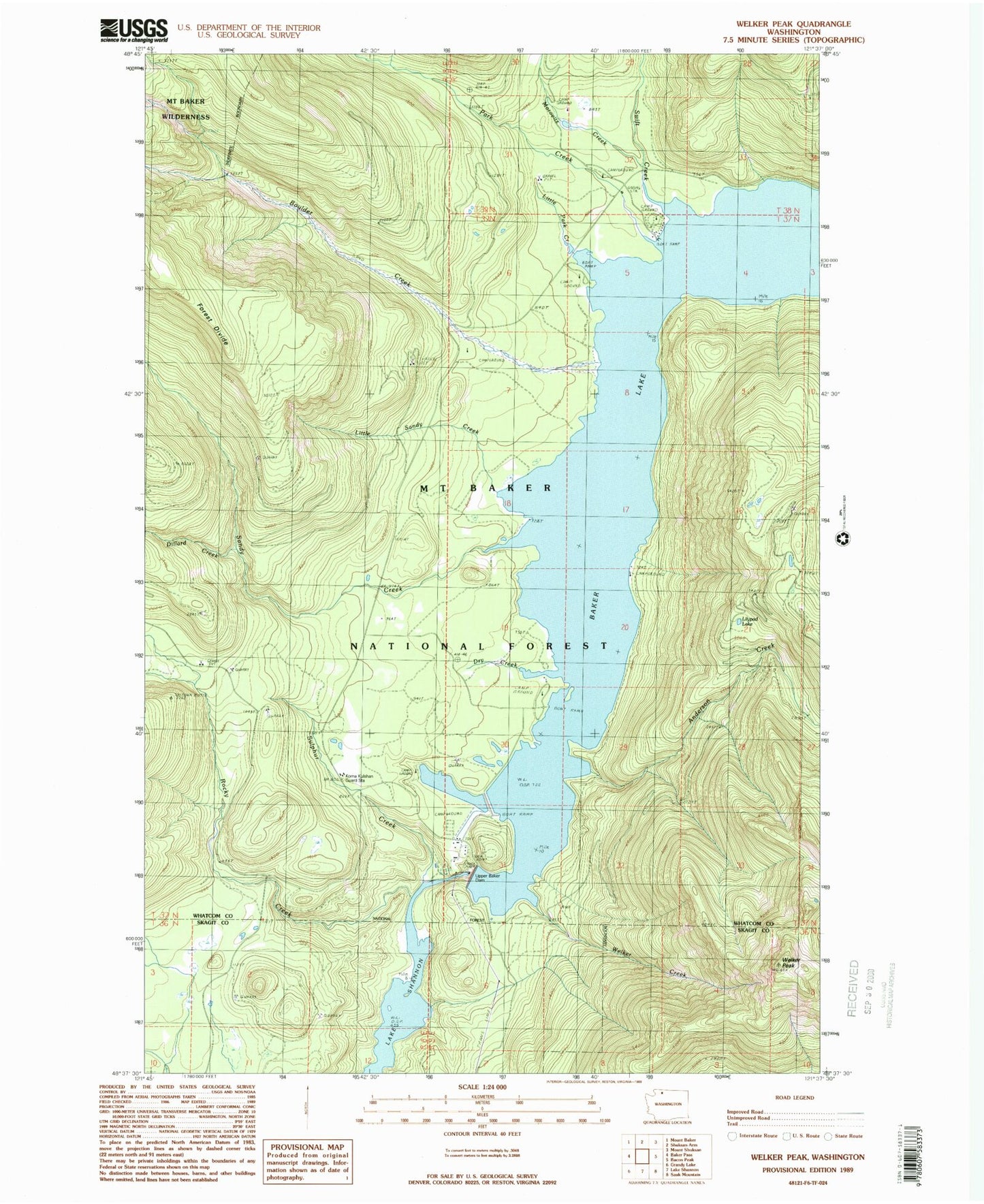
Classic USGS Welker Peak Washington 7.5'x7.5' Topo Map
Couldn't load pickup availability
Historical USGS topographic quad map of Welker Peak in the state of Washington. Map scale may vary for some years, but is generally around 1:24,000. Print size is approximately 24" x 27"
This quadrangle is in the following counties: Skagit, Whatcom.
The map contains contour lines, roads, rivers, towns, and lakes. Printed on high-quality waterproof paper with UV fade-resistant inks, and shipped rolled.
Contains the following named places: Anderson Creek, Baker Lake, Baker Lake Resort, Boulder Creek, Boulder Creek Campground, Depression Lake Campground, Dillard Creek, Dillard Point Lookout, Horseshoe Cove Campground, Koma Kulshan Guard Station, Kulshan Campground, Lilypad Lake, Little Park Creek, Little Sandy Creek, Maple Grove Campground, Marble Rapids, Morovitz Creek, Morovitz Ranch, Mount Baker Ranger District, Panorama Point Campground, Park Creek, Park Creek Campground, Rocky Creek, Rocky Creek Dam, Sandy Creek, Sulphur Creek, Sulphur Point Lookout, Swift Creek, Upper Baker Dam, Upper Baker Lake Viewpoint, Welker Creek, Welker Peak, West Pass Dike Dam