
MyTopo
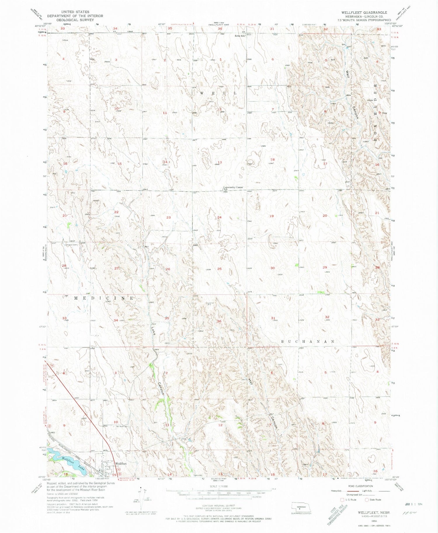
Classic USGS Wellfleet Nebraska 7.5'x7.5' Topo Map
Couldn't load pickup availability
Historical USGS topographic quad map of Wellfleet in the state of Nebraska. Map scale may vary for some years, but is generally around 1:24,000. Print size is approximately 24" x 27"
This quadrangle is in the following counties: Lincoln.
The map contains contour lines, roads, rivers, towns, and lakes. Printed on high-quality waterproof paper with UV fade-resistant inks, and shipped rolled.
Contains the following named places: Community Center School, Detour Airport, Echo Post Office, Echo School, Lutheran Cemetery, Maywood Wellfleet Volunteer Fire Department, Medicine Election Precinct, Saint William Catholic Church, Village of Wellfleet, Welfleet Lake, Well Election Precinct, Wellfleet, Wellfleet Cemetery, Wellfleet Dam, Wellfleet Lake, Wellfleet Post Office, Wellfleet School, ZIP Code: 69170


