MyTopo
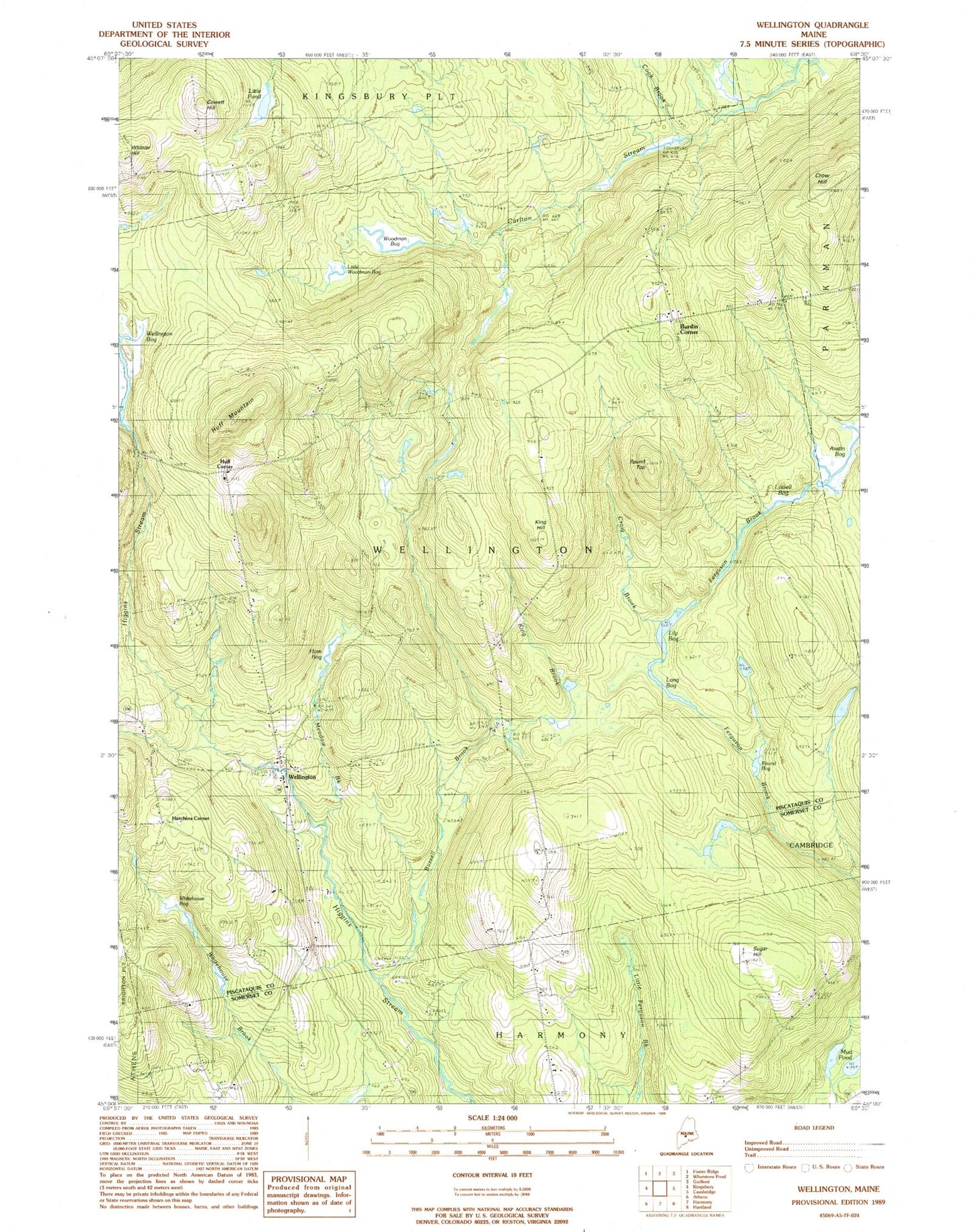
Classic USGS Wellington Maine 7.5'x7.5' Topo Map
Couldn't load pickup availability
Historical USGS topographic quad map of Wellington in the state of Maine. Typical map scale is 1:24,000, but may vary for certain years, if available. Print size: 24" x 27"
This quadrangle is in the following counties: Piscataquis, Somerset.
The map contains contour lines, roads, rivers, towns, and lakes. Printed on high-quality waterproof paper with UV fade-resistant inks, and shipped rolled.
Contains the following named places: Austin Bog, Buzzell Brook, Campbell School, Cook Brook, Cowett Hill, Craig Brook, Crow Hill, Huff Mountain, King Brook, King Hill, Klondike Cemetery, Lily Bog, Little Pond, Little Woodman Bog, Long Bog, Lowell Bog, Mud Pond, Round Bog, Round Top, Sugar Hill, Taylor Cemetery, Wellington, Whittier Hill, Woodman Bog, Whitehouse Bog, Ham Bog, Town of Wellington, Burdin Corner, Huff Corner, Hutchins Corner, Meadow Brook, Wellington Elementary School, Wellington Post Office, Wellington Fire Department, Burdins Corner Cemetery, Hutchins Corner Cemetery, Small Philbrick Cemetery, Drew Cemetery, Herriman Cemetery, Reed Cemetery