MyTopo
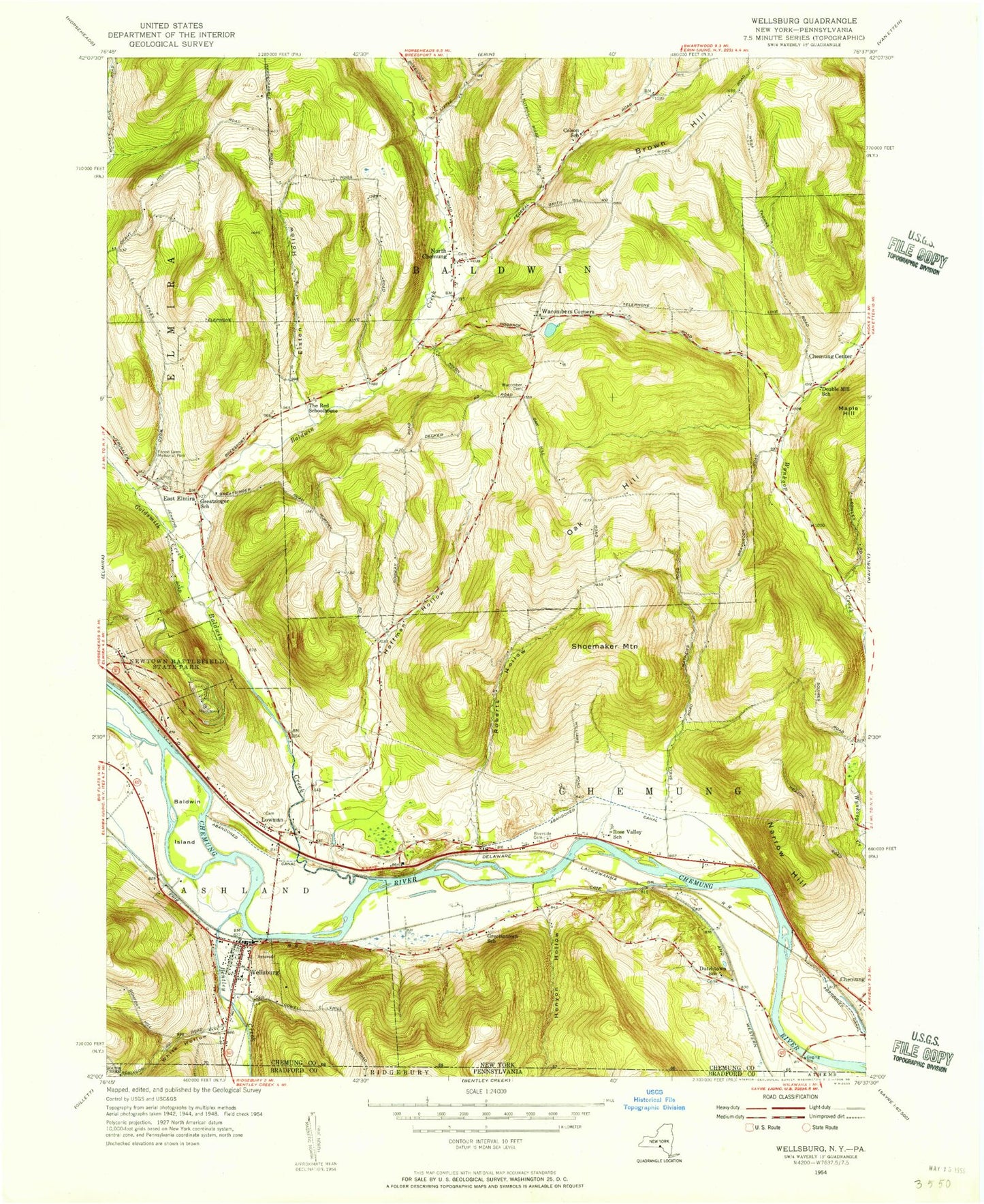
Classic USGS Wellsburg New York 7.5'x7.5' Topo Map
Couldn't load pickup availability
Historical USGS topographic quad map of Wellsburg in the state of New York. Typical map scale is 1:24,000, but may vary for certain years, if available. Print size: 24" x 27"
This quadrangle is in the following counties: Bradford, Chemung.
The map contains contour lines, roads, rivers, towns, and lakes. Printed on high-quality waterproof paper with UV fade-resistant inks, and shipped rolled.
Contains the following named places: Baldwin Creek, Baldwin Island, Beantown, Bentley Creek, Brown Hill, Elston Hollow, Forest Lawn Memorial Park, Goldsmith Creek, Henyon Hollow, Hoffman Hollow, Lowman, Mallory Creek, Narrow Hill, Newtown Battlefield Reservation, North Chemung, Oak Hill, Riverside Cemetery, Roberts Hollow, Shoemaker Mountain, Wacomber Cemetery, Wacombers Corners, Wellsburg, Maple Hill, East Elmira, Town of Baldwin, White Hollow, Village of Wellsburg, Birchland Park, Carriage Estates, Holly Park Terrace, North Chemung Cemetery, Elliott-Searles Cemetery, Ashland Cemetery, Wellsburg Baptist Church Cemetery, Dutchtown Cemetery, Millards Berry Farm, Grace Farms, Foxwin Farm, North Chemung United Methodist Church, Wellsburg United Methodist Church, Lowman Post Office, Wellsburg Post Office, Chemung County Landfill, Bentley Creek Bridge, Garner Hill Campground, Baldwin Volunteer Fire Company Station 1, Wellsburg Volunteer Fire Department, Sly Creek, Washburn Brook, White Hollow Run