
MyTopo
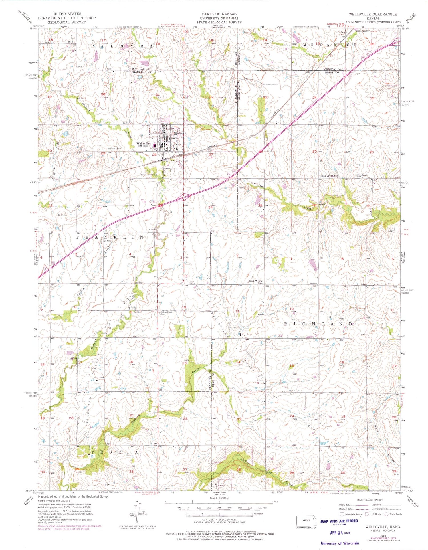
Classic USGS Wellsville Kansas 7.5'x7.5' Topo Map
Couldn't load pickup availability
Historical USGS topographic quad map of Wellsville in the state of Kansas. Map scale may vary for some years, but is generally around 1:24,000. Print size is approximately 24" x 27"
This quadrangle is in the following counties: Douglas, Franklin, Johnson, Miami.
The map contains contour lines, roads, rivers, towns, and lakes. Printed on high-quality waterproof paper with UV fade-resistant inks, and shipped rolled.
Contains the following named places: Amar Farms Airport, City of Wellsville, Hartland Airport, Rock Creek Cemetery, Rock Creek School, Township of Franklin, Walnut Creek Cemetery, Wellsville, Wellsville Baptist Church, Wellsville Cemetery, Wellsville City Hall, Wellsville City Library, Wellsville Elementary School, Wellsville Family Workship Center, Wellsville Fire District, Wellsville High School, Wellsville Middle School, Wellsville Police Department, Wellsville Post Office, Wellsville Unified School District Office, Wellsville United Methodist Church, Wellsville Wastewater Plant, Wellsville-Paola Oil Field, West Windy School, ZIP Code: 66092


