MyTopo
Classic USGS Wellsville Ohio 7.5'x7.5' Topo Map
Couldn't load pickup availability
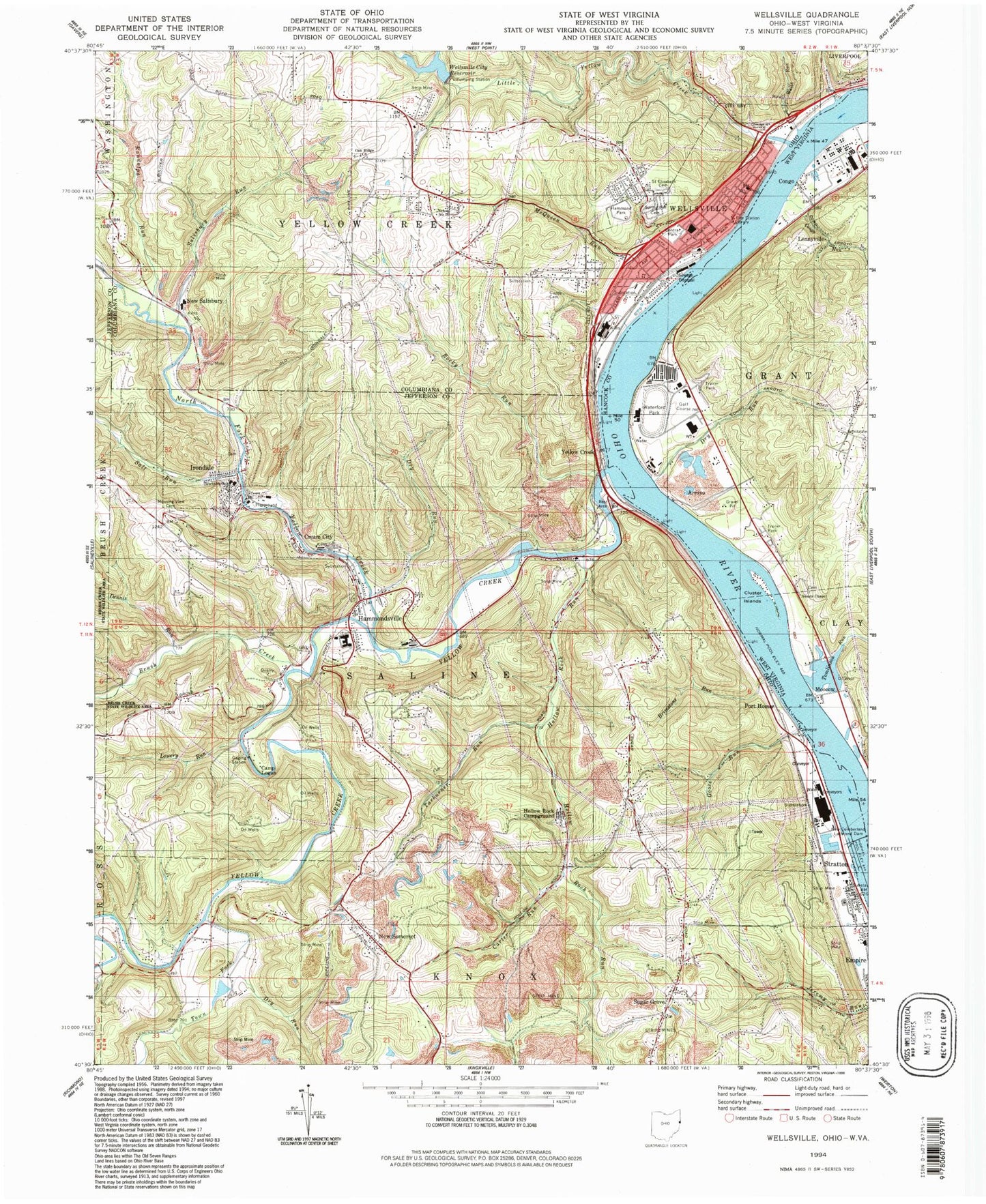
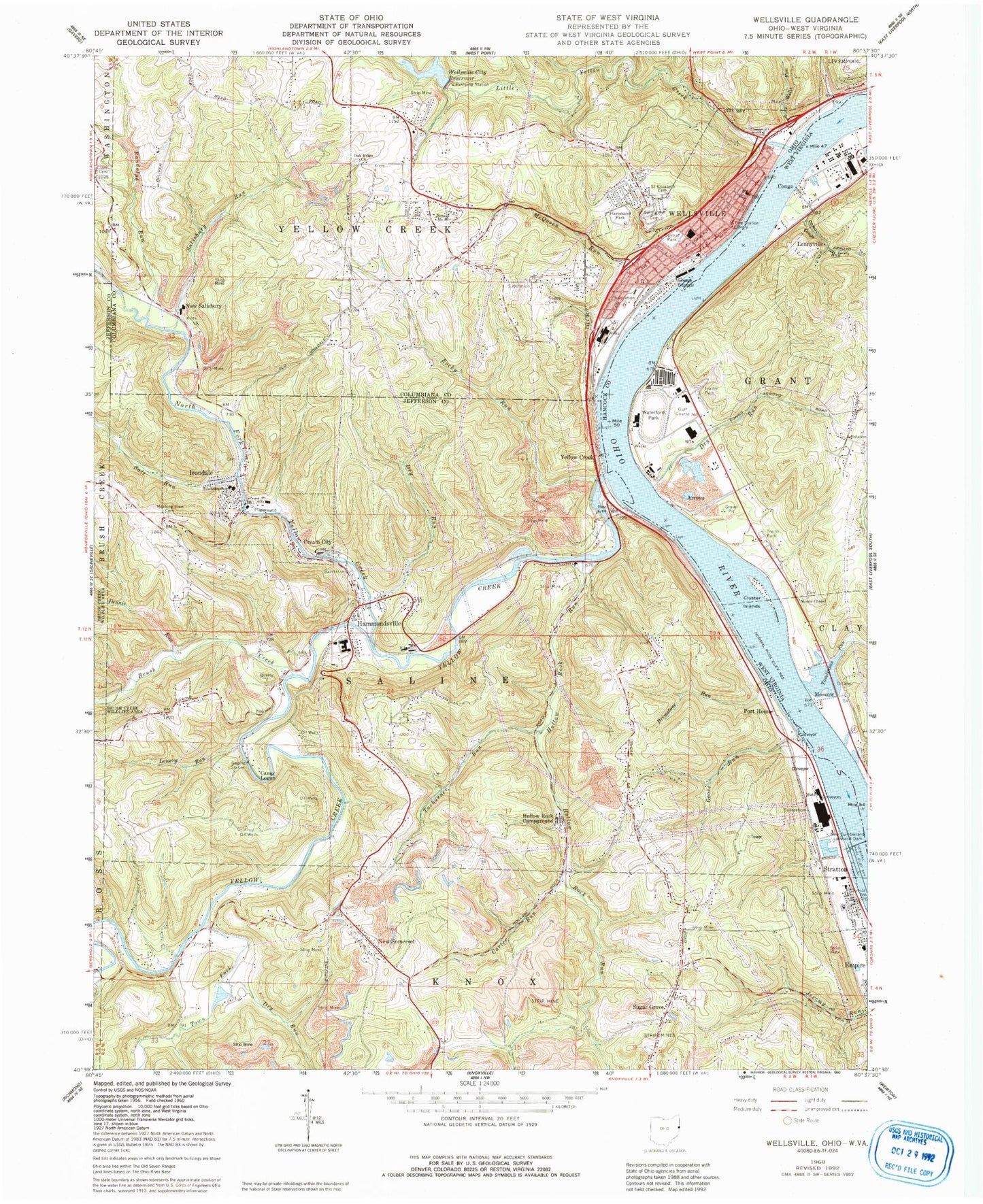
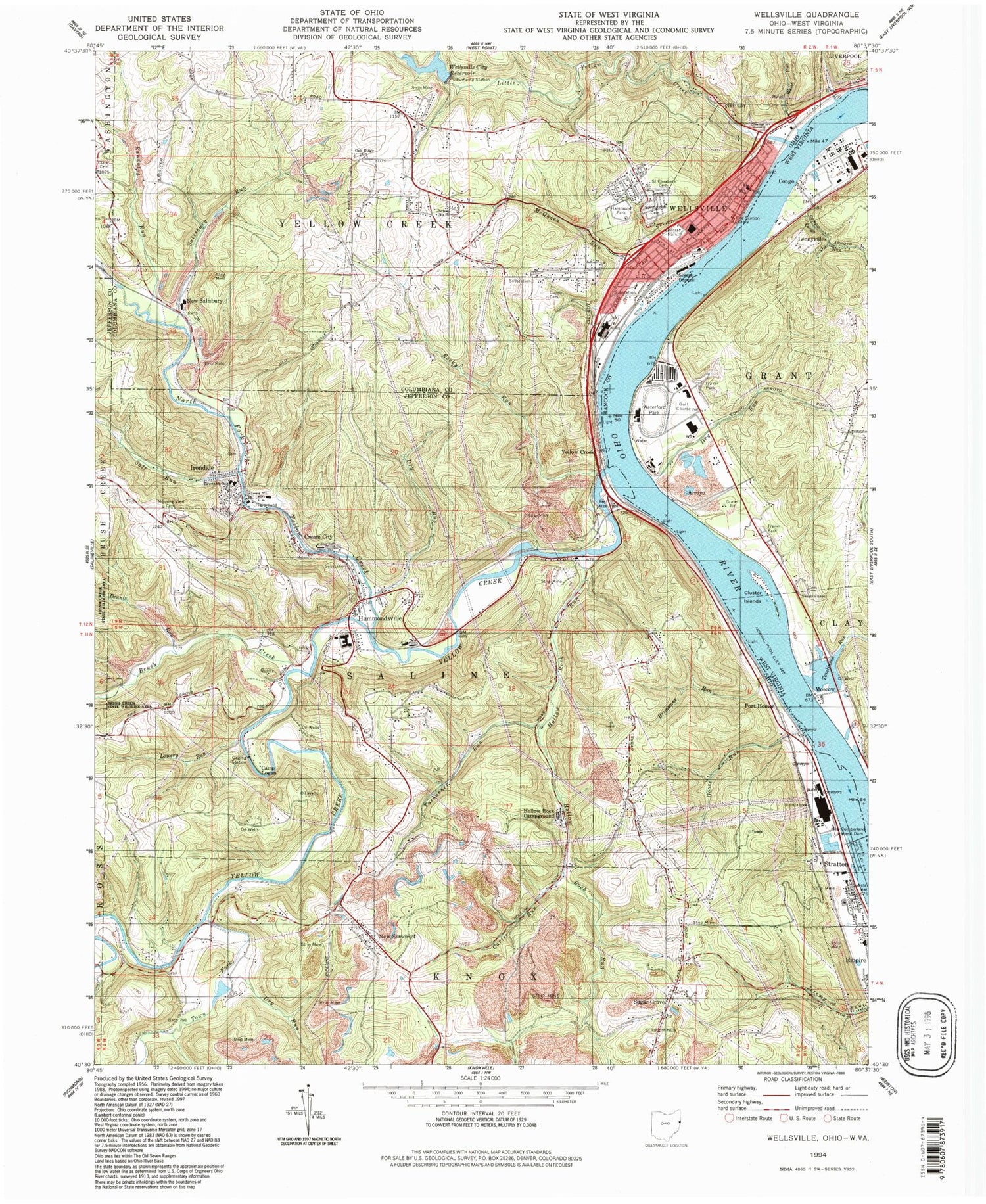
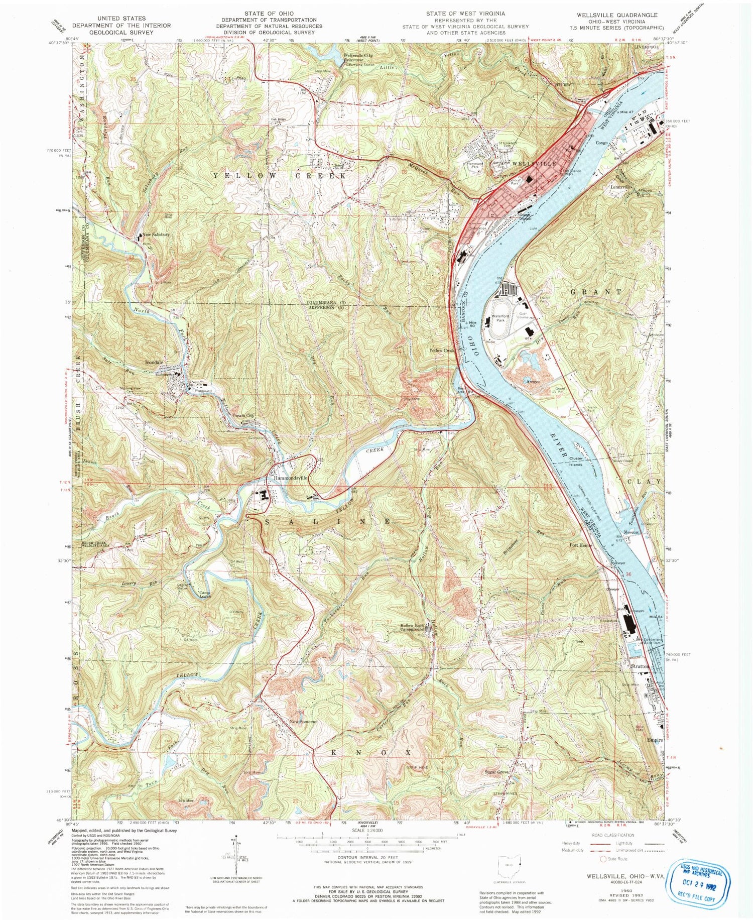
Historical USGS topographic quad map of Wellsville in the states of Ohio, West Virginia. Typical map scale is 1:24,000, but may vary for certain years, if available. Print size: 24" x 27"
This quadrangle is in the following counties: Columbiana, Hancock, Jefferson.
The map contains contour lines, roads, rivers, towns, and lakes. Printed on high-quality waterproof paper with UV fade-resistant inks, and shipped rolled.
Contains the following named places: Bailey Run, Brimstone Run, Camp Logan, Central Park, Cuppy Cemetery, Dennis Run, Dry Run, Dry Run, Hammond Park, Hollow Rock Campground, Hollow Rock Run, Little Yellow Creek, Lowery Run, Morning View Cemetery, North Fork Yellow Creek, Randolph Run, Rocky Run, Saint Elizabeth Cemetery, Salisbury Run, Salt Run, School Number 16, Spring Hill Cemetery, Town Fork, Wells Run, Cream City, Sugar Grove, Wellsville, Edison North High School, Irondale Elementary School, Yellow Creek Bar, Coopers Landing, Wellsville Carnegie Public Library, Koontz Bar, Blacks Island (historical), Stratton, Yellow Creek, New Somerset, New Salisbury, Port Homer, Wells Hollow, Hammondsville, Irondale, Brush Creek, Carter Run, Goose Run, McQueen Run, Tarburner Run, Yellow Creek, Vulcan, Oak Ridge United Presbyterian Church, Episcopal Church of the Ascension, First Christian Church, Wellsville City Reservoir, Wellsville Reservoir Dam, Wellsville Post Office, Village of Wellsville, Township of Yellow Creek, Township of Saline, Central United Methodist Church, Covenant Presbyterian Church, First Baptist Church, First United Methodist Church of Wellsville, Mount Sinai Fire Baptized Holiness Church, Riverside United Presbyterian Church, Clark Family Cemetery, Oak Ridge Cemetery, Hammondsville Cemetery, Sugar Grove Cemetery, Irondale Cemetery, New Somerset Christian Cemetery, New Somerset Christian Church, New Somerset Methodist Cemetery, New Somerset Methodist Church, Sugar Grove Methodist Cemetery, Vulcan Post Office (historical), New Salisbury Post Office (historical), Sammis Power Plant, New Somerset Post Office (historical), Port Homer Post Office (historical), Stratton Post Office, Irondale Post Office, Village of Irondale, Village of Empire, Village of Stratton, Broadway Mobile Home Park, Cline Mobile Park, Coopers Mobile Home Park, Gordon Trailer Park, Graves Trailer Park, Ekey Trailer Park, Stratton Volunteer Fire Department, Irondale Fire Department, Wellsville Fire Department, Saline Township Emergency Medical Services, Stratton Police Department, Wellsville Police Department, Hammondsville Post Office, Arroyo, Cluster Islands, Congo Run, Dry Run, Nessly Chapel, Tomlinson Run, Waterford Park, Moscow, Baker Island (historical), Congo, Lennyville, Brownsdale Mobile Home Park, Brownsdale Mobile Home Park Spring, Nessly Chapel Cemetery, New Cumberland Locks and Dam, New Cumberland Pool, Mahan Light