MyTopo
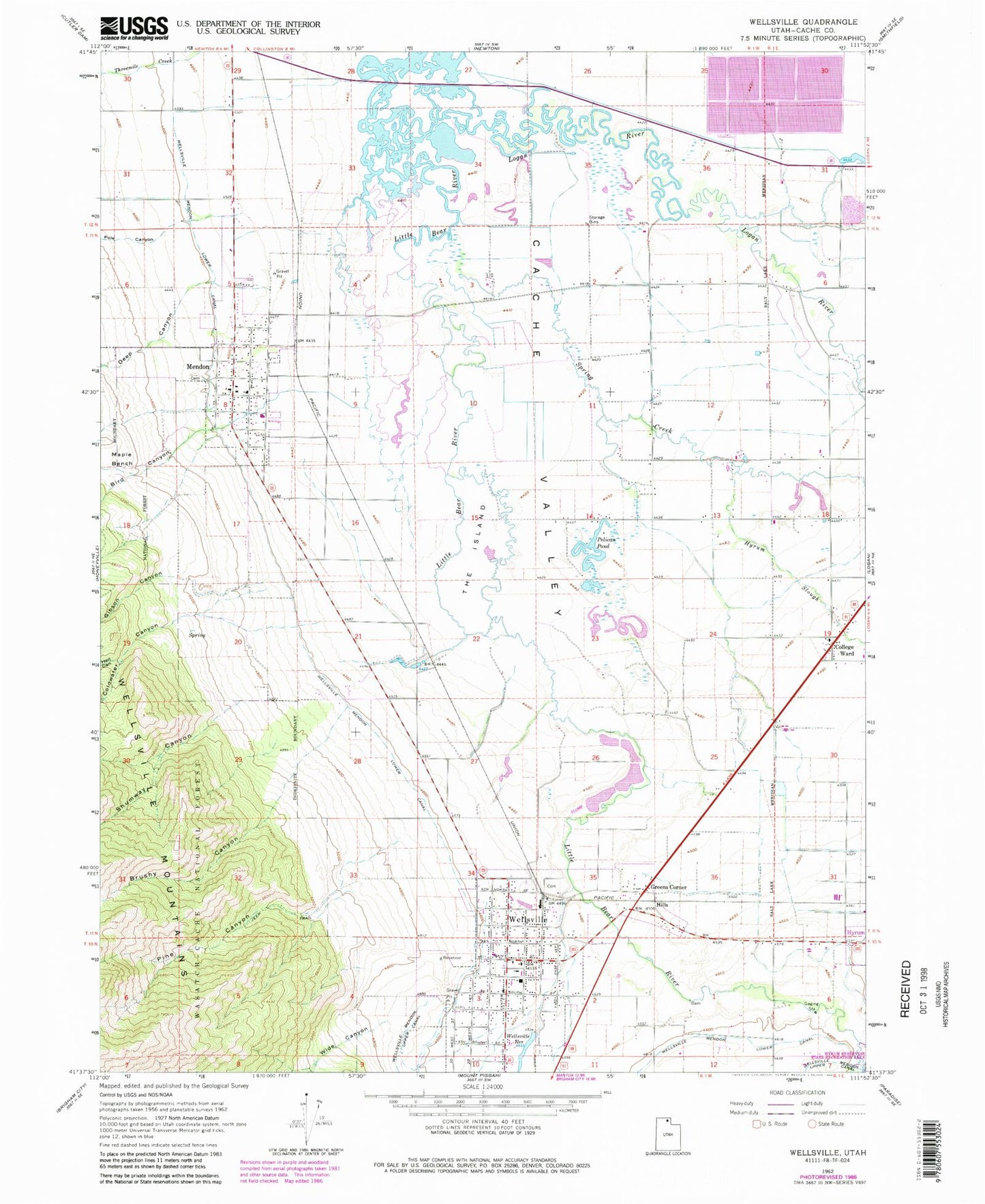
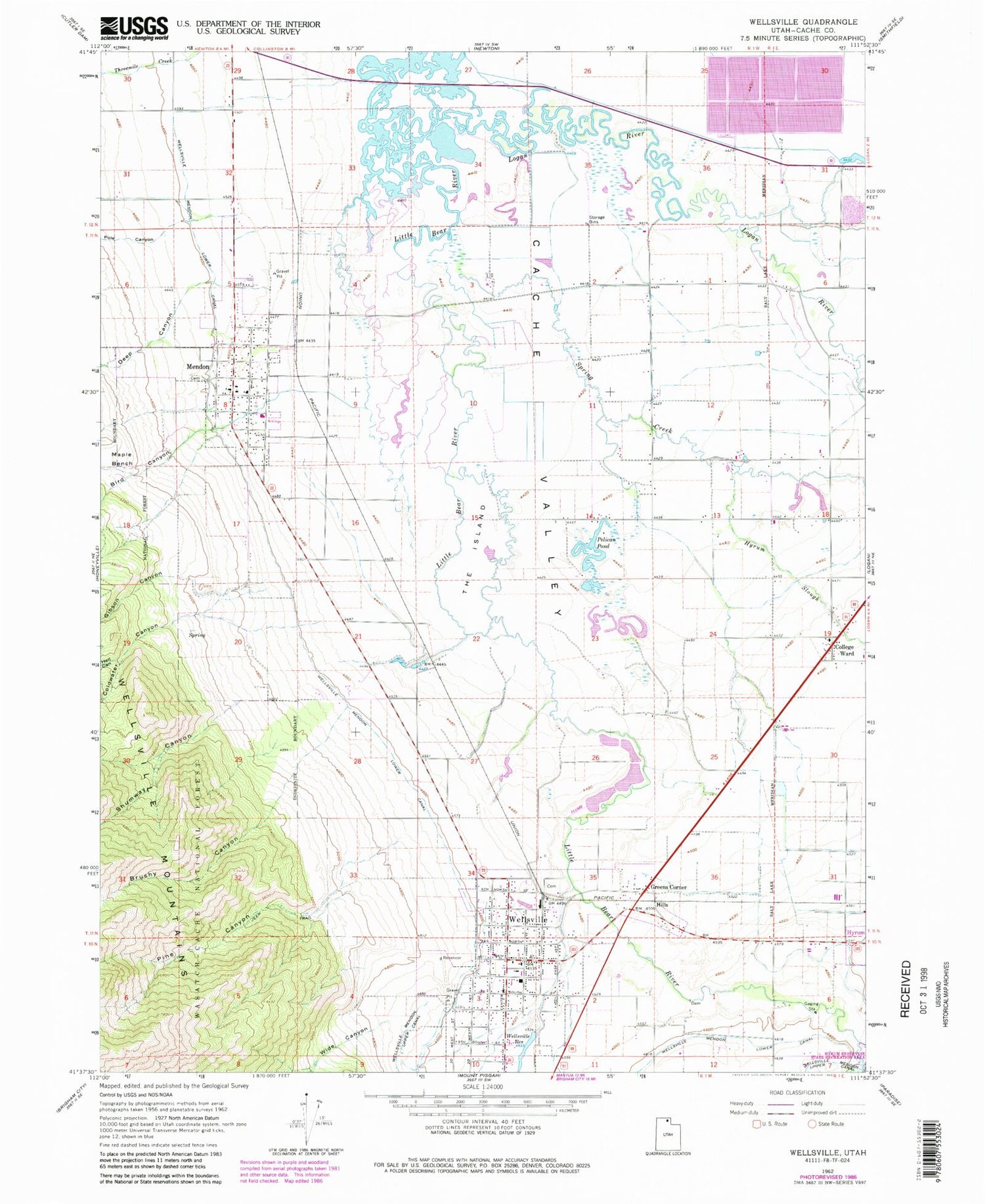
Classic USGS Wellsville Utah 7.5'x7.5' Topo Map
Couldn't load pickup availability
Historical USGS topographic quad map of Wellsville in the state of Utah. Map scale may vary for some years, but is generally around 1:24,000. Print size is approximately 24" x 27"
This quadrangle is in the following counties: Cache.
The map contains contour lines, roads, rivers, towns, and lakes. Printed on high-quality waterproof paper with UV fade-resistant inks, and shipped rolled.
Contains the following named places: Benson Census Designated Place, Bird Canyon, Brushy Canyon, City of Mendon, Coldwater Canyon, College Ward, Deep Canyon, Gibson Canyon, Greens Corner, Hell Canyon, Hills, Hyrum Slough, KVNU-AM (Logan), Little Logan River, Logan River, Maple Bench, Mendon, Mendon City Cemetery, Mendon Fire Department, Mendon Post Office, Pelican Pond, Pine Canyon, Pole Canyon, Shumway Canyon, Spring Creek, The Church of Jesus Christ of Latter Day Saints, The Island, Wellsville, Wellsville Cemetery, Wellsville Division, Wellsville Elementary School, Wellsville Fire Department Station 60, Wellsville Post Office, Wellsville Reservoir, Wide Canyon, ZIP Codes: 84325, 84339