MyTopo
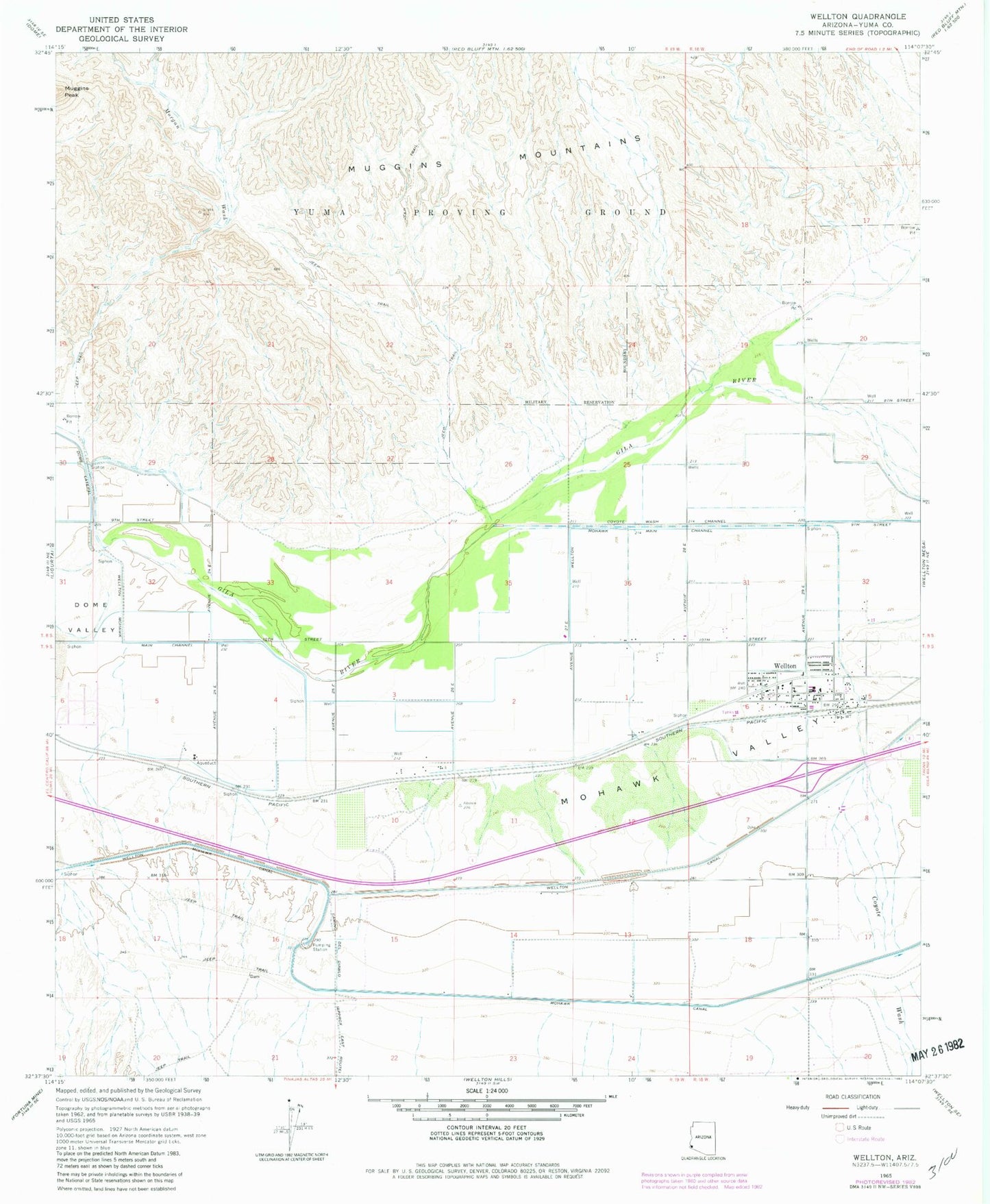
Classic USGS Wellton Arizona 7.5'x7.5' Topo Map
Couldn't load pickup availability
Historical USGS topographic quad map of Wellton in the state of Arizona. Map scale may vary for some years, but is generally around 1:24,000. Print size is approximately 24" x 27"
This quadrangle is in the following counties: Yuma.
The map contains contour lines, roads, rivers, towns, and lakes. Printed on high-quality waterproof paper with UV fade-resistant inks, and shipped rolled.
Contains the following named places: Adonde, Butterfield Golf Course, Butterfield Park, Coyote Wash, Coyote Wash Channel, Dome Lateral, Grace Fellowship Church, Mohawk Valley, Morgan Wash, Muggins Mountains, The Links at Coyote Wash, Town of Wellton, Wellton, Wellton 4.2 Lateral, Wellton Assembly of God, Wellton Community Presbyterian Church, Wellton Elementary School, Wellton Fire Department, Wellton Library, Wellton Mohawk Main Channel, Wellton Post Office, Wellton Town Hall, Wellton Underpass, Yuma County Sheriff's Office District 5, ZIP Code: 85356