MyTopo
Classic USGS Wenas Lake Washington 7.5'x7.5' Topo Map
Couldn't load pickup availability
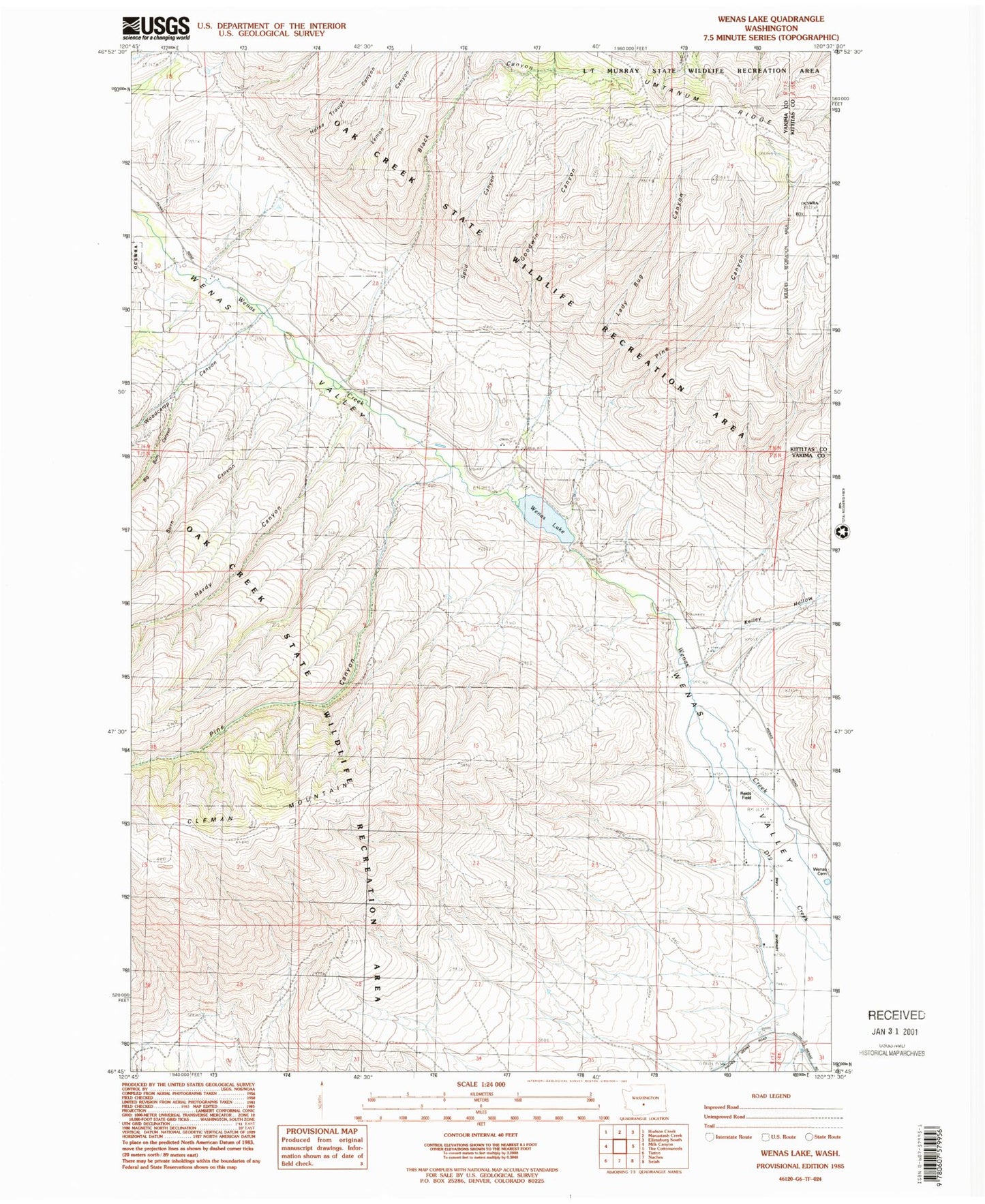
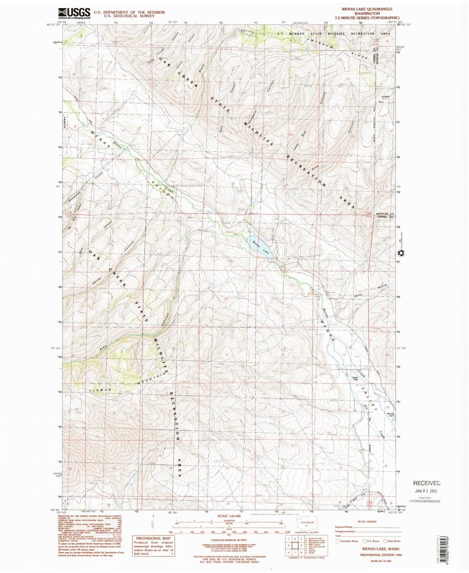
Historical USGS topographic quad map of Wenas Lake in the state of Washington. Map scale may vary for some years, but is generally around 1:24,000. Print size is approximately 24" x 27"
This quadrangle is in the following counties: Kittitas, Yakima.
The map contains contour lines, roads, rivers, towns, and lakes. Printed on high-quality waterproof paper with UV fade-resistant inks, and shipped rolled.
Contains the following named places: Big Burn Canyon, Black Canyon, Burn Canyon, Goodwin Canyon, Hardy Canyon, Horse Trough Canyon, Kelley Hollow, Lady Bug Canyon, Lemon Canyon, Pine Canyon, Reids Field, Spud Canyon, Watering Trough Canyon, Wenas Cemetery, Wenas Dam, Wenas Lake, Woodcamp Canyon, Yakima County Fire District 2 Selah Fire Department Station 26, ZIP Code: 98942