MyTopo
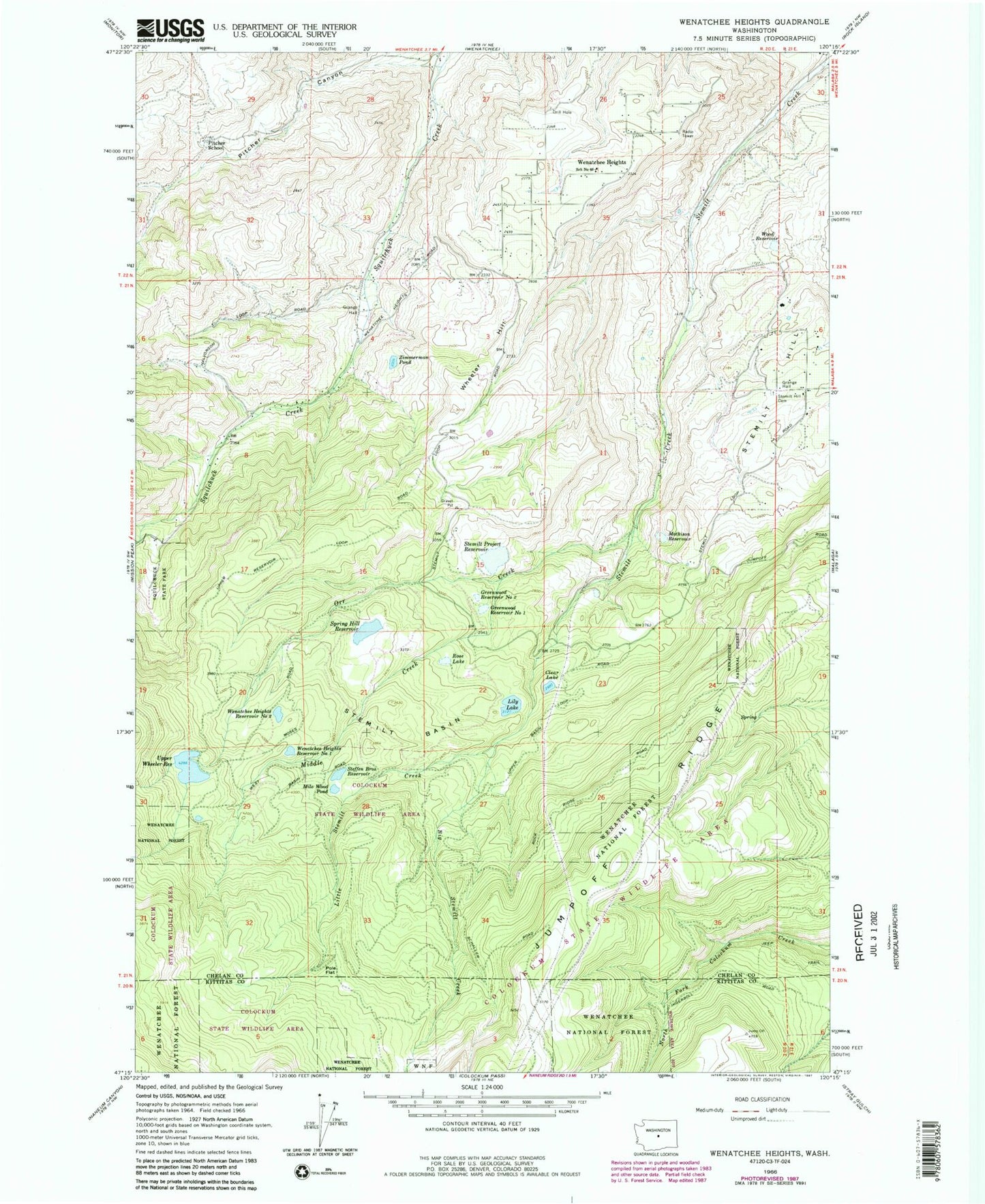
Classic USGS Wenatchee Heights Washington 7.5'x7.5' Topo Map
Couldn't load pickup availability
Historical USGS topographic quad map of Wenatchee Heights in the state of Washington. Map scale may vary for some years, but is generally around 1:24,000. Print size is approximately 24" x 27"
This quadrangle is in the following counties: Chelan, Kittitas.
The map contains contour lines, roads, rivers, towns, and lakes. Printed on high-quality waterproof paper with UV fade-resistant inks, and shipped rolled.
Contains the following named places: Big Stemilt Creek, Cammack Dam, Chelan County Fire District 1 Station 14 Squilchuck, Chelan County Fire District 1 Wenatchee Station 15, Clear Lake, Clear Lake Dam, Greenwood Reservoir Number One, Greenwood Reservoir Number One Dam, Greenwood Reservoir Number Two, Greenwood Reservoir Number Two Dam, Hoverhawk Ranch Airport, Lily Lake, Lily Lake Dam, Little Stemilt Creek, Malaga Division, Mathison Reservoir, Mathison Reservoir Dam, Middle Creek, Milo Wood Pond, Milo Wood Pond Dam, Miners Run Creek, Orr Creek, Pitcher Canyon, Pitcher School, Pole Flat, Rose Lake, Rose Lake Dam, School Number 60, Spring Hill Dam, Spring Hill Reservoir, Spring Hill Saddle Dam, Squilchuck State Park, Steffen Brothers Reservoir, Steffen Brothers Reservoir Dam, Stemilt Basin, Stemilt Hill, Stemilt Hill Cemetery, Stemilt Main Dam, Stemilt Project Reservoir, Stemilt Saddle Dam, Upper Wheeler Dam, Upper Wheeler Reservoir, Wenatchee Heights, Wenatchee Heights Reservoir Number One, Wenatchee Heights Reservoir Number One Dam, Wenatchee Heights Reservoir Number Two, Wenatchee Heights Reservoir Number Two Dam, Wheeler Hill, Wood Reservoir, Wood Reservoir Dam, Zimmerman Pond, Zimmerman Pond Dam