
MyTopo
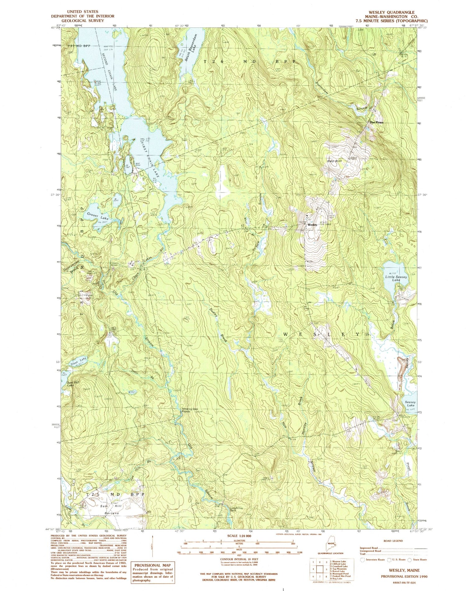
Classic USGS Wesley Maine 7.5'x7.5' Topo Map
Couldn't load pickup availability
Historical USGS topographic quad map of Wesley in the state of Maine. Map scale may vary for some years, but is generally around 1:24,000. Print size is approximately 24" x 27"
This quadrangle is in the following counties: Washington.
The map contains contour lines, roads, rivers, towns, and lakes. Printed on high-quality waterproof paper with UV fade-resistant inks, and shipped rolled.
Contains the following named places: Chain Lake Dam, Chain Lake Stream, Day Hill, Dudley Brook, First Chain Lake, Grover Lake, Honeymoon Brook, Huntley Brook, Joe Hill Brook, Little Seavey Lake, Longfellow Pitch, Lower Wesley School, Sam Hill Barrens, Seavey Brook, Second Chain Lake, South Beaverdam Lake, Stinking Jam Rapids, The Pines, Town of Wesley, Trout Brook, Trout Lake, Wesley, Wesley Elementary School, Wesley Volunteer Fire Department, West Branch New Stream, ZIP Code: 04686


