MyTopo
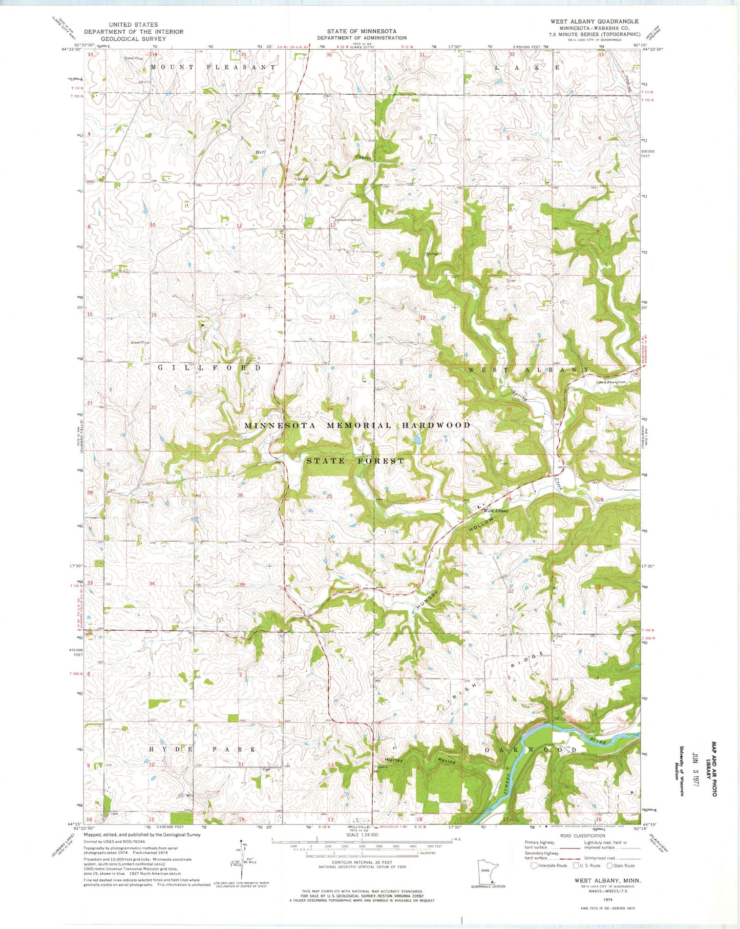
Classic USGS West Albany Minnesota 7.5'x7.5' Topo Map
Regular price
$16.95
Regular price
Sale price
$16.95
Unit price
per
Couldn't load pickup availability
Historical USGS topographic quad map of West Albany in the state of Minnesota. Map scale may vary for some years, but is generally around 1:24,000. Print size is approximately 24" x 27"
This quadrangle is in the following counties: Wabasha.
The map contains contour lines, roads, rivers, towns, and lakes. Printed on high-quality waterproof paper with UV fade-resistant inks, and shipped rolled.
Contains the following named places: Hell Coulee, Hungry Hollow, Hurley Ravine, Hyde Park Cemetery, Irish Ridge, Jacksonville Cemetery, L Myers Dam, Township of Gillford, Township of Hyde Park, West Albany, West Albany Cemetery, West Albany Post Office