MyTopo
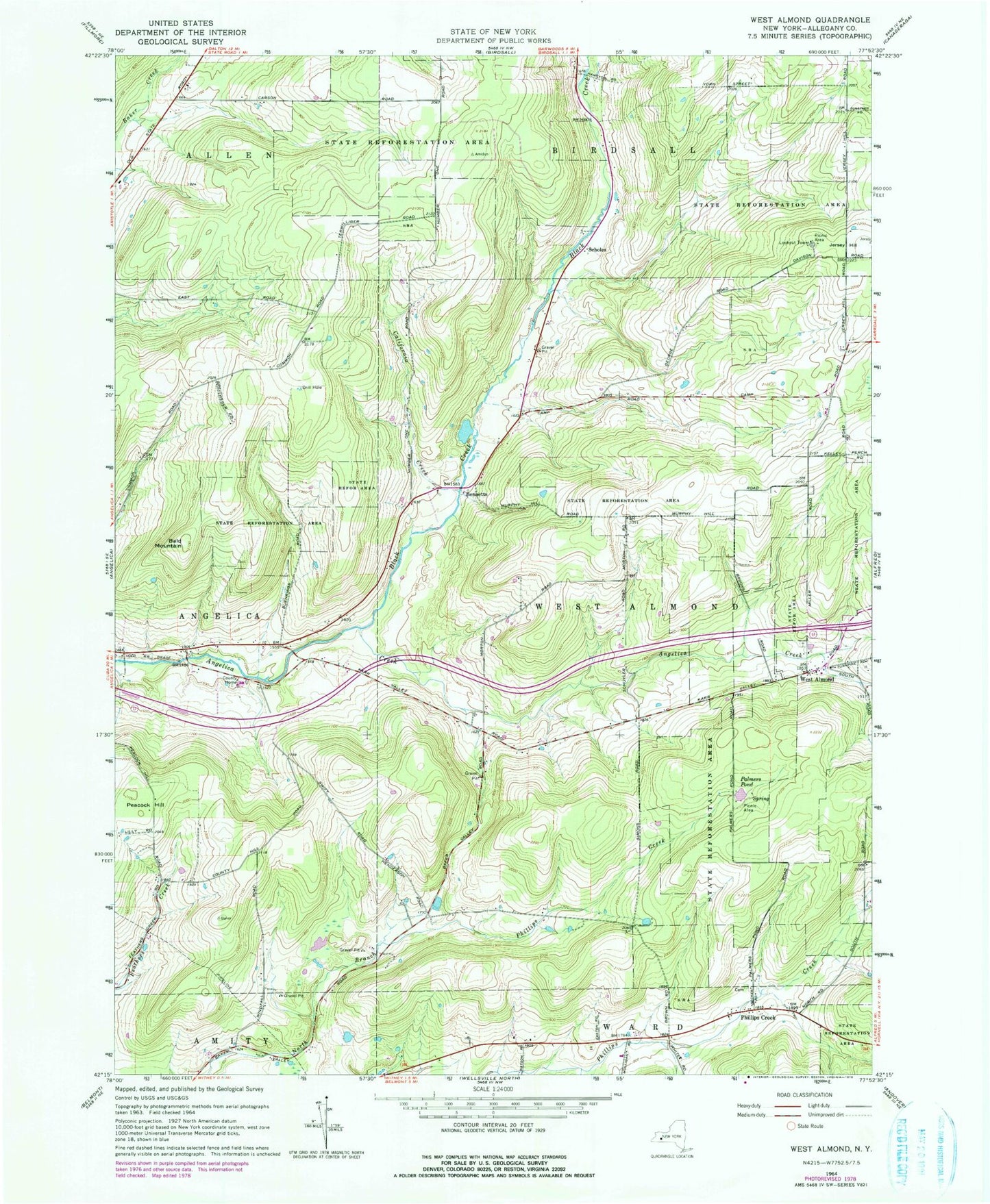
Classic USGS West Almond New York 7.5'x7.5' Topo Map
Couldn't load pickup availability
Historical USGS topographic quad map of West Almond in the state of New York. Typical map scale is 1:24,000, but may vary for certain years, if available. Print size: 24" x 27"
This quadrangle is in the following counties: Allegany.
The map contains contour lines, roads, rivers, towns, and lakes. Printed on high-quality waterproof paper with UV fade-resistant inks, and shipped rolled.
Contains the following named places: Bald Mountain, Black Creek, California Creek, Palmers Pond, Peacock Hill, Phillips Creek, West Almond, Bennetts, Scholes, Town of West Almond, West Almond Cemetery, Black Creek School (historical), Jersey Hill School (historical), School Number 1 (historical), School Number 2 (historical), School Number 3 (historical), School Number 4 (historical), School Number 6 (historical), School Number 6 (historical), School Number 6 (historical), School Number 7 (historical), School Number 8 (historical), Phillips Creek Cemetery, Potters Field County Home Cemetery, Bainbridge Family Farm, Shadows Pond