MyTopo
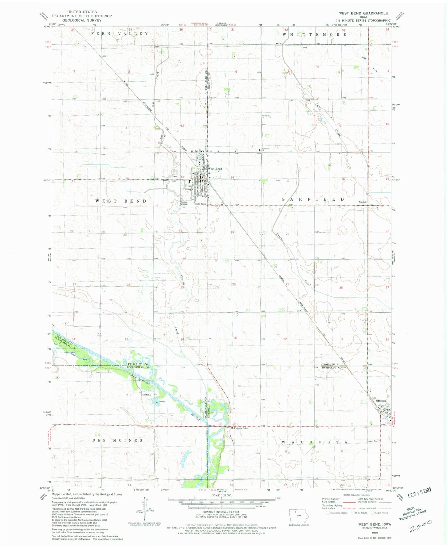
Classic USGS West Bend Iowa 7.5'x7.5' Topo Map
Couldn't load pickup availability
Historical USGS topographic quad map of West Bend in the state of Iowa. Map scale may vary for some years, but is generally around 1:24,000. Print size is approximately 24" x 27"
This quadrangle is in the following counties: Humboldt, Kossuth, Palo Alto, Pocahontas.
The map contains contour lines, roads, rivers, towns, and lakes. Printed on high-quality waterproof paper with UV fade-resistant inks, and shipped rolled.
Contains the following named places: Apostolic Christian Cemetery, Apostolic Christian Fellowship, Apostolic Church, Banwart Prairie, Central Iowa Eyecare Center, City of Ottosen, City of West Bend, Farmers Co-op Elevator, Garfield Township Cemetery, Grotto of the Redemption, Grotto of the Redemption Campground, McKnight Post Office, McKnights Point, McKnights Point Area, Ottosen, Ottosen Post Office, Palo Alto Community Ambulance West Bend, Palo Alto State Wildlife Area Number One, Peace Lutheran Church, Prairie Creek, Saint Peter and Paul School, Saint Peter and Pauls Church, Township of Garfield, Trinity Lutheran Church, Union Cemetery, United Methodist Church, West Bend, West Bend - Mallard Middle / High School, West Bend - Mallard Middle and High School, West Bend Care Center, West Bend Cemetery, West Bend City Hall, West Bend Dental Clinic, West Bend Elevator Company Elevator, West Bend Fire Department, West Bend Golf and Country Club, West Bend Historical Society Museum, West Bend Police Department, West Bend Post Office, West Bend Public Library, West Bend Wildlife Area, ZIP Code: 50597