MyTopo
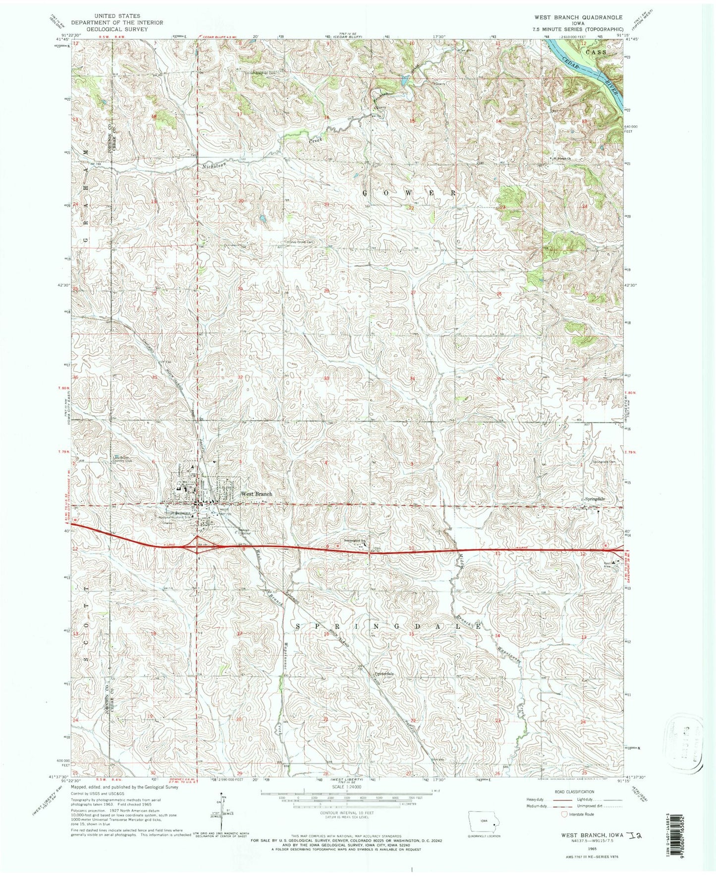
Classic USGS West Branch Iowa 7.5'x7.5' Topo Map
Couldn't load pickup availability
Historical USGS topographic quad map of West Branch in the state of Iowa. Map scale may vary for some years, but is generally around 1:24,000. Print size is approximately 24" x 27"
This quadrangle is in the following counties: Cedar, Johnson.
The map contains contour lines, roads, rivers, towns, and lakes. Printed on high-quality waterproof paper with UV fade-resistant inks, and shipped rolled.
Contains the following named places: Bethany Lutheran Church, Centerdale, Centerdale Post Office, Chamness Burial Plot, City of West Branch, Cookson Memorial Home, Crestview Nursing and Rehabilitation Center, Fox Run Golf and Country Club, Friends Church, Gravesite of President and Mrs Hoover, Herbert Hoover National Historic Site, Herbert Hoover Presidential Library and Museum, Hickory Grove Cemetery, Honey Grove Cemetery, Hoover Creek, Hoover Elementary School, Howard Cemetery, KIIN-TV (Iowa City), KSUI-FM (Iowa City), Old Friends Cemetery, Plato, Plato Post Office, President Herbert Hoover's Birthplace Historical Marker, Saint Bernadette Catholic Church, Saint Joseph Cemetery, Saint Joseph Church, Scattergood Friends School, Springdale, Springdale Cemetery, Springdale Methodist Church, Springdale Post Office, Township of Gower, Township of Springdale, Underground Railroad Station Historical Marker, United Methodist Church, West Branch, West Branch Cemetery, West Branch Family Practice Center, West Branch Fire Department, West Branch Heritage Museum, West Branch High School, West Branch Middle School, West Branch Mobile Home Village, West Branch Police Department, West Branch Post Office, West Branch Public Library, Zoar, Zoar Post Office, ZIP Code: 52358