MyTopo
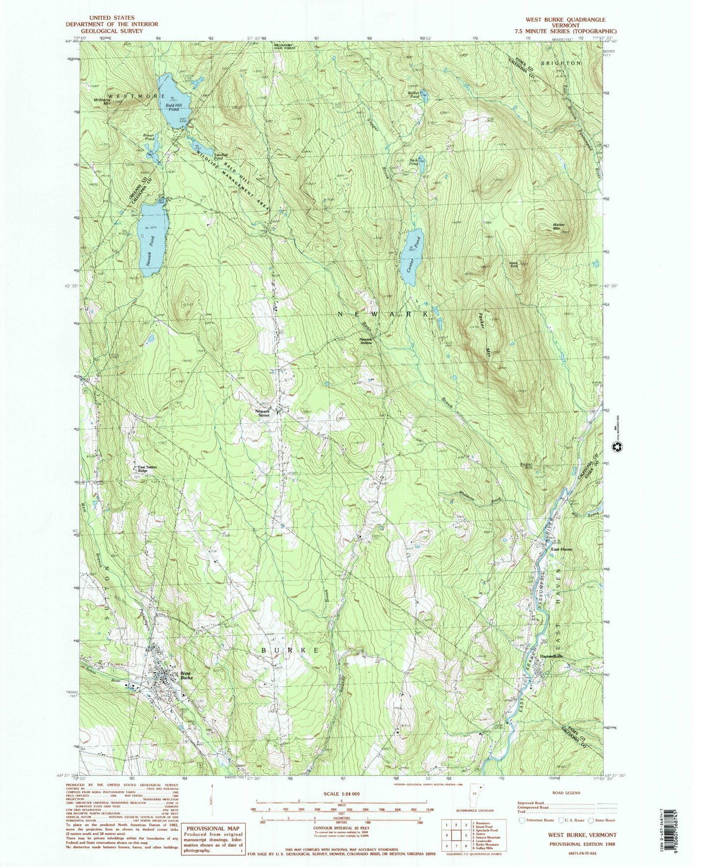
Classic USGS West Burke Vermont 7.5'x7.5' Topo Map
Couldn't load pickup availability
Historical USGS topographic quad map of West Burke in the state of Vermont. Map scale may vary for some years, but is generally around 1:24,000. Print size is approximately 24" x 27"
This quadrangle is in the following counties: Caledonia, Essex, Orleans.
The map contains contour lines, roads, rivers, towns, and lakes. Printed on high-quality waterproof paper with UV fade-resistant inks, and shipped rolled.
Contains the following named places: Bald Hill Hatchery, Bald Hill Pond, Bald Hill Wildlife Management Area, Bean Brook, Bean School, Beck Pond, Brown Pond, Bundy School, Center Pond, Connor Island, Craig Cove, East Haven, East Haven Cemetery, East Haven Post Office, East Haven River School, East Haven Volunteer Fire Department, East Ridge Cemetery, East Sutton Ridge, Flower Brook, Hartwellville, Hawk Rock, Hillside Cemetery, Marshall School, McSherry Mountain, Mill Brook, Newark Hollow, Newark Pond, Newark School, Newark Street, Newark Volunteer Fire Department, Packer Cemetery, Packer Mountain, Packer School, Pleasant View Cemetery, Sawdust Pond, Sleeper Brook, Sugar Hill, Sutton River, Town of Newark, Village of West Burke, Walker Mountain, Walker Pond, Walters Cemetery, West Burke, West Burke Fire Department, West Burke Post Office, Whetstone Brook, ZIP Code: 05871