MyTopo
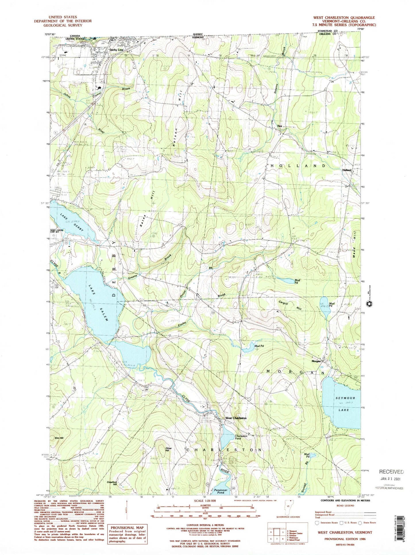
Classic USGS West Charleston Vermont 7.5'x7.5' Topo Map
Couldn't load pickup availability
Historical USGS topographic quad map of West Charleston in the state of Vermont. Map scale may vary for some years, but is generally around 1:24,000. Print size is approximately 24" x 27"
This quadrangle is in the following counties: Orleans.
The map contains contour lines, roads, rivers, towns, and lakes. Printed on high-quality waterproof paper with UV fade-resistant inks, and shipped rolled.
Contains the following named places: Balm of Gilead Beach, Bates Hill, Cargill Hill, Castle Cemetery, Chargo Campground, Charleston Pond, Clark Cemetery, Coche Brook, Crawford Hill, Crawford Hill Cemetery, Crystal Brook, Davis Cemetery, Derby Center Cemetery, E Taylor Hatton School, Elm Hill, Gore Cemetery, Green School, Greens Brook, Holland, Holland Congregational Church, Holland Elementary School, Lake Derby, Lake Salem, Little Salem Pond, Mead Hill, Mead Hill Cemetery, Meadow Brook Girl Scout Camp, Moon Cemetery, Morgan, Morgan Post Office, Mount Pisgah East Trail, Mud Pond, Nelson Hill, Oliver Hill, Orcutt Brook, Pensioner Pond, Pensioner Pond Dam, Pisgah Trail, Salem Lake Cemetery, Tice, Tice - Marston - Moon Cemetery, Tice-Marston Cemetery, West Charleston, West Charleston Cemetery, West Charleston Post Office, Wilcox Cemetery, ZIP Code: 05829