MyTopo
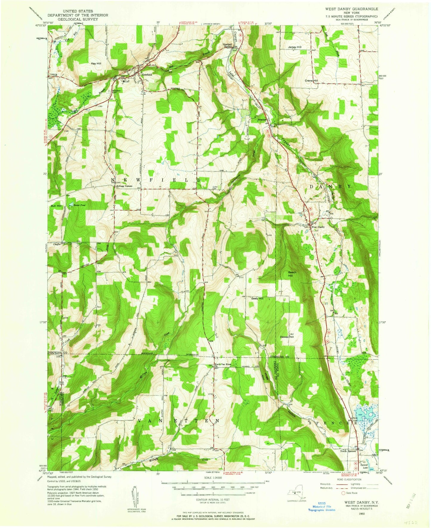
Classic USGS West Danby New York 7.5'x7.5' Topo Map
Couldn't load pickup availability
Historical USGS topographic quad map of West Danby in the state of New York. Typical map scale is 1:24,000, but may vary for certain years, if available. Print size: 24" x 27"
This quadrangle is in the following counties: Chemung, Schuyler, Tioga, Tompkins.
The map contains contour lines, roads, rivers, towns, and lakes. Printed on high-quality waterproof paper with UV fade-resistant inks, and shipped rolled.
Contains the following named places: Barnes Hill, Beaver Pond, Beech Hill, Benjamin Hill, Bruce Hill, Newfield Senior High School, Alexander Cemetery, Dawes Hill, Elston Hill, Huddle Hill, Hulburt Hollow, Jersey Hill, Kellogg Corners, McCorn Creek, Newfield, Newfield Station, North Spencer, North Van Etten Church, Protts Hill, Sebring Cemetery, Seely Hill, Stratton, VanBuskirk Gulf, West Danby, Bull Hill, Woodlawn Cemetery, Tom N' Jerry Airport, WHCU-AM (Ithaca), Town of Newfield, Newfield Census Designated Place, Newfield Bridge, Bible Baptist Church, North Spencer Christian Academy, North Spencer Cemetery, Cloverland Park, Shelter Valley Mobile Home Park, Elston Hill Cemetery, Larue Cemetery, Stoneybrook Farm, Littletree Orchards, Dassance Cemetery, Hine Family Cemetery, People's Baptist Cemetery, Valley View Cemetery, West Danby Methodist Cemetery, Mandeville Farm, Indian Creek Fruit Farm, Newfield Elementary School, Bible Baptist Church, First Baptist Church, First Baptist Church, Newfield United Methodist Church, Peoples Baptist Church, Newfield Post Office, Newfield Public Library, Newfield Town Hall, Danby Fire District - West Danby Volunteer Fire Department, West Danby Census Designated Place