MyTopo
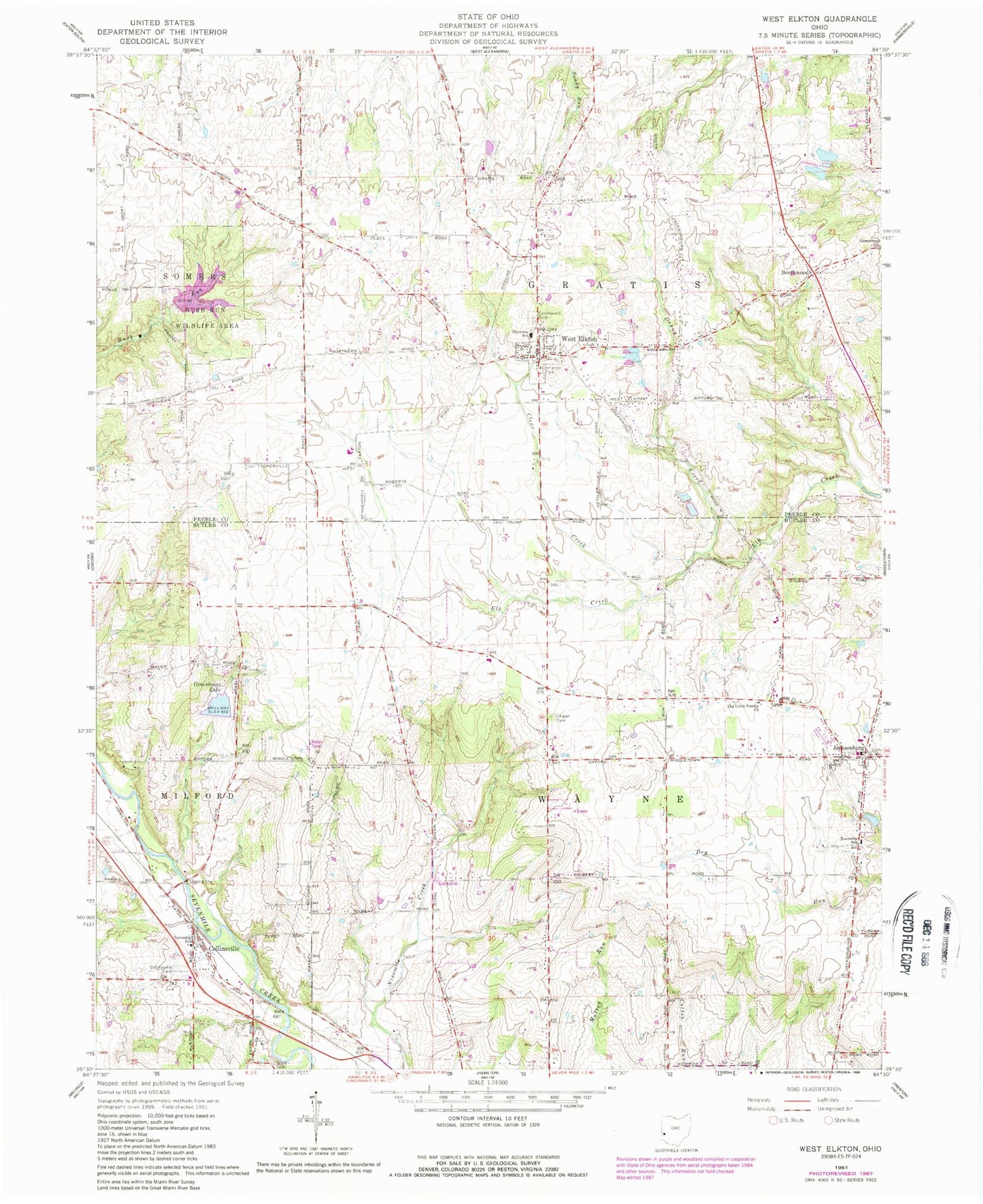
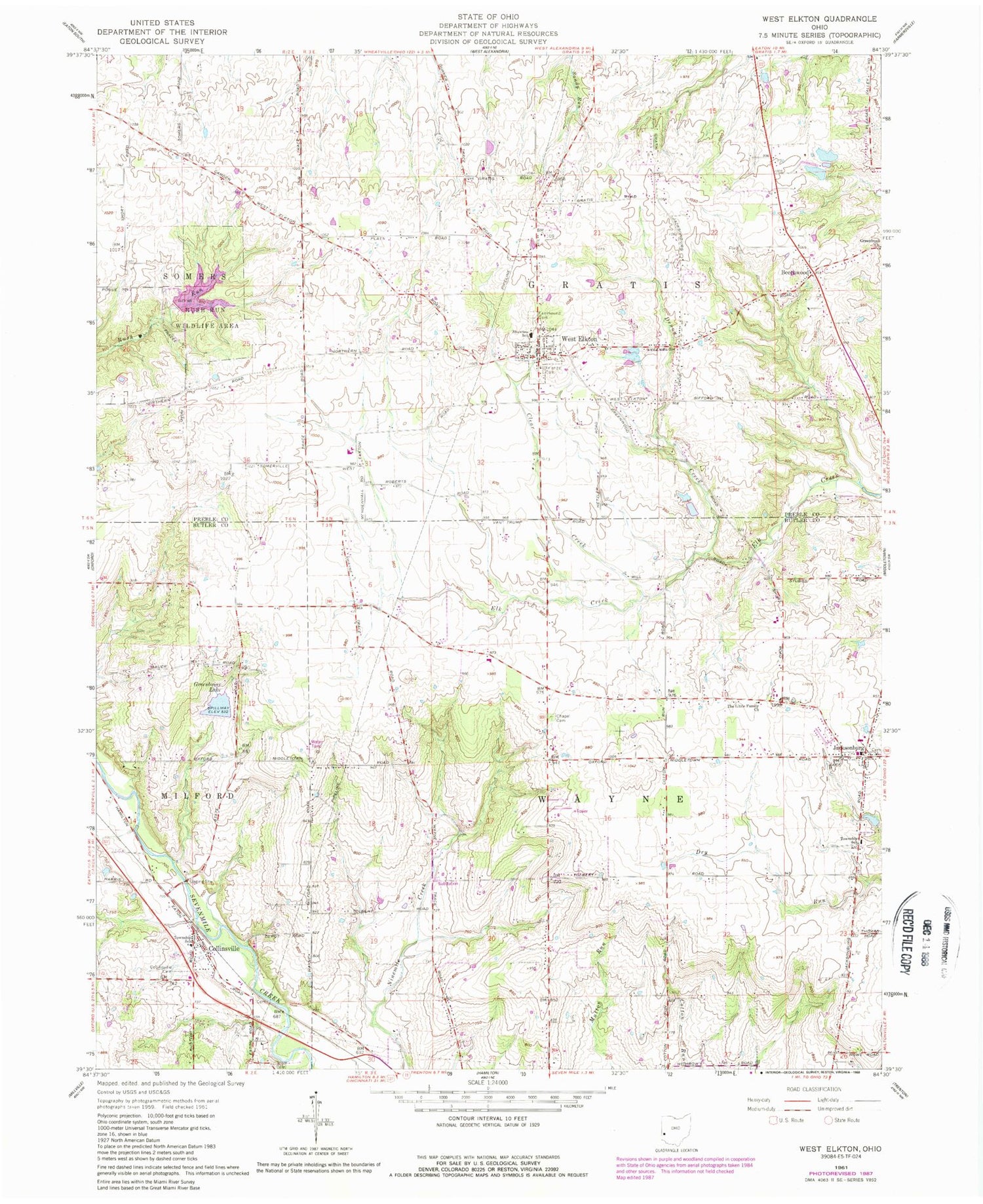
Classic USGS West Elkton Ohio 7.5'x7.5' Topo Map
Couldn't load pickup availability
Historical USGS topographic quad map of West Elkton in the state of Ohio. Typical map scale is 1:24,000, but may vary for certain years, if available. Print size: 24" x 27"
This quadrangle is in the following counties: Butler, Preble.
The map contains contour lines, roads, rivers, towns, and lakes. Printed on high-quality waterproof paper with UV fade-resistant inks, and shipped rolled.
Contains the following named places: Chapel Cemetery, Clear Creek, Collinsville Cemetery, Denny Creek, Fairmound Cemetery, Friends Cemetery, Greenbush Church, Rush Run Wildlife Area, Scott Cemetery, The Little Family Church, Beechwood, Collinsville, West Elkton, Jacksonburg United Methodist Church, Cotton Run School (historical), Pleasant Grove School (historical), Ninemile School (historical), Greenbrier School (historical), Beech Grove School (historical), Greenwood School (historical), Kenworthy School (historical), Bakes School (historical), Loope School (historical), Shawnee School, Jacksonburg, School Number 1 (historical), Phare School (historical), Paradise Lakes-North Lake Dam, Paradise Lakes-North Lake, Paradise Lakes-South Lake Dam, Paradise Lakes-South Lake, Greenbriar Lake Dam, Greenbriar Lake, Doughman Lake Dam, Doughman Lake, Rush Run Lake Dam, Rush Run Lake, Bear Pond Dam, Bear Pond, Township of Wayne, Township of Gratis, Jacksonburg Cemetery, Patterson Cemetery, Collinsville Post Office, West Elkton Post Office, Village of Jacksonburg, Village of West Elkton, Wayne Township Fire Department, Milford Township Fire Department Station 1, West Elkton Gratis Township Fire Department, Eck Farm