MyTopo
Classic USGS West Fork Rio Brazos New Mexico 7.5'x7.5' Topo Map
Regular price
$16.95
Regular price
Sale price
$16.95
Unit price
per
Couldn't load pickup availability
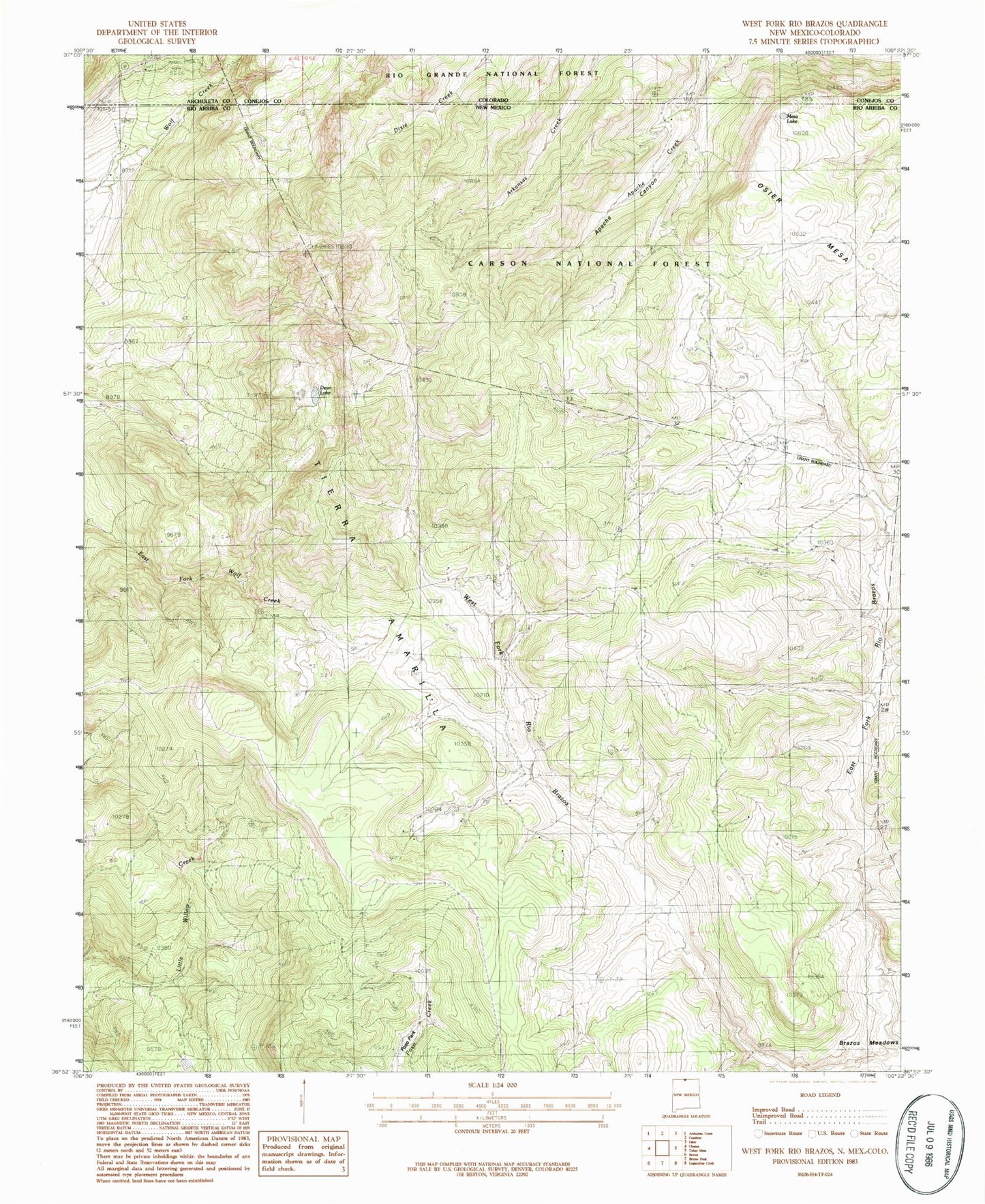
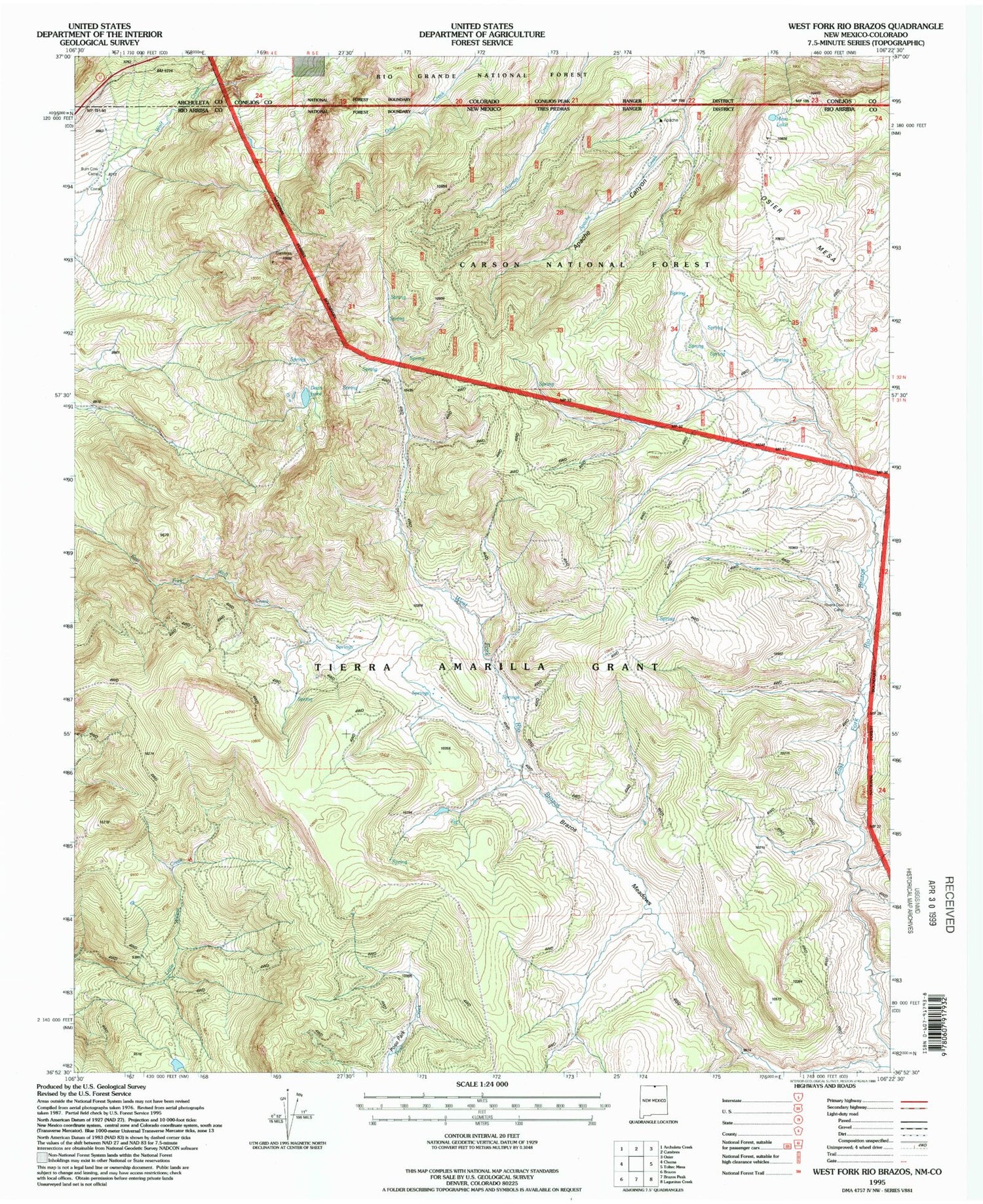
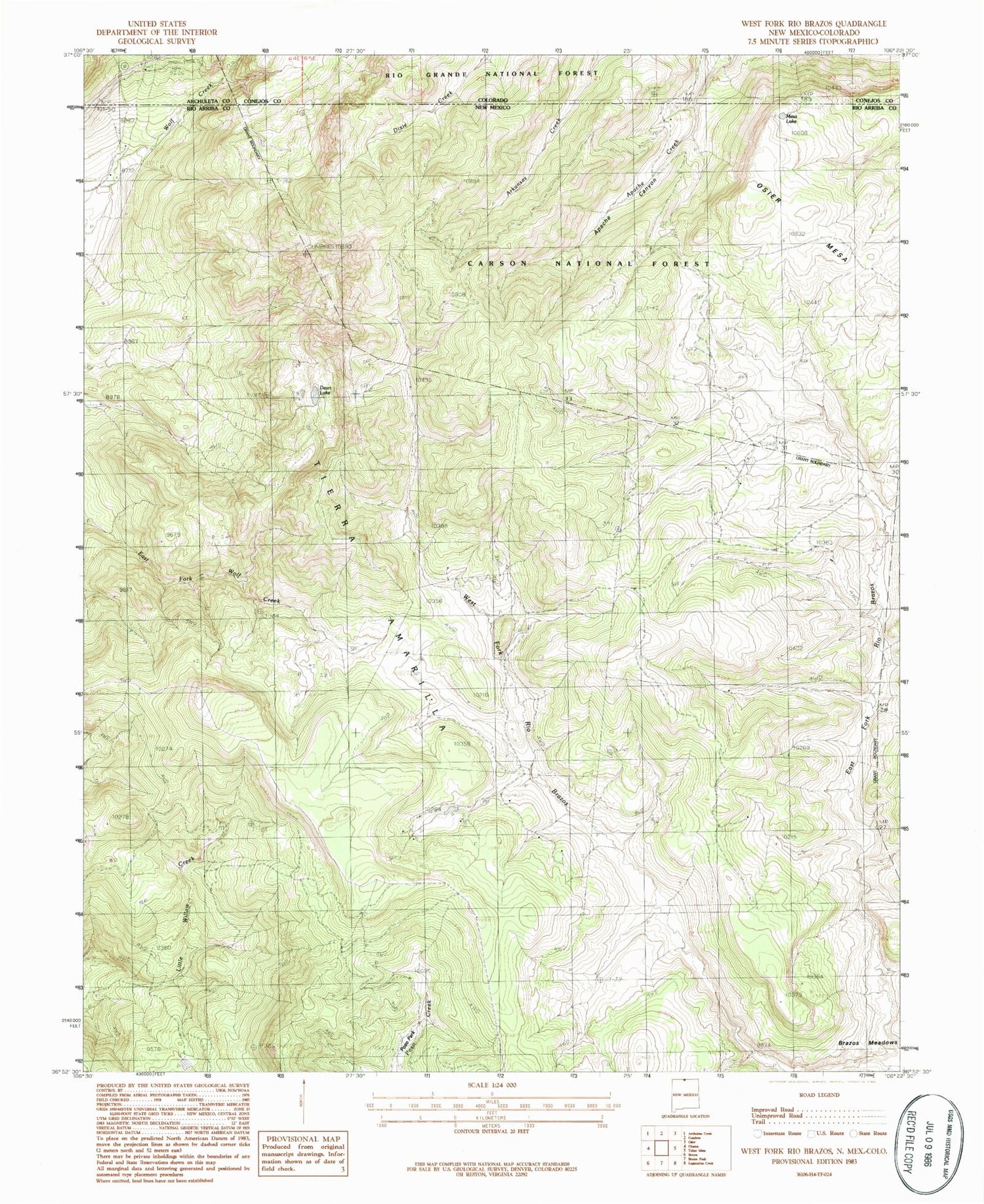
Historical USGS topographic quad map of West Fork Rio Brazos in the states of New Mexico, Colorado. Typical map scale is 1:24,000, but may vary for certain years, if available. Print size: 24" x 27"
This quadrangle is in the following counties: Archuleta, Conejos, Rio Arriba.
The map contains contour lines, roads, rivers, towns, and lakes. Printed on high-quality waterproof paper with UV fade-resistant inks, and shipped rolled.
Contains the following named places: Brazos Meadows, Burn Cow Camp, Huffaker Cabin, Rivera Cow Camp, Apache Forest Service Facility, Osier Fork Rio Brazos, Osier Mesa, Mesa Lake, Dean Lake, Cresco