MyTopo
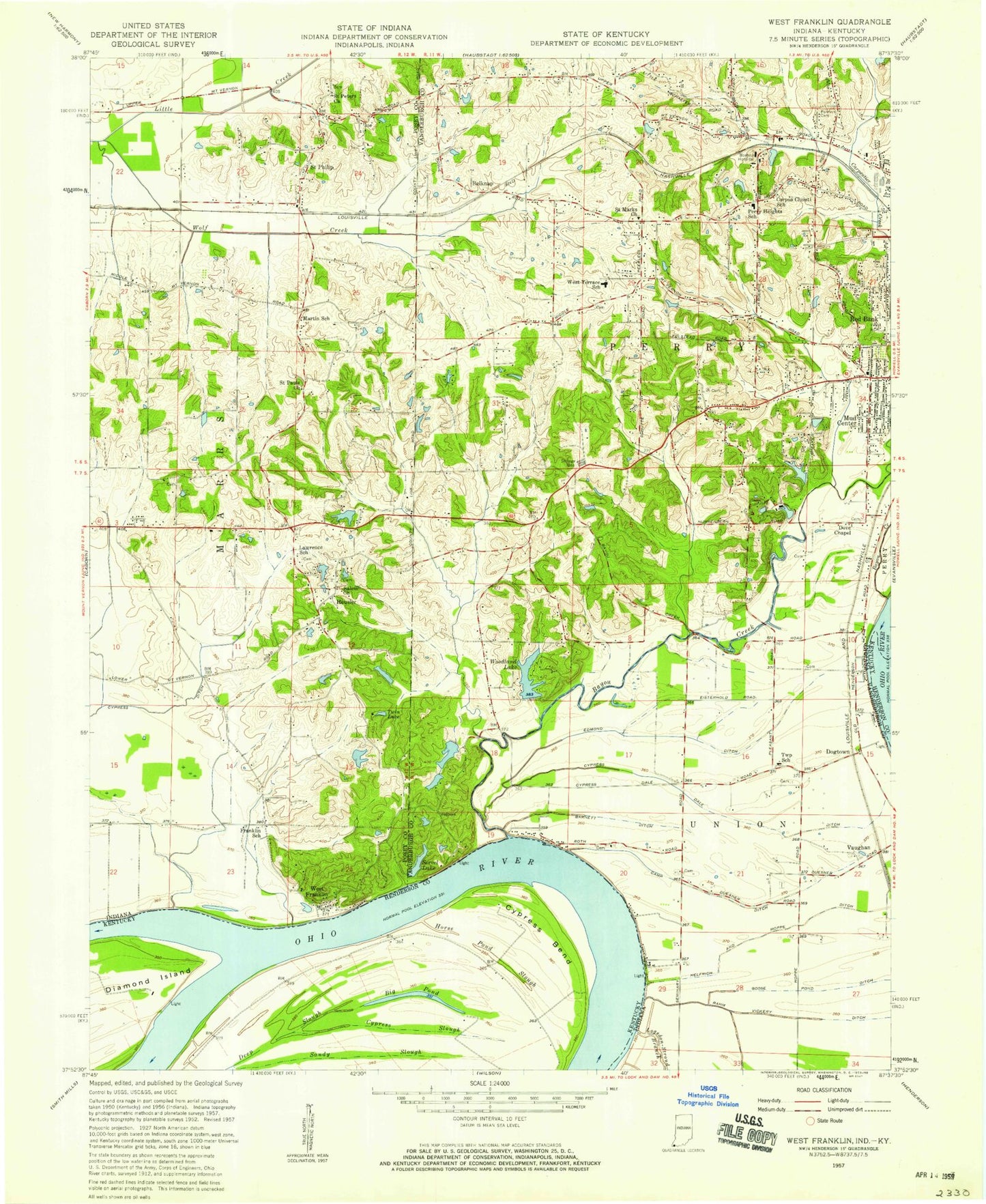
Classic USGS West Franklin Indiana 7.5'x7.5' Topo Map
Couldn't load pickup availability
Historical USGS topographic quad map of West Franklin in the states of Indiana, Kentucky. Map scale may vary for some years, but is generally around 1:24,000. Print size is approximately 24" x 27"
This quadrangle is in the following counties: Henderson, Posey, Vanderburgh.
The map contains contour lines, roads, rivers, towns, and lakes. Printed on high-quality waterproof paper with UV fade-resistant inks, and shipped rolled.
Contains the following named places: Barnett Ditch, Bayou Creek, Belknap, Big Pond, Boehne Hospital, Burdette Park, Camp Duesner Ditch, Carpentier Creek, Corpus Christi School, Cypress, Cypress Bend, Cypress Dale Ditch, Cypress Ditch, Cypress Slough, Dove Chapel, Edmond Ditch, Franklin School, Goose Pond Ditch, Helfrich and Hoppe Ditch, Heusler, Horse Pond Slough, Indiana State University Lake, Indiana State University Lake Dam, Lawrence School, Lloyd Hahn Lake, Lloyd Hahn Lake Dam, Marrs Township Volunteer Fire Department Station 1, Martin School, Mud Center, Perry Heights Elementary and Junior High School, Perry Township Fire Department Station 2, Perry Township Volunteer Fire Department Station 1, Philip Station, Rahm Vickery Ditch, Red Bank, Saint Marks Church, Saint Pauls Church, Saint Peters Church, Saint Philip, Salem Church, Servel Lake, Slim Pond Slough, Township of Perry, Township of Union, Tupman Cemetery, Twin Lake, University of Southern Indiana, Vaughan, West Franklin, West Terrace Elementary and Junior High School, William Hamilton Lake, William Hamilton Lake Dam, Wolf Creek, Woodland Lake, Woodland Lake Dam, ZIP Code: 47712


