MyTopo
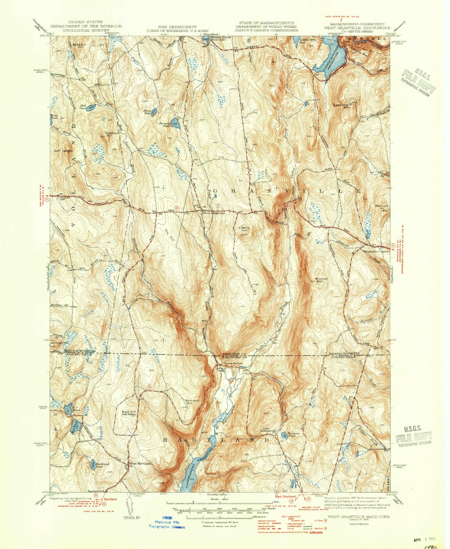
Classic USGS West Granville Massachusetts 7.5'x7.5' Topo Map
Couldn't load pickup availability
Historical USGS topographic quad map of West Granville in the states of Massachusetts, Connecticut. Typical map scale is 1:24,000, but may vary for certain years, if available. Print size: 24" x 27"
This quadrangle is in the following counties: Hampden, Hartford.
The map contains contour lines, roads, rivers, towns, and lakes. Printed on high-quality waterproof paper with UV fade-resistant inks, and shipped rolled.
Contains the following named places: Granville State Forest, Barber Camp, Tolland Cemetery, South Quarter Cemetery, Wild Cat Aqueduct, Trout Pond Dam, Phelon Pond Dam, Phelon Pond, Johnson Hill, Pond Brook, Babb Hill, Babcock Brook, Black Pond, Chestnut Hill, Cobble Mountain, Ellis Brook, Goff Ledges, Granville Center, Hall Pond, Hall Pond Brook, Liberty Hill, Ore Hill, Parsons Pond, Pond Brook, Potash Brook, Prospect Hill, Ripley Brook, Sweetman Mountain, West Granville, Winchell Mountain, Baird Four Corners, Holden Hill, Degano Pond, Shaughnessy Swamp, Otter Pond, Town of Granville, Morehaven Airport, Valley Brook, Center Cemetery, Granville Center Town Hall, Granville Fire Department Center Headquaters, Granville Fire Department Station 2, Granville Police Department, Barkhamsted Reservoir, Booth Hill, Emmons Pond, Falls Brook, Fosters Pond, Halfway Brook, Howells Pond, Hubbard River, Hurricane Brook, May Ponds, Morrison Hill, Trout Pond, Tunxis State Forest, Valley Brook, North Hollow, West Hartland, Town of Hartland, Twining Hollow, Fosters Pond Dam, Fosters Pond, Howells Pond Dam, Hartland Public Library, West Hartland Cemetery, West Hartland Post Office, West Hartland Volunteer Fire Department, Granville State Forest, Barber Camp, Tolland Cemetery, South Quarter Cemetery, Wild Cat Aqueduct, Trout Pond Dam, Phelon Pond Dam, Phelon Pond, Johnson Hill, Pond Brook, Babb Hill, Babcock Brook, Black Pond, Chestnut Hill, Cobble Mountain, Ellis Brook, Goff Ledges, Granville Center, Hall Pond, Hall Pond Brook, Liberty Hill, Ore Hill, Parsons Pond, Pond Brook, Potash Brook, Prospect Hill, Ripley Brook, Sweetman Mountain, West Granville, Winchell Mountain, Baird Four Corners, Holden Hill, Degano Pond, Shaughnessy Swamp, Otter Pond, Town of Granville, Morehaven Airport, Valley Brook, Center Cemetery, Granville Center Town Hall, Granville Fire Department Center Headquaters, Granville Fire Department Station 2, Granville Police Department, Barkhamsted Reservoir, Booth Hill, Emmons Pond, Falls Brook, Fosters Pond, Halfway Brook, Howells Pond, Hubbard River, Hurricane Brook, May Ponds, Morrison Hill, Trout Pond, Tunxis State Forest, Valley Brook, North Hollow, West Hartland, Town of Hartland, Twining Hollow, Fosters Pond Dam, Fosters Pond, Howells Pond Dam, Hartland Public Library, West Hartland Cemetery, West Hartland Post Office, West Hartland Volunteer Fire Department, Granville State Forest, Barber Camp, Tolland Cemetery, South Quarter Cemetery, Wild Cat Aqueduct, Trout Pond Dam, Phelon Pond Dam, Phelon Pond, Johnson Hill, Pond Brook, Babb Hill, Babcock Brook, Black Pond, Chestnut Hill, Cobble Mountain, Ellis Brook, Goff Ledges, Granville Center, Hall Pond, Hall Pond Brook, Liberty Hill, Ore Hill, Parsons Pond, Pond Brook, Potash Brook, Prospect Hill, Ripley Brook, Sweetman Mountain, West Granville, Winchell Mountain, Baird Four Corners, Holden Hill, Degano Pond, Shaughnessy Swamp, Otter Pond, Town of Granville, Morehaven Airport, Valley Brook, Center Cemetery, Granville Center Town Hall, Granville Fire Department Center Headquaters, Granville Fire Department Station 2, Granville Police Department, Barkhamsted Reservoir, Booth Hill, Emmons Pond, Falls Brook, Fosters Pond, Halfway Brook, Howells Pond, Hubbard River, Hurricane Brook, May Ponds, Morrison Hill, Trout Pond, Tunxis State Forest, Valley Brook, North Hollow, West Hartland, Town of Hartland, Twining Hollow, Fosters Pond Dam, Fosters Pond, Howells Pond Dam, Hartland Public Library, West Hartland Cemetery, West Hartland Post Office, West Hartland Volunteer Fire Department