MyTopo
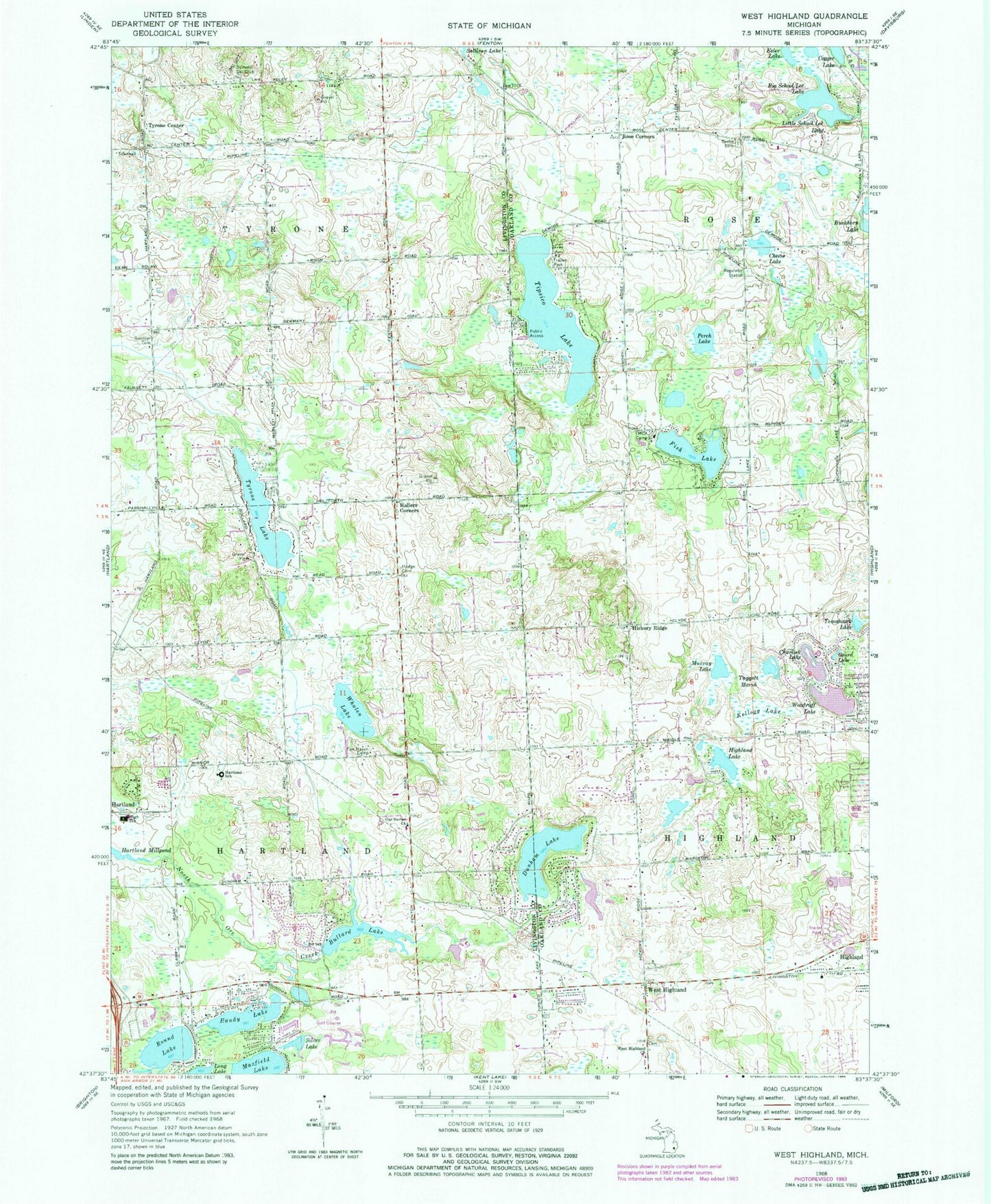
Classic USGS West Highland Michigan 7.5'x7.5' Topo Map
Couldn't load pickup availability
Historical USGS topographic quad map of West Highland in the state of Michigan. Map scale may vary for some years, but is generally around 1:24,000. Print size is approximately 24" x 27"
This quadrangle is in the following counties: Livingston, Oakland.
The map contains contour lines, roads, rivers, towns, and lakes. Printed on high-quality waterproof paper with UV fade-resistant inks, and shipped rolled.
Contains the following named places: All Saints Lutheran Church, Beebe Cemetery, Big School Lot Lake, Bullard Lake, Charlick Lake, Chase Lake, Child of Christ Lutheran School, Cogger Lake, Dollar Lake, Dunham Hills Golf Club, Dunham Lake, Esler Lake, Fair Haven Camp, First Congregational Church Historical Marker, Fish Lake, Gardner Cemetery, Gourd Lake, Hallers Corners, Hallers Post Office, Handy Lake, Hartland Census Designated Place, Hartland Family Physicians, Hartland Glen Golf Club, Hartland High School, Hartland Meadows Mobile Home Park, Hartland Millpond, Hickory Ridge, Highland Heliport, Highland Lake, Hodge Cemetery, Kellogg Lake, Little School Lot Lake, Maxfield Lake, Murray Lake, Ore Creek Community Church, Our Savior Church, Perch Lake, Ponderosa Heliport, Rose Corners, Round Elementary School, Round Lake, Salem Lutheran Church Campground, Silver Lake, Summit Ski Club, Taggett Marsh, Tipsico Lake, Tomahawk Lake, Township of Hartland, Township of Rose, Township of Tyrone, Tyrone Center, Tyrone Lake, Tyrone Post Office, Tyrone Township Hall Historical Marker, Village Elementary School, WACY-AM (Fenton), West Highland, West Highland Cemetery, West Highland Church, West Highland Post Office, Whalen Lake, Woodruff Lake, ZIP Codes: 48353, 48357


