MyTopo
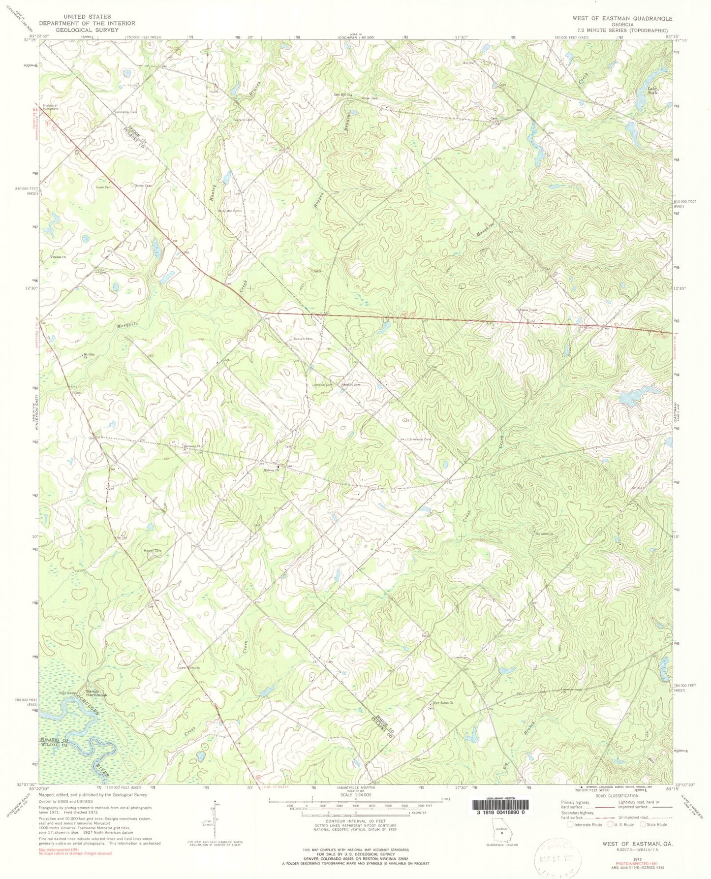
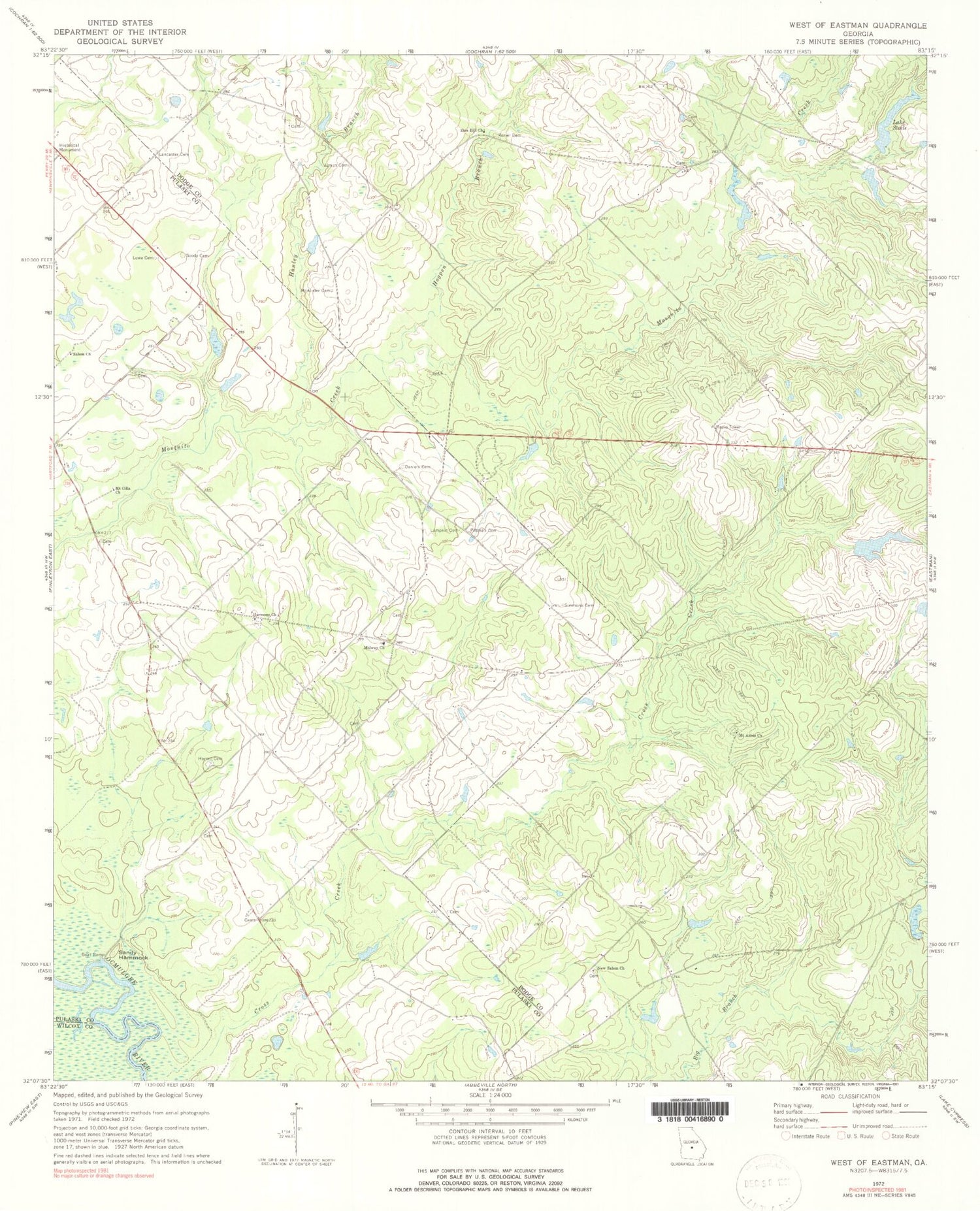
Classic USGS West of Eastman Georgia 7.5'x7.5' Topo Map
Couldn't load pickup availability
Historical USGS topographic quad map of West of Eastman in the state of Georgia. Map scale may vary for some years, but is generally around 1:24,000. Print size is approximately 24" x 27"
This quadrangle is in the following counties: Dodge, Pulaski, Wilcox.
The map contains contour lines, roads, rivers, towns, and lakes. Printed on high-quality waterproof paper with UV fade-resistant inks, and shipped rolled.
Contains the following named places: Bennett Pond, Bennett Pond Dam, Coody Cemetery, Cross Creek, Daniels Cemetery, Franklin Pond, Franklin Pond Dam, Goody Cemetery, Hadden Lake, Hadden Lake Dam, Hanley Branch, Hardy Lake, Hardy Lake Dam, Harmony Church, Harrell Cemetery, Hogpen Branch, Jumps Cemetery, Lake Steele, Lake Steele Dam, Lampkin Cemetery, Lancaster Cemetery, Lowe Cemetery, McAlister Cemetery, Midway Church, Mount Annis Church, Mount Cilla Church, New Salem Church, Pittman Cemetery, Rozier Cemetery, Salem Church, Sandy Hammock, Simmons Cemetery, Zion Hill Church