MyTopo
Classic USGS West of Fagin Mountain Nevada 7.5'x7.5' Topo Map
Regular price
$16.95
Regular price
Sale price
$16.95
Unit price
per
Couldn't load pickup availability
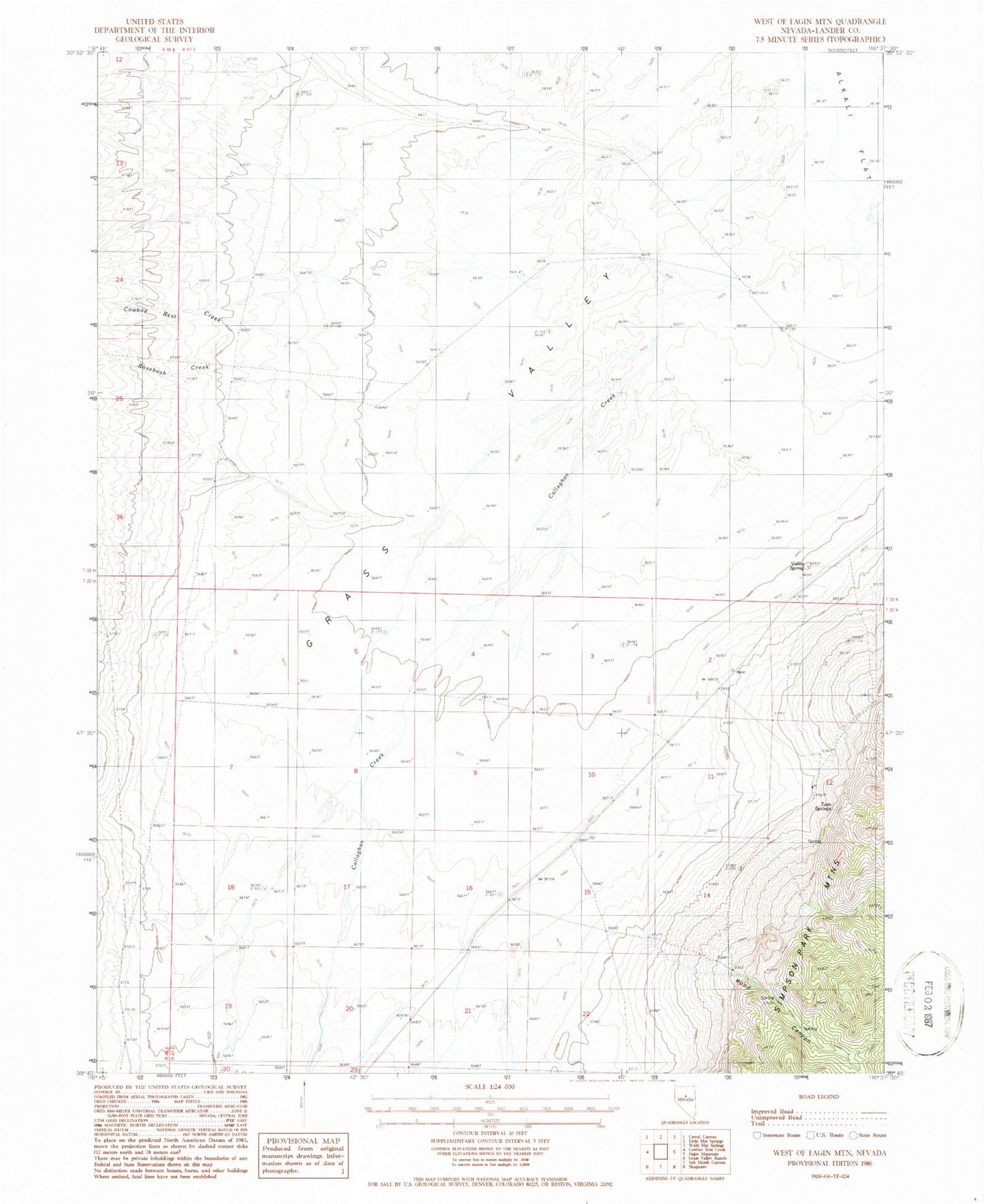
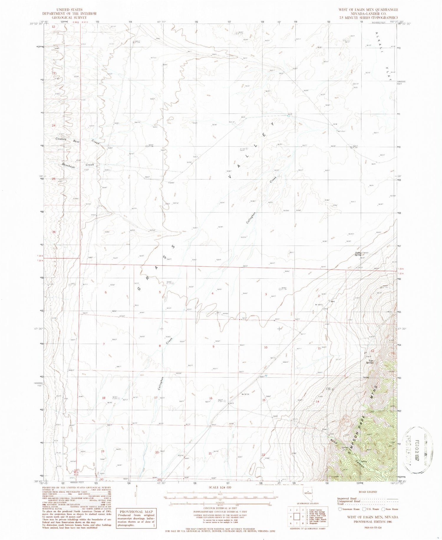
Historical USGS topographic quad map of West of Fagin Mountain in the state of Nevada. Map scale may vary for some years, but is generally around 1:24,000. Print size is approximately 24" x 27"
This quadrangle is in the following counties: Lander.
The map contains contour lines, roads, rivers, towns, and lakes. Printed on high-quality waterproof paper with UV fade-resistant inks, and shipped rolled.
Contains the following named places: Brackney Ranch, Callaghan Creek, Corral Canyon Creek, Cowboy Rest Creek, Grass Valley, Indian Creek, Rosebush Creek, Twin Springs, Valley Spring, Wood Canyon